Key Points
- Planning application submitted by Lands Improvement Holdings Ltd to Bromley Council in November for up to 350 homes on 17-hectare farmland south of Crockenhill Road, St Mary Cray.
- Developers cite “critical housing need” in Bromley; plans include mix of one to four-bedroom properties, with 50 per cent (175 homes) affordable.
- 569 objections submitted to Bromley Council; public demonstration held on the site.
- Concerns over loss of prime agricultural land, support for protected species, health and wellbeing space.
- Proposal seeks reclassification from green belt to grey belt, deemed “suitable for development” under revised national guidance.
- Additional features: public open space, community or healthcare building, new roads, walking and cycling routes, infrastructure.
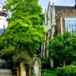
- Site comprises three arable fields between residential area and open countryside, accessible by public footpath.
- Planning documents claim site is “grey belt land” and proposals constitute “appropriate development” per national planning policy.
St Mary Cray (Bromley Times) January 17, 2026 – A contentious planning application to construct up to 350 homes on farmland edging St Mary Cray has sparked fierce opposition, with 569 objections lodged to Bromley Council and a public demonstration on the site. Developer Lands Improvement Holdings Ltd submitted the proposals in November, arguing they address a “critical housing need” in the borough through a mix of one to four-bedroom properties, 50 per cent of which—175 homes—would be affordable, as detailed in a cover letter from planning agent Nexus Planning. Local campaigners, however, decry the scheme as a threat to vital green space and agricultural land.
- Key Points
- Why is the development facing such strong opposition?
- What does the proposed development include?
- How do developers justify the grey belt reclassification?
- What are the main environmental and community concerns?
- Who submitted the application and what is their stance?
- What is Bromley Council’s role and next steps?
- How does this fit into national planning policy?
- What have locals and experts said?
- Could the development deliver broader benefits?
- What happens if the plan is approved or rejected?
Why is the development facing such strong opposition?
Hundreds of residents have mobilised against the plans, submitting 569 formal objections to Bromley Council since the application surfaced. A public demonstration took place directly on the land, underscoring the depth of local discontent. Protesters highlighted fears over the site’s reclassification from green belt—strictly protected—to grey belt, which under revised national planning guidance could render it developable.
Local resident and campaigner Peitra Napier voiced a central concern, stating:
“This land is prime agricultural land that feeds us, supports protected species and provides much-needed space for health and wellbeing.”
Her comments, captured amid the protest, reflect broader anxieties about environmental and community impacts.
As reported in initial coverage by local outlets tracking the application, the volume of objections signals a rare level of unified resistance in St Mary Cray, a village on the cusp of Orpington known for its rural fringes.
What does the proposed development include?
The application encompasses far more than housing. Alongside the 350 homes, Lands Improvement Holdings Ltd proposes a public open space, a community or healthcare building, new roads, and enhanced walking and cycling routes, plus associated infrastructure works. These elements aim to integrate the site into existing residential areas while providing amenities.
Planning documents emphasise a balanced mix: one to four-bedroom homes tailored to diverse needs, with half designated affordable to tackle Bromley’s housing shortage. Nexus Planning’s cover letter frames the scheme as a direct response to this “critical housing need,” positioning it as a pragmatic solution amid national pressures for increased supply.
The 17-hectare site south of Crockenhill Road consists of three arable fields, bordered by housing to the north and open countryside to the south, with public footpath access. Developers argue this location minimises urban sprawl while maximising accessibility.
How do developers justify the grey belt reclassification?
Central to the proposal is the push to redesignate the land from green belt to grey belt. Planning documents submitted to Bromley Council assert that “the site comprises grey belt land,” aligning with updated national policy that permits “appropriate development” on such parcels. This reclassification hinges on the site’s characteristics: previously developed or underused farmland not performing core green belt functions like preventing urban merger.
Lands Improvement Holdings Ltd contends the plans meet criteria for exceptional circumstances, given Bromley’s housing deficit. As outlined in the application, the development would deliver substantial affordable units without compromising openness, thanks to low-rise designs and retained green buffers.
Critics counter that arable fields qualify as prime agricultural land, integral to food security and biodiversity. Yet developers maintain the grey belt status overrides green belt protections, per government guidance revised to prioritise housing delivery.
What are the main environmental and community concerns?
Opposition centres on irreversible losses. Peitra Napier, a prominent local voice, warned of harm to protected species and wellbeing, encapsulated in her statement:
“This land is prime agricultural land that feeds us, supports protected species and provides much-needed space for health and wellbeing.”
Residents echo this, citing the site’s role as a green lung amid suburban expansion.
The public demonstration amplified these worries, with banners and speeches decrying the shift to grey belt as a loophole eroding protections. Objectors fear increased traffic, strained services, and diminished countryside access, despite promised infrastructure.
Bromley’s green belt, encompassing St Mary Cray’s edges, safeguards against coalescence with neighbouring areas like Swanley. Campaigners argue the 17-hectare footprint—three fields straddling urban and rural—exemplifies why such land merits unwavering defence.
Who submitted the application and what is their stance?
Lands Improvement Holdings Ltd, the applicant, partnered with Nexus Planning for the submission in November. The developer’s cover letter underscores urgency: Bromley’s “critical housing need” demands bold action, with 175 affordable homes addressing acute shortages for families and first-time buyers.
Nexus Planning’s documents robustly defend the scheme, stating it “demonstrates that the site comprises grey belt land” and amounts to “appropriate development” under national policy. They highlight mitigation: open spaces, cycling paths, and a community facility to benefit locals.
The firm’s expertise in navigating planning constraints bolsters confidence in approval prospects, though the objection tally poses hurdles.
What is Bromley Council’s role and next steps?
Bromley Council received the application last November and must now weigh 569 objections against developer arguments. As the local planning authority, it assesses compliance with green belt policy, housing targets, and infrastructure capacity.
No decision timeline is fixed, but public consultation has closed, shifting focus to officer recommendations. Councillors will scrutinise impacts on agriculture, ecology, and traffic—key objection themes.
Residents urge rejection, while supporters eye national mandates favouring housing. The outcome could set precedents for grey belt releases borough-wide.
How does this fit into national planning policy?
Revised national guidance enables grey belt development where it constitutes “appropriate” growth, prioritising housing in high-need areas like Bromley. The application’s claim—that the site meets this threshold—mirrors government pushes to re-evaluate underperforming green belt.
Paragraph 149 of the National Planning Policy Framework (NPPF) defines grey belt as land not fulfilling openness or separation roles, opening doors for sustainable schemes. Developers position their low-density, amenity-rich plans as exemplary.
Yet safeguards persist: councils must prove no suitable non-green belt alternatives exist. Objectors challenge this, insisting the farmland’s productivity disqualifies it.
What have locals and experts said?
Peitra Napier’s protest quote resonates widely:
“This land is prime agricultural land that feeds us, supports protected species and provides much-needed space for health and wellbeing.”
As a resident campaigner, she embodies grassroots defiance.
Planning agent Nexus Planning countered in submissions, framing affordability as a community boon amid Bromley’s waitlists. Lands Improvement Holdings Ltd echoes this, stressing economic benefits like jobs during construction.
No expert endorsements surface yet, but CPRE (Campaign to Protect Rural England) critiques similar schemes nationally, warning of green belt dilution. Local Tory MP Gareth Bacon has fielded constituent concerns, though no public stance emerged.
Could the development deliver broader benefits?
Proponents highlight upsides: 175 affordable homes easing pressures, plus a healthcare or community hub addressing gaps. New roads and active travel routes promise connectivity, linking St Mary Cray’s fields to Crockenhill Road.
Public open space retention softens impacts, maintaining recreation amid builds. Developers project 10-year construction, injecting funds via Section 106 contributions for schools and services.
Sceptics doubt delivery, citing past overpromises on affordability and infrastructure nationwide.
What happens if the plan is approved or rejected?
Approval would greenlight phased building, transforming fields into a neighbourhood. Bromley might secure mitigations via conditions, like species surveys.
Rejection prompts appeal to the Planning Inspectorate, where national policy weighs heavily. Lands Improvement could revise and resubmit, prolonging uncertainty.
Either way, the saga spotlights tensions between housing imperatives and rural preservation in Greater London commuter belts.