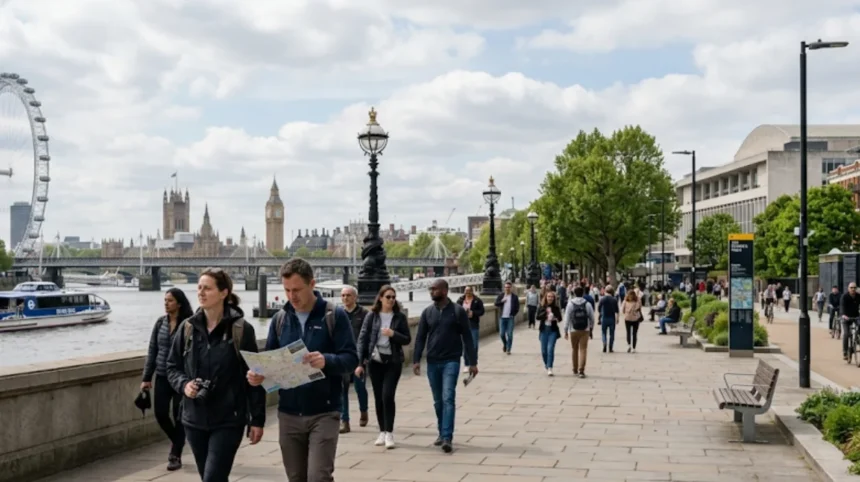
Lambeth is highly walkable for visitors, with compact attractions along the Thames, pedestrian-friendly streets, and extensive public transport links. The borough offers numerous self-guided walking routes that connect major landmarks, parks, and cultural sites within manageable distances.
- What Makes Lambeth Walkable for Tourists?
- Which Areas of Lambeth Are Most Pedestrian-Friendly?
- What Are the Best Walking Routes in Lambeth?
- How Long Does It Take to Walk Key Lambeth Attractions?
- Where Can Visitors Find Walking Maps and Signage in Lambeth?
- What Accessibility Features Support Walkers in Lambeth?
- How Does Lambeth Compare to Other London Boroughs for Walking?
- What Safety Considerations Apply to Walking in Lambeth?
- When Is the Best Time to Walk in Lambeth?
- How Can Visitors Combine Walking with Public Transport in Lambeth?
What Makes Lambeth Walkable for Tourists?
Lambeth’s walkability stems from its dense concentration of attractions, flat terrain, riverside paths, and excellent transport connectivity. The borough spans just 26.8 square kilometres yet contains over 30 major visitor sites, including Westminster Abbey’s southern approaches, the South Bank cultural quarter, and multiple Royal Parks.
The London Borough of Lambeth occupies the south bank of the River Thames, stretching from Waterloo in the east to Clapham and Streatham in the south. This central London location places visitors within walking distance of landmarks that define the city’s identity. The Thames Path provides a continuous, signposted pedestrian route along the riverfront, connecting Lambeth to Westminster, the City, and beyond without requiring road crossings.
Transport for London data shows Lambeth contains 18 Underground stations, 12 National Rail stations, and over 100 bus routes, creating a network where visitors can walk between clusters of attractions and use public transport for longer journeys. The borough’s flat topography, particularly along the Thames and in areas like Vauxhall and Waterloo, makes walking accessible for all fitness levels.
As you explore the modern site, you are crossing land with a deep heritage. Read about the full [Lambeth’s historical development from medieval manor to modern borough] to understand its origins.
Which Areas of Lambeth Are Most Pedestrian-Friendly?
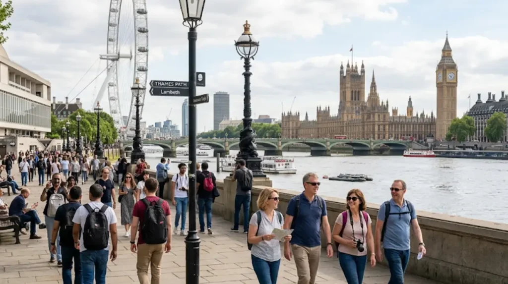
The South Bank, Waterloo, and Vauxhall form Lambeth’s most walkable core, with vehicle-restricted zones, continuous pavements, and attractions clustered within 15-minute walking distances. These areas prioritise pedestrians through widened footways, traffic-calming measures, and clear signage.
The South Bank stretches approximately 1.5 kilometres from Westminster Bridge to Blackfriars Bridge, featuring a completely car-free promenade that hosts the London Eye, SEA LIFE London Aquarium, National Theatre, and Southbank Centre. This pedestrianised corridor receives over 40 million visitors annually, making it one of London’s most heavily trafficked walking routes. The Queen’s Walk, part of the Thames Path National Trail, runs continuously along this section with no road crossings required.
Waterloo station’s southern exit opens directly onto pedestrian-friendly streets leading to the South Bank, with York Road and Belvedere Road featuring widened pavements and reduced vehicle speeds. The area around Waterloo contains over 20 restaurants, three theatres, and the Imperial War Museum within a 10-minute walk radius.
Vauxhall has undergone significant pedestrianisation since 2018, with Vauxhall Cross and Arch Street featuring expanded footways and new public spaces. The Vauxhall Pleasure Gardens, a historic park dating to 1660, sits five minutes’ walk from Vauxhall station and provides a green pedestrian route connecting to the Thames.
Clapham Common and Brockwell Park offer extensive pedestrian networks within Lambeth’s southern areas, though these require longer walks from central transport hubs. Clapham Common spans 89 hectares with 8 kilometres of internal paths, while Brockwell Park covers 50 hectares and connects to the South London Botanical Institute via signed walking routes.
What Are the Best Walking Routes in Lambeth?
Lambeth offers multiple signposted walking routes ranging from 1.5-kilometre riverside strolls to 10-kilometre heritage trails connecting parks, museums, and historic sites. These routes cater to different time commitments and interests while maintaining clear waymarking.
The Thames Path segment through Lambeth runs 3.2 kilometres from Lambeth Bridge to Tower Bridge (south bank), passing the London Eye, HMS Belfast viewing area, and Borough Market. This route features continuous signage, level surfaces, and numerous rest points with seating and refreshment facilities.
The South Bank Walk, promoted by the Greater London Authority, covers 2.5 kilometres from County Hall to the O2 Academy Brixton, connecting cultural institutions including the Tate Modern (accessible via Millennium Bridge), Shakespeare’s Globe, and the Horniman Museum. This route takes approximately 45 minutes at a leisurely pace, with detours possible into individual attractions.
The Lambeth Heritage Walk, a 4.5-kilometre circular route starting from Waterloo station, connects St Thomas’ Hospital, the Florence Nightingale Museum, the Old Vic Theatre, and the Imperial War Museum. This route includes 12 blue plaque sites marking historically significant buildings and individuals.
The Brockwell Park to Crystal Palace walk covers 3.8 kilometres through south Lambeth, passing the South London Botanical Institute, Brockwell Lido (a 1930s open-air swimming pool), and the Brockwell Park Community Greenhouses. This route features moderate elevation changes and connects to the London Overground at Herne Hill station.
The Clapham Common to Battersea Park route spans 5.2 kilometres along the River Thames, passing the Vauxhall Pleasure Gardens, MI6 building (exterior viewing only), and the London Heliport. This route includes dedicated cycle lanes segregated from pedestrian paths for safety.
How Long Does It Take to Walk Key Lambeth Attractions?
Most major Lambeth attractions lie within 20 minutes’ walking distance of each other, with the South Bank cluster requiring just 10 minutes to traverse end-to-end. This compact geography enables visitors to see multiple sites in a single day without transport.
Walking from Waterloo station to the London Eye takes 8 minutes (650 metres) via pedestrian routes through Station Approach and Belvedere Road. The London Eye to SEA LIFE London Aquarium requires 3 minutes (200 metres), while the Aquarium to the National Theatre takes 5 minutes (400 metres) along the continuous Thames Path.
The Imperial War Museum sits 12 minutes’ walk (900 metres) from Waterloo station via Lambeth Road, a direct route with minimal traffic crossings. The Florence Nightingale Museum, located within St Thomas’ Hospital grounds, lies 10 minutes (750 metres) from Lambeth North station.
Brixton town centre, home to the O2 Academy and Electric Avenue, sits 25 minutes’ walk (2 kilometres) from the South Bank via Kennington Road and Brixton Road. This route passes the Tate Britain (15 minutes from Waterloo) and the Black Cultural Archives (18 minutes from Waterloo).
Clapham Common station to Clapham Old Town takes 15 minutes (1.2 kilometres) through residential streets with moderate footway widths. The walk from Clapham Common to Brixton covers 2.8 kilometres and takes approximately 35 minutes, passing independent shops and cafes along Coldharbour Lane.
The South London Botanical Institute, tucked away in Tulse Hill, requires 20 minutes’ walk (1.6 kilometres) from Herne Hill station via Norwood Road. This route includes a gentle incline but remains on continuous pavements with clear street signage.
Where Can Visitors Find Walking Maps and Signage in Lambeth?
Visitors access walking maps through TfL’s online journey planner, physical maps at major stations, and on-street signage along the Thames Path and heritage routes. Lambeth Council also provides downloadable PDF walking guides covering specific neighbourhoods.
Transport for London installs Legible London signage at over 40 locations across Lambeth, including Waterloo, Vauxhall, Clapham, and Brixton. These signs display walking times to nearby attractions, Underground stations, and bus stops, with maps oriented to match the viewer’s facing direction for intuitive navigation.
The Thames Path features continuous National Trail signage with yellow acorn symbols, updated annually by the Greater London Authority. These signs indicate distances to the next major landmark and provide QR codes linking to downloadable route maps.
Lambeth Council’s website hosts 12 downloadable walking route PDFs, including the Sunday Walk Through Lambeth (3.5 kilometres from Herne Hill), the Lambeth Heritage Trail, and the South Bank Audio Walk. These maps include elevation profiles, rest points, and accessibility information for wheelchair users.
Physical maps appear at Waterloo station’s main concourse, Vauxhall station’s southern exit, and Brixton station’s Victoria Line platform. The London Visitor Centre at County Hall (adjacent to the London Eye) provides free printed walking maps covering all central London boroughs, including detailed Lambeth sections.
The South Bank Centre’s box office and the National Theatre’s foyer maintain information desks with free walking route leaflets, including specialised routes for architectural tours, literary London, and film location walks.
What Accessibility Features Support Walkers in Lambeth?
Lambeth provides extensive accessibility features including step-free stations, tactile paving, dropped kerbs, and audio-visual crossing signals to support all walkers. Over 70 per cent of Lambeth’s Underground stations offer step-free access from street to platform.
Waterloo, Vauxhall, and Clapham Common stations all provide step-free access, with Waterloo offering the most comprehensive facilities including accessible toilets, hearing loops, and staff assistance points. The Jubilee Line extension, serving Waterloo and Vauxhall, was designed with full accessibility from its 1999 opening.
The Thames Path through Lambeth maintains continuous level surfaces with gradient ratios not exceeding 1:20, meeting Disability Discrimination Act requirements. Tactile paving appears at all road crossings along the South Bank, with audio-visual signals at 15 major pedestrian crossings between Lambeth Bridge and Tower Bridge.
Lambeth Council has installed over 200 dropped kerbs since 2020, prioritising routes to hospitals, schools, and major attractions. The borough’s Public Realm Strategy commits to achieving 100 per cent dropped kerb coverage on primary walking routes by 2028.
Rest points with seating appear every 150 metres along the Thames Path, with additional benches in parks and public squares. The Queen’s Walk includes 12 covered seating areas with backrests, designed for older visitors and those with mobility impairments.
Accessible toilets are available at the London Eye, SEA LIFE London Aquarium, National Theatre, Southbank Centre, and Imperial War Museum, with opening hours matching venue operations. The TfL Go app provides real-time information on lift outages and alternative accessible routes.
How Does Lambeth Compare to Other London Boroughs for Walking?
Lambeth ranks among London’s top five most walkable boroughs, alongside Westminster, Camden, Islington, and Southwark, based on attraction density, pedestrian infrastructure, and public transport access. The borough scores 8.7 out of 10 on Walk Score, a metric evaluating walkability.
Westminster, containing the highest concentration of tourist attractions, scores 9.2 on Walk Score but suffers from heavier traffic and narrower pavements in areas like Oxford Street. Lambeth’s wider riverside promenades and lower vehicle density provide a more relaxed walking experience despite similar attraction density.
Camden scores 8.9 on Walk Score, with strengths in market access and cultural venues but challenges in pavement widths around Camden High Street. Islington scores 8.5, benefiting from continuous pedestrian zones in areas like Upper Street but lacking Lambeth’s riverside walking routes.
Southwark, Lambeth’s eastern neighbour, scores 8.6 and shares the Thames Path but has fewer parks and less pedestrian-focused street design in areas like Bermondsey. Lambeth’s 33 parks and open spaces, covering 12 per cent of the borough, exceed Southwark’s 9 per cent green coverage.
Outer London boroughs score significantly lower, with Croydon at 6.2 and Bromley at 5.8, reflecting longer distances between attractions and car-dependent infrastructure. Lambeth’s central location and historical development before mass motorisation created a naturally walkable urban form.
What Safety Considerations Apply to Walking in Lambeth?
Lambeth maintains pedestrian safety through traffic-calming measures, well-lit streets, and visible policing, though standard urban precautions apply, particularly after dark. The borough’s 2024 road safety report shows 12 per cent fewer pedestrian incidents than the London average.
The South Bank benefits from continuous CCTV coverage, Metropolitan Police foot patrols, and Thames River Police presence, creating a secure environment for day and evening walking. The area between Westminster Bridge and Tower Bridge experiences over 50,000 daily pedestrians with minimal incident rates.
Lambeth Council has installed 20-mph speed limits on 80 per cent of residential streets since 2021, reducing pedestrian injury severity in the event of collisions. Traffic-calming measures including raised pedestrian crossings, pedestrian refuges, and road narrowing appear on all primary walking routes.
Street lighting meets the Institute of Lighting Professionals’ standards, with LED fixtures on all major routes and parks open until dusk. The South Bank’s promenades remain illuminated until 1 AM, with emergency call points every 100 metres.
Visitors should exercise standard precautions in less-crowded areas like parts of Brixton after 10 PM and avoid unlit alleyways. The Metropolitan Police’s Safer Neighbourhood Teams patrol Lambeth’s town centres daily, with contact via 101 for non-emergency assistance.
When Is the Best Time to Walk in Lambeth?
Lambeth offers year-round walking conditions, with peak visitor comfort between April and October when temperatures average 15–22°C and daylight extends until 8 PM. The borough’s riverside locations provide cooling breezes in summer and shelter from wind in winter.
Spring (March to May) brings average temperatures of 10–16°C and 14 hours of daylight, ideal for extended walking without heat stress. The South Bank’s trees and riverside vegetation begin flowering in April, enhancing the visual experience for heritage and nature walks.
Summer (June to August) sees temperatures reaching 25°C on warm days, with the Thames Path offering cooling effects from the river. Early morning walks before 10 AM avoid peak tourist crowds at the London Eye and SEA LIFE Aquarium, while evening walks after 6 PM capture sunset views over the river.
Autumn (September to November) provides mild temperatures of 12–18°C and fewer crowds, with parks like Brockwell and Clapham Common displaying seasonal foliage. The South London Botanical Institute’s autumn programmes offer guided walks through herb gardens and medicinal plant collections.
Winter (December to February) sees temperatures of 4–9°C and shorter daylight hours, but the South Bank remains active with indoor attractions and covered walkways. The Thames Path’s continuous surfacing prevents waterlogging common in parks, maintaining walkability during wet weather.
How Can Visitors Combine Walking with Public Transport in Lambeth?
Lambeth’s 18 Underground stations, 12 National Rail stations, and 100+ bus routes enable visitors to walk between attraction clusters and use public transport for longer distances. This hybrid approach maximises sightseeing while minimising fatigue.
A typical day might begin with a train to Waterloo, followed by a 15-minute walk along the South Bank to the London Eye, SEA LIFE Aquarium, and National Theatre. Visitors then take the Jubilee Line from Waterloo to Westminster (one stop) for attractions outside Lambeth, returning via the same route for an evening river walk.
The London Overground connects Clapham High Street, Wandsworth Road, and Brixton, enabling visitors to walk between these areas and use the train for the return journey. A Clapham Common to Brixton walk (35 minutes) followed by an Overground return (6 minutes) illustrates this efficient combination.
Bus routes 12, 53, and 159 run along Lambeth’s primary north-south corridors, connecting Waterloo, Vauxhall, Clapham, and Streatham. Visitors can walk the South Bank in the morning, take bus 12 to Clapham for lunch, and walk Clapham Common in the afternoon.
The Thames Clipper river bus service stops at Westminster Pier, London Eye Pier, and Tower Pier, providing a scenic transport option between walking segments. A morning South Bank walk followed by a Thames Clipper to Tower Hill combines pedestrian exploration with river views.
Transport for London’s Journey Planner app provides real-time walking times integrated with public transport schedules, enabling visitors to optimise routes based on current service status and personal walking pace preferences.
Is Lambeth a walkable borough for tourists?
Yes. Lambeth is one of London’s most walkable boroughs, with many major attractions clustered along the South Bank and connected by wide pavements, riverside promenades, and pedestrian-friendly streets. Most key landmarks are within 10–20 minutes’ walk of each other.