Key Points
- Urban Journey: The A2 route begins as an inner-city street in Borough, central London, before expanding into a major dual carriageway heading south-east.
- Historic Starting Point: The road originates at Great Dover Street, adjacent to St George the Martyr Church near the A3 junction.
- Historic Thoroughfares: It transitions directly into the Old Kent Road, a key historic link connecting London to the county of Kent for centuries.
- Key Junctions: Entering New Cross in the London Borough of Lewisham, the A2 intersects with the A20, where the route diverges east towards Blackheath.
South London (South London News) September 30, 2026 – The A2 thoroughfare serves as one of south-east London’s primary arterial routes, starting as a single-carriageway urban street before widening into a trunk route that connects the central capital to the wider outer boroughs and Kent.
- Key Points
- Where Does the A2 Route Begin in Central London?
- Which Historic Thoroughfares Form Part of the A2 Route?
- How Does the A2 Navigate Through New Cross and South-East London?
- Background of the A2 Corridor Development
- Predictions: How Will Developments Along the A2 Affect Local Residents and Commuters?
Where Does the A2 Route Begin in Central London?
The A2 officially starts its journey in Borough, positioned close to St George the Martyr church and its immediate junction with the A3. At this starting section, the road is designated as Great Dover Street.
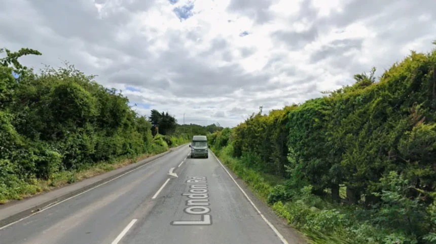
At this point, the thoroughfare appears markedly different from the expansive, high-capacity dual carriageway seen further into south-east London. Great Dover Street functions as a standard inner-city road, surrounded by urban architecture, local businesses, and pedestrian crossings, carrying local traffic out of the central district.
Which Historic Thoroughfares Form Part of the A2 Route?
Heading out of central London, the A2 transitions from Great Dover Street into the Old Kent Road. The Old Kent Road represents one of London’s best-known thoroughfares, having served as a vital travel connection between the capital and the county of Kent for centuries.
Continuing in a south-easterly direction, the road navigates through heavily populated parts of inner London. The route accommodates a mix of local residential traffic, public transport links, and commercial delivery vehicles moving between central and south-eastern districts.
How Does the A2 Navigate Through New Cross and South-East London?
Upon arriving in New Cross, the A2 traverses one of the London Borough of Lewisham’s busiest neighbourhoods. This section handles significant traffic volumes as it processes vehicles moving through the inner south-east transport corridor.
In this specific location, the A20 diverges from the A2. While the A20 splits off to route through alternative areas of south-east London, the A2 maintains its eastward path, heading towards Blackheath and eventually expanding into the multi-lane dual carriageway structure that characterises its outer journey.
Background of the A2 Corridor Development
The route followed by the modern A2 largely traces the alignment of ancient trackways and historic roads, most notably Watling Street, an ancient route utilized extensively during the Roman occupation of Britain to link London with coastal ports such as Dover.
Over centuries, as London expanded outwards, these historic travel routes were integrated into the urban fabric. During the 19th and 20th centuries, suburban expansion and increasing motor vehicle traffic necessitated significant infrastructure adaptations along the south-east corridor. Consequently, urban sections such as the Old Kent Road remained tightly integrated into dense commercial and residential development, whilst outer segments beyond Lewisham and Greenwich were progressively widened into dual carriageways and grade-separated trunk roads to accommodate regional travel demand.
Predictions: How Will Developments Along the A2 Affect Local Residents and Commuters?
The physical characteristics and capacity changes along the A2 will continue to impact several distinct groups of transport users and residents across south-east London:
- Local Residents: Dense residential populations lining early sections of the route, particularly along the Old Kent Road and New Cross, will continue to feel the effects of high traffic density, air quality initiatives, and local urban regeneration plans aimed at balancing commercial traffic flow with pedestrian safety.
- Daily Commuters: Commuters travelling between Kent, outer London, and central districts will face varying road conditions, moving from high-speed dual carriageway sections into urban, single-lane environments with lower speed limits and higher junction density near central London.
- Freight and Transport Operators: Commercial vehicle operators relying on the A2 as a key artery between central London and eastern port corridors will need to adapt to evolving traffic management policies, local low-emission zone requirements, and congestion controls along the inner sections of the road.