Lambeth is one of south London’s most varied boroughs for cycling, combining riverside routes, protected cycleways, quieter residential streets, major bridges, parks and connections towards central London. Its cycling network serves both short recreational rides and longer journeys through Waterloo, Vauxhall, Clapham, Brixton and Streatham.
- Where can visitors start a cycling trip in Lambeth?
- Which cycle routes connect Waterloo with the rest of Lambeth?
- Can visitors cycle beside the River Thames in Lambeth?
- What is Cycle Quietway 5 through Lambeth?
- Which Lambeth areas are suitable for a cycle ride around Vauxhall and Kennington?
- Where can cyclists explore Clapham in Lambeth?
- Can visitors cycle through Streatham Common?
- Where does Cycleway 17 run in Lambeth?
- How can visitors connect Lambeth cycling routes with London attractions?
- How does Lambeth’s cycling network work for recreational riders?
- What historical context should visitors know while cycling through Lambeth?
- What should visitors check before cycling in Lambeth?
- Which Lambeth cycling routes suit different types of visitors?
- Why is Lambeth significant for London’s wider cycling network?
The borough has 29 km of cycleways within its highway network, according to Lambeth Council’s 2026/27 highways information. London’s wider Cycleway network exceeded 360 km in 2024, while Lambeth had 20.8 km of London Cycle Network infrastructure recorded in March 2025 under the Greater London Authority’s network reporting.
For visitors, this creates several distinct cycling experiences. Central Lambeth connects easily with Waterloo and the South Bank. Vauxhall provides links towards Westminster and Pimlico. Clapham and Brixton provide quieter neighbourhood connections. Streatham offers access to greener routes and longer recreational rides.
Where can visitors start a cycling trip in Lambeth?
Visitors can start cycling in Lambeth from Waterloo, Vauxhall, Kennington, Clapham, Brixton or Streatham, with each area providing access to different cycle routes, transport connections, cycle parking and attractions. Waterloo is particularly useful for combining cycling with central London sightseeing and public transport.
Waterloo is one of the most practical starting points for visitors. The area sits beside the South Bank and has connections to major attractions, including the London Eye and the cultural venues around the Thames.
TfL provides cycling maps and journey-planning information, while its network includes Cycleways, cycle parking and Santander Cycles.
The TfL map around Lower Marsh and Waterloo also shows Santander Cycles docking locations around Waterloo Station, Waterloo Road, Tenison Way and the South Bank.
Vauxhall is another useful starting point. It connects central London with Lambeth neighbourhoods towards Stockwell, Clapham and Brixton.
Kennington provides access towards Elephant & Castle, Oval and the surrounding residential network. Clapham is useful for riders looking for quieter streets and connections towards Norbury.
Streatham provides a different experience. It sits farther south within Lambeth and connects with longer routes towards neighbouring parts of south London.
Visitors who bring their own bicycle should check the current TfL and Lambeth cycling maps before departure. Infrastructure changes over time, and temporary roadworks can affect route conditions.
Which cycle routes connect Waterloo with the rest of Lambeth?
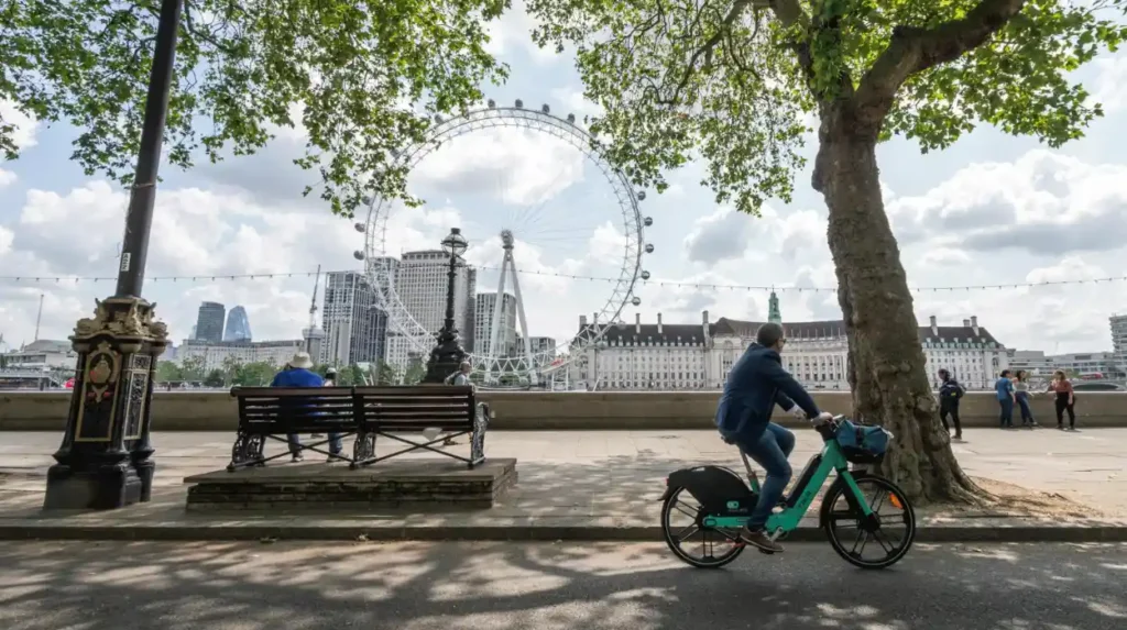
Waterloo connects with several important cycling corridors through Lambeth, including routes towards Lambeth North, Vauxhall, Kennington, Clapham and the South Bank. These connections allow visitors to combine central London attractions with longer recreational rides without starting from a distant suburb.
Waterloo sits at the northern edge of Lambeth and functions as an important gateway into the borough.
The Central London Cycleways map shows routes around Waterloo, Lambeth North, the South Bank, Lambeth Palace, Westminster Bridge and the River Thames.
A short ride from Waterloo can therefore become a longer circuit. Visitors can travel towards Lambeth North before continuing towards Kennington or Vauxhall.
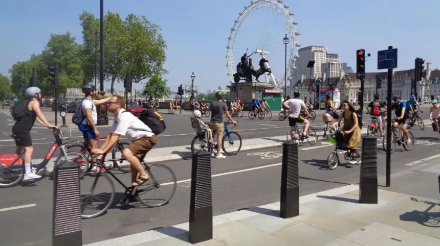
The area also connects cycling with major visitor destinations. The South Bank contains the London Eye, Royal Festival Hall and other cultural attractions. These locations provide natural stopping points during a recreational ride.
Waterloo also offers practical transport connections. Visitors arriving by train can combine rail travel with cycle hire or bring a bicycle into the area.
The concentration of cycle infrastructure around Waterloo means that it works particularly well for visitors who want to cycle for part of a day rather than spend the entire day on a bicycle.
For first-time visitors, the main consideration is route planning. Central London contains busy junctions, pedestrian-heavy areas and complex road layouts. Checking the current route before setting off provides a clearer understanding of where cycle tracks, crossings and quieter connections are located.
Can visitors cycle beside the River Thames in Lambeth?
Visitors can cycle around several riverside areas of Lambeth, particularly around the South Bank, Lambeth Bridge, Vauxhall and Albert Embankment. Riverside cycling works best when visitors follow designated cycle infrastructure and check current restrictions where pedestrian routes become busy.
The River Thames forms Lambeth’s northern boundary and creates an important geographical reference point for cycling.
The Central London cycle map identifies routes around the South Bank, Lambeth Bridge, Vauxhall Bridge and the riverfront.
The riverside is useful for visitors because several major landmarks are close together. Lambeth Palace, Westminster Bridge, the London Eye, Tate Britain and the Houses of Parliament sit within the wider central London cycling area.
Cyclists should distinguish between riverside cycling routes and pedestrian-only sections. A route beside the river is not automatically a route where cycling is permitted on every section.
TfL’s Cycling Infrastructure Database specifically records paths through parks and green spaces that can and cannot be cycled on. The database also records cycle tracks, crossings, traffic restrictions and signed cycle routes.
This makes the database particularly useful when planning a route that combines streets with open spaces.
The Lambeth Bridge area also provides a strategic connection across the Thames. TfL documentation identifies cycle facilities around Lambeth Bridge and surrounding roads.
Visitors can therefore use the riverside as part of a wider loop rather than treating it as an isolated cycling destination.
For a recreational ride, the riverside is particularly useful when combined with Waterloo, Westminster and Vauxhall. The route can then become a central London sightseeing circuit.
What is Cycle Quietway 5 through Lambeth?
Cycle Quietway 5 is a route linking Waterloo with Norbury through Lambeth North, Vauxhall and Clapham. Lambeth Council describes Quietways as lower-traffic routes using quieter streets, making this corridor relevant to visitors seeking an alternative to major roads.
Cycle Quietway 5 is one of the most significant named cycling routes associated with Lambeth.
Lambeth Council states that the route runs between Waterloo and Norbury through Lambeth North, Vauxhall and Clapham. The council also describes Quietways as continuous cycling routes using less-busy backstreets.
The route is particularly relevant to recreational cyclists because it creates a north-south connection through several distinct parts of the borough.
A visitor starting around Waterloo can use the corridor to move towards Vauxhall and Clapham. Continuing south takes the route towards Norbury.
Quietway infrastructure uses route signs to help cyclists navigate streets that are less familiar to visitors. Lambeth Council states that approximately 60% of Quietway 5 had been delivered when the project information was published, with the remaining sections subject to delivery work.
The route has also included measures allowing two-way cycling on Bromell’s Road between Venn Street and The Pavement. Lambeth Council’s traffic-order documentation identifies Bromell’s Road as part of the Waterloo-to-Norbury route.
This corridor is useful for visitors who want to explore beyond the central tourist district.
It also demonstrates an important feature of cycling in Lambeth. Recreational cycling does not depend entirely on segregated cycle tracks. Quieter residential streets, traffic restrictions and signed routes form part of the wider network.
Which Lambeth areas are suitable for a cycle ride around Vauxhall and Kennington?
Vauxhall and Kennington provide important cycling connections between central London and southern Lambeth. Visitors can use these areas to connect Waterloo, Westminster, Oval, Stockwell and Clapham while following designated infrastructure and quieter local streets where available.
Vauxhall occupies a strategic position between the River Thames and southern Lambeth.
The area connects with Westminster, Pimlico, Stockwell and Kennington. It also contains major roads and junctions, so route selection is important.
TfL documentation identifies cycling infrastructure around Vauxhall Cross, Vauxhall Bridge Road, Harleyford Road and Kennington Lane.
Kennington provides another useful connection. The Central London Cycleways map shows cycling routes around Kennington Road, Lambeth Road, Elephant & Castle and the Imperial War Museum.
Visitors can therefore create a route that links historic and cultural sites with residential neighbourhoods.
Kennington also sits close to the Imperial War Museum. The surrounding roads provide access to central London and southern Lambeth.
The main practical issue is junction complexity. Vauxhall Cross is a major transport interchange, while several roads in this part of Lambeth carry substantial traffic.
Visitors should follow marked cycle infrastructure and current route directions rather than relying only on a general road map.
The area’s strategic value is also reflected in Lambeth’s long-term transport planning. The council identifies Waterloo, Vauxhall, Brixton and Streatham as important destinations for walking and cycling improvements.
Where can cyclists explore Clapham in Lambeth?
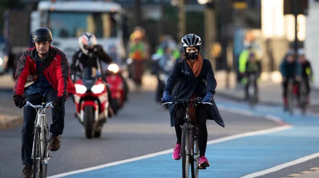
Clapham provides access to quieter residential cycling routes, Clapham Common and the Waterloo-to-Norbury Quietway corridor. Visitors can use Clapham as a recreational midpoint between central Lambeth and southern destinations rather than treating it only as a residential neighbourhood.
Clapham forms an important part of Lambeth’s cycling geography.
Cycle Quietway 5 passes through Clapham on its route between Waterloo and Norbury.
The area also contains Clapham Common, one of the major open spaces in this part of London. Visitors should check local park rules before cycling away from designated routes.
The wider Clapham area provides access to streets with different traffic conditions. Some residential roads function as quieter connections, while larger roads carry higher volumes of traffic.
Bromell’s Road provides a documented example of how cycling infrastructure has been adapted to improve route continuity. Lambeth’s traffic-order documentation states that bicycles are exempted from the one-way restriction on the relevant section, allowing two-way cycling.
Clapham therefore works well as a transition point between central and southern Lambeth.
A visitor can begin near Waterloo, travel through Lambeth North and Vauxhall, continue towards Clapham and then extend the ride towards Streatham or Norbury.
This makes the area useful for different cycling distances. Short rides can remain within the Clapham area. Longer rides can use it as a midpoint.
Can visitors cycle through Streatham Common?
Cycling is permitted on the two paths heading south over Streatham Common from Valley Road, according to Lambeth Council. Visitors should remain aware that park cycling rules apply and that not every open-space path automatically permits cycling.
Streatham Common provides one of Lambeth’s clearer examples of cycling within a green-space setting.
Lambeth Council specifically confirmed that cycling is permitted on both paths heading south over Streatham Common from Valley Road.
This distinction is important because cycling permissions in parks are not universal.
Lambeth’s published cycling information also explains different levels of cycling infrastructure. Its cycle map identifies traffic-free routes, residential roads, higher-traffic routes and infrastructure requiring greater cycling experience.
Visitors should therefore distinguish between a public open space and a designated cycling route.
Streatham Common can form part of a longer southern Lambeth itinerary. Riders using Quietway 5 can continue towards Norbury, while other connections lead towards neighbouring south London areas.
The common also provides a change from dense central streets. This makes the southern part of Lambeth useful for visitors who want a recreational ride rather than a direct transport journey.
Before entering any park, cyclists should follow signs, barriers and current local regulations. Pedestrian activity can also be higher around entrances and shared paths.
Where does Cycleway 17 run in Lambeth?
Cycleway 17 is a London cycling route associated with Rosendale Road in Lambeth. It forms part of London’s expanding high-quality cycling network and provides an important south London connection beyond the central Waterloo and Vauxhall corridors.
Cycleway 17 is particularly relevant to visitors exploring southern Lambeth.
The Mayor of London’s cycling information identifies C17 along Rosendale Road in Lambeth among major additions to London’s Cycleway network.
Cycleways are designed as higher-quality cycling routes within London’s wider active-travel network.
The development of C17 demonstrates the broader change in Lambeth’s cycling infrastructure. The borough’s network is not limited to central London routes around the Thames.
Instead, cycling infrastructure extends towards southern neighbourhoods and creates connections between different parts of the borough.
For visitors, C17 is useful when building a longer itinerary around southern Lambeth. It also provides a route option for people staying farther south who want to reach central destinations by bicycle.
Current conditions should always be checked before travelling because construction programmes, temporary closures and traffic arrangements can change.
How can visitors connect Lambeth cycling routes with London attractions?
Visitors can connect Lambeth’s cycle routes with major attractions including the London Eye, South Bank, Lambeth Palace, Imperial War Museum, Westminster Bridge and Tate Britain. Cycling provides a practical way to combine several nearby destinations within one central London itinerary.
Lambeth’s location gives cyclists direct access to a dense concentration of cultural attractions.
The South Bank provides one of the strongest examples. Waterloo connects with the London Eye and wider South Bank destinations.
Lambeth Palace sits beside the River Thames and near Lambeth Bridge. The surrounding cycling network connects the area with Westminster and Vauxhall.
The Imperial War Museum sits near Lambeth Road and Kennington Road. It can therefore be incorporated into a route between Waterloo and Kennington.
Tate Britain sits across the river from parts of the South Bank and connects with cycling routes around Millbank and Vauxhall.
These attractions create opportunities for short cycling loops.
A visitor can begin at Waterloo, travel towards Lambeth Palace, continue towards Vauxhall, cross towards Westminster or Pimlico, and return through the central London cycling network.
The precise route depends on current cycleway arrangements and pedestrian restrictions.
Cyclists should also allow time for secure cycle parking. Lambeth Council provides free cycle stands and states that its kerbside strategy includes a commitment to provide cycle parking every 50 metres on streets.
That infrastructure supports sightseeing journeys where the bicycle is used for transport between attractions rather than ridden continuously.
How does Lambeth’s cycling network work for recreational riders?
Lambeth’s cycling network combines protected cycleways, quieter streets, signed routes, traffic restrictions, crossings and park connections. This structure supports both recreational cycling and everyday journeys while providing different route environments for riders with different levels of experience.
Lambeth’s network is not one continuous type of infrastructure.
The council’s cycle map distinguishes several categories, including Cycle Superhighways, National Cycle Network routes, Quietways and formal local cycling routes.
TfL’s Cycling Infrastructure Database provides a more detailed infrastructure framework. It records cycle lanes, cycle tracks, crossings, modal filters, traffic-calming measures, signage and cycle parking across London.
This means a recreational route can contain several infrastructure types.
A visitor might start on a segregated cycleway, continue along a quieter residential street, cross at a cycle-specific signal and then enter an area with shared pedestrian and cycling space.
The cycling experience therefore changes according to location.
The Lambeth Healthy Routes Plan also identifies a strategic approach based on cycling demand. The council states that high-demand routes are complemented by connector routes, with segregation planned on main roads wherever possible.
For visitors, this network structure has a practical implication. Route planning should focus on connected corridors rather than selecting individual streets at random.
What historical context should visitors know while cycling through Lambeth?
Lambeth’s cycling routes cross neighbourhoods shaped by centuries of riverside activity, transport development, housing growth and institutional change. Understanding this background adds geographic context to modern routes through Waterloo, Vauxhall, Kennington, Brixton, Clapham and Streatham.
Lambeth’s modern cycling network sits within a much older urban landscape.
The River Thames influenced the development of northern Lambeth through transport, industry and riverside commerce. Roads and bridges later strengthened connections between Lambeth and Westminster.
Southwards, villages and suburban districts gradually became incorporated into the expanding London metropolitan area. Railways, tramways and roads changed the relationship between central London and neighbourhoods such as Brixton and Streatham.
Modern cycling routes often follow corridors that developed for earlier forms of transport.
As you explore the modern cycling network, you are crossing neighbourhoods with a deep heritage. Read the to understand its origins.
This historical context helps explain why Lambeth contains such different urban environments within one borough.
Waterloo is highly central and transport-focused. Vauxhall combines major infrastructure with riverside development. Kennington contains historic residential streets and major institutions. Clapham combines a large common with dense neighbourhoods. Streatham has a more suburban character.
Cycling provides a way to move between these environments at a local scale.
What should visitors check before cycling in Lambeth?
Visitors should check current TfL route information, Lambeth cycling information, roadworks, cycle parking, park restrictions and route conditions before setting off. They should follow signed cycle routes and observe local restrictions, especially around busy junctions and pedestrian areas.
Cycling infrastructure changes as London continues to invest in active travel.
Lambeth Council publishes current information about its cycle network, highways and transport projects. TfL provides route planning, cycle maps, cycle parking information and Santander Cycles information.
Visitors should also check whether a route is currently affected by construction.
The distinction between cycleways and park paths is particularly important. A path through green space does not automatically provide unrestricted cycling access.
Lambeth’s cycle map identifies different levels of route environment, ranging from traffic-free paths to roads requiring higher levels of cycling experience.
Visitors unfamiliar with London traffic should choose routes appropriate to their cycling experience.
Weather also affects recreational cycling. Wet surfaces reduce braking performance, while poor visibility affects night-time journeys. Lights and reflective clothing are appropriate for cycling after dark.
Cycle security is another practical issue. Lambeth provides free cycle stands across the borough, while TfL provides cycle parking information.
A planned route should therefore include both the cycling journey and the location where the bicycle will be secured during sightseeing.
Explore More Area Guide
Best Birdwatching Spots in Lambeth: Parks, Wildlife and Nature
Lambeth Wildlife: Parks, Nature Reserves & Habitats
Which Lambeth cycling routes suit different types of visitors?
Short sightseeing rides suit Waterloo and the South Bank, quieter exploratory rides suit the Waterloo-to-Norbury corridor, and longer recreational journeys suit connections towards Streatham and Rosendale Road. The best route depends on distance, traffic conditions, attractions and cycling experience.
Visitors with limited time can focus on central Lambeth.
Waterloo, the South Bank and Lambeth Bridge provide access to major attractions within a compact area.
Visitors with several hours can extend southwards through Vauxhall, Kennington and Clapham.
Those seeking a longer recreational journey can use the Waterloo-to-Norbury Quietway corridor and southern Lambeth connections.
Cyclists interested in green-space riding can incorporate Streatham Common where cycling is specifically permitted on the identified paths.
Visitors interested in London’s developing strategic cycling network can explore Cycleway 17 around Rosendale Road.
The key difference is not simply distance. It is the type of cycling environment.
Central routes contain major junctions and heavy pedestrian activity. Quieter corridors contain residential streets and traffic-management measures. Southern routes provide access to larger open spaces and longer neighbourhood connections.
This variety makes Lambeth relevant to recreational cycling at several scales.
Why is Lambeth significant for London’s wider cycling network?
Lambeth forms an important part of London’s wider cycling network because it connects central London with south London neighbourhoods through Cycleways, Quietways, cycle tracks, quieter streets and strategic corridors. Its location makes the borough a key link between riverside and southern routes.
London’s cycling infrastructure has expanded substantially.
The Greater London Authority reports that the Cycleway network grew from 90 km in 2016 to more than 360 km in 2024. Nearly one quarter of London residents lived within 400 metres of a high-quality cycling route in 2024.
Lambeth forms part of this wider network.
The Greater London Authority recorded 20.8 km of London Cycle Network infrastructure in Lambeth in March 2025, compared with 17.5 km in November 2022.
Lambeth Council separately reports 29 km of cycleways within its highway network for 2026/27. These figures measure different infrastructure categories, so they should not be treated as interchangeable totals.
The borough’s strategic position explains its importance.
It sits beside the Thames, connects directly to Westminster and Southwark, and extends southwards through Vauxhall, Kennington, Clapham, Brixton and Streatham.
For visitors, this geography creates a practical opportunity. A cycling trip does not need to remain inside one neighbourhood.
A route can begin beside the Thames, pass through central Lambeth, continue through quieter southern streets and finish near a green-space destination.
That combination makes Lambeth a useful base for visitors who want to experience London by bicycle while remaining close to major attractions, public transport and established cycling infrastructure.
Where can visitors cycle in Lambeth?
Visitors can cycle through Waterloo, the South Bank, Vauxhall, Kennington, Clapham, Brixton and Streatham. These areas connect through cycleways, quieter streets, signed routes and wider London cycling infrastructure.