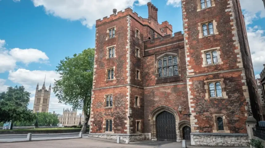
Lambeth’s maritime history is best discovered along the River Thames waterfront, particularly between Westminster Bridge, Lambeth Bridge and Albert Embankment. Visitors can explore historic riverside landmarks, trace the remains of former wharves and boat-building industries, and investigate historical maps, photographs and documents at Lambeth Archives. These places reveal how river transport, trade and industry shaped the borough’s development.
- What Is Lambeth’s Maritime History?
- Where Can Visitors Explore Lambeth’s Historic Thames Waterfront?
- How Does Lambeth Palace Reveal the River’s Historical Importance?
- Where Can Visitors Discover Evidence of Lambeth’s Boatbuilding and Industrial Past?
- How Can Lambeth Archives Help Visitors Research Maritime History?
- What Role Did the River Thames Play in Lambeth’s Development?
- How Did River Transport Support Local Businesses?
- How Did Industrialisation Change Lambeth’s Waterfront?
- How Can Visitors Plan a Lambeth Maritime Heritage Walking Route?
- Stop One: Begin in Waterloo
- Stop Two: Walk Towards Lambeth Palace
- Stop Three: Explore Lambeth Bridge
- Stop Four: Follow Albert Embankment
- Stop Five: Continue Research at Lambeth Archives
- Why Does Lambeth’s Maritime Heritage Matter Today?
- What Does Maritime Heritage Contribute to Local Identity?
- How Can Historical Records Support Waterfront Conservation?
- How Can Visitors Make the Most of a Maritime History Visit to Lambeth?
The London Borough of Lambeth occupies part of the south bank of the Thames, extending inland through neighbourhoods including Waterloo, Vauxhall, Kennington, Brixton and Streatham. Its riverside districts once supported watermen, boatbuilders, fishermen, warehouses and manufacturing businesses. Today, modern promenades, protected historic buildings and public cultural spaces preserve evidence of that relationship with the river.
For visitors interested in London’s working waterfront, Lambeth offers a way to understand the capital beyond its famous royal landmarks. The area connects medieval ecclesiastical history, commercial river traffic, Victorian industrial development and modern urban regeneration.
What Is Lambeth’s Maritime History?
Lambeth’s maritime history describes the borough’s relationship with the River Thames through boatbuilding, fishing, passenger crossings, commercial wharves and riverside industries. Its development reflects how the river supported transport, employment and trade before modern roads and railways transformed movement across London.
The Thames provided an important transport route long before the expansion of London’s railway network. Boats carried people and goods between riverside settlements, while the tidal river connected local businesses with wider commercial networks.
Lambeth’s position opposite Westminster made its waterfront particularly significant. The north bank contained royal, governmental and commercial institutions, while the south bank supported a mixture of residences, religious establishments, workshops and industrial premises.
The shoreline also influenced where particular businesses operated. Boatbuilders required access to the water, while warehouses and wharves needed convenient locations for loading and unloading cargo. River-dependent trades developed alongside industries that used locally available transport connections.
Lambeth Council’s historical assessment of the Albert Embankment records the area’s former association with boatbuilding, fishing, wharves and warehouses. It also describes the sandy foreshore as a suitable location for building and keeping boats and barges. Related occupations included making oars, sculls and pumps.
These activities formed part of a wider working waterfront. The maritime economy was not limited to ships travelling long distances. It also depended on small craft, local crossings, storage buildings, repair work and the movement of materials between businesses.
The historical landscape changed as London expanded. Industrial buildings occupied parts of the shoreline, and infrastructure projects reshaped the river’s edges. Later redevelopment introduced new buildings, public spaces and cultural venues.
Visitors exploring the present-day waterfront therefore encounter a landscape where the surviving architecture, street layout and river views provide clues to earlier activities.
Where Can Visitors Explore Lambeth’s Historic Thames Waterfront?
Visitors can investigate Lambeth’s historic Thames waterfront along the South Bank, around Lambeth Palace and beside Albert Embankment. These riverside locations provide views of historic buildings, former industrial districts and transport corridors that explain the borough’s long connection with river activity.
The most useful starting point is the stretch of waterfront between Westminster Bridge and Lambeth Bridge. From the south bank, visitors can observe the relationship between the river, Lambeth Palace, the Palace of Westminster and the changing built environment.
Walking along the embankment provides a practical introduction to the geography of Lambeth’s maritime past. The river remains a major feature of the landscape, although the commercial activity that once occupied the shoreline is less visible.
South Bank and Waterloo
The South Bank and Waterloo area offers a strong starting point for exploring how transport shaped Lambeth. The district is now associated with cultural venues, pedestrian routes and major railway connections, but its earlier history also involved water-based travel and riverside commerce.
The South Bank’s historical importance extended beyond entertainment and tourism. Its position near central London supported connections between the City, Westminster and settlements further along the Thames.
South Bank London’s account of its transport history describes the area’s earlier boatbuilding, wharves and warehousing, alongside its later development as a road and rail transport hub. A published guided walk has also examined these overlapping histories through a route of approximately 2.4 kilometres lasting around 90 minutes.
Visitors can use the modern pedestrian routes to understand the broad relationship between water, land transport and urban growth. The riverside also provides clear views of bridges, embankments and buildings that help explain how London adapted its waterfront over time.
Albert Embankment
Albert Embankment extends along the Thames between Lambeth Bridge and the Vauxhall area. Its built environment reflects successive changes in riverside infrastructure, industry and residential development.
Historical records describe this section of Lambeth as a place of boatbuilding, boat storage, warehousing and manufacturing. These uses depended on access to the river and contributed to the area’s employment and physical character.
Today, the embankment combines modern buildings with historic landmarks and stretches of public riverside access. Visitors can compare the current landscape with older maps and images to identify changes in the shoreline and surrounding streets.
The embankment is particularly useful for understanding industrial maritime history because it connects the broader Thames narrative with documented local trades. Its history also demonstrates that the riverfront supported production and storage, rather than functioning solely as a passenger route.
Lambeth Bridge and Westminster Bridge
The bridges provide fixed points from which to study the river’s role in connecting different parts of London. Their positions help visitors understand why the waterfront attracted transport, trade and development.
The river crossings also make the geography easier to interpret. Looking across the Thames reveals the close relationship between Lambeth and Westminster, while walking along the south bank demonstrates how the shoreline connects historic buildings with modern public spaces.
Visitors should distinguish between the history of a bridge and the broader maritime history of its surroundings. A bridge is evidence of changing transport infrastructure, while the nearby riverfront can reveal earlier patterns of boat traffic, industry and waterfront access.
How Does Lambeth Palace Reveal the River’s Historical Importance?
Lambeth Palace reveals the Thames’s historical importance through its position on the south bank, its centuries-old institutional role and its relationship with Westminster. The medieval complex demonstrates how the river shaped access, settlement and connections between religious and political centres.
Lambeth Palace has served as the London residence of the Archbishop of Canterbury for more than 800 years. The Archbishop of Canterbury is the senior bishop of the Church of England, and the palace remains an important religious and historic site beside the Thames.
Its riverside position is central to understanding its historical significance. Before modern transport networks became dominant, access by water offered an important means of reaching locations along the Thames. Lambeth Palace occupied a position close to Westminster while retaining its own grounds and institutional identity.
Historic England identifies the palace and its gardens as a substantial riverside complex on the south bank. The site includes buildings from different periods, including Morton’s Tower, constructed in 1490, and the Great Hall, rebuilt during the seventeenth century.
The buildings are not maritime structures in the narrow sense. Their significance lies in what they reveal about the river’s influence on settlement, movement and the location of important institutions.
What Can Visitors See at Lambeth Palace?
Visitors can explore selected historic interiors and spaces on scheduled tours and open days. The official visitor information identifies the Great Hall, Chapel and Guard Room among the areas available on selected visits. Access depends on the published programme, so advance booking is essential.
The palace’s historic architecture helps establish the age and importance of this stretch of the Thames. Visitors can combine a scheduled visit with a walk along the nearby waterfront to examine the contrast between the medieval complex and the modern embankment.
Lambeth Palace is also close to Lambeth Bridge and the former St Mary’s Church, now home to the Garden Museum. The surrounding conservation area includes historic buildings and streets that contribute to the character of this part of the borough.
As you explore the modern waterfront, you are crossing a landscape shaped by centuries of change. Read the [historical development of Lambeth and its riverside communities] to understand how the area’s institutions, industries and transport connections evolved.
Where Can Visitors Discover Evidence of Lambeth’s Boatbuilding and Industrial Past?
Visitors can investigate Lambeth’s boatbuilding and industrial past along Albert Embankment and through historical records held by Lambeth Archives. Maps, photographs and conservation documents identify former boatyards, wharves, warehouses and factories, helping visitors reconstruct a working waterfront that has largely changed.
The most direct evidence of Lambeth’s maritime industries comes from historical documentation rather than a single preserved shipyard or dedicated maritime museum. The shoreline has undergone substantial redevelopment, making archival records particularly valuable for identifying businesses and former land uses.
Lambeth’s sandy riverbank historically supported boatbuilding and the keeping of boats and barges. These activities created demand for associated trades, including oar, scull and pump makers. The river therefore supported an interconnected industrial economy rather than one isolated occupation.
Wharves and Warehouses
A wharf is a structure or area beside navigable water where vessels load and unload goods. A warehouse is a building used to store goods before distribution or further processing.
Both played an important role in a river-based economy. Wharves provided the physical connection between boats and land, while warehouses allowed businesses to hold materials and products close to transport routes.
Historical references to Lambeth’s wharves and warehouses demonstrate how the river supported commercial activity. Their former locations can be investigated through old maps, planning documents and photographs, even where the original buildings no longer survive.
Visitors should look for changes in building scale, street alignment and the relationship between roads and the shoreline. These features help explain how former industrial sites were organised around the movement and storage of goods.
Boatbuilders and Supporting Trades
Boatbuilding required a combination of skilled labour, suitable ground and access to the water. Workers built and maintained craft used for transporting people and goods, while supporting trades produced equipment needed for operation.
Historical evidence from the Albert Embankment area identifies boatbuilders and fishermen among the occupations associated with the riverfront. The records also describe workshops and industrial businesses that developed around these activities.
The industrial economy changed as transport systems and manufacturing methods developed. Railway connections, improved roads, changing land values and redevelopment gradually altered the uses of the waterfront.
The result is a landscape where maritime history is often embedded in place names, old property boundaries and documentary records rather than displayed through intact industrial machinery.
Factories and Riverside Manufacturing
Lambeth’s working waterfront also supported manufacturing businesses. Historical accounts describe soap works and pottery-related activity, including glazed stoneware production. These industries show that the river served as a location for manufacturing and distribution as well as boat transport.
The concentration of workshops and factories brought employment but also created environmental problems. Historical planning records describe cramped housing, industrial fumes and waste entering the riverfront environment.
This evidence adds an important dimension to a visitor’s understanding of maritime history. The river was an economic resource, but the growth of industrial activity also affected living conditions and the quality of the surrounding environment.
How Can Lambeth Archives Help Visitors Research Maritime History?
Lambeth Archives is the borough’s principal local-history research resource for investigating its maritime past. Its collections include historic maps, photographs, documents and records dating back to the sixteenth century, allowing visitors to investigate riverfront industries, changing neighbourhoods and historic buildings.
Lambeth Archives is the local authority archive and local studies library for the London Borough of Lambeth. It preserves records relating to the borough’s government, organisations, buildings, businesses and communities.
The archive is especially useful because the maritime history of Lambeth is spread across different types of evidence. A photograph can show a building or riverbank, while a map identifies its location. A business record can explain the use of a site, and a planning document can describe how the area subsequently changed.
According to Lambeth Council, the collections include extensive catalogues dating back to the sixteenth century. The archive also holds material relating to architecture, archaeology, transport, geography, business and social history.
Which Records Should Visitors Look For?
Visitors researching maritime history should begin with maps and photographs of Waterloo, north Lambeth, Lambeth Palace and Albert Embankment. These records provide a visual basis for comparing the historic riverfront with its modern appearance.
Historic maps help identify former industrial plots, streets and waterfront boundaries. Photographs provide evidence of the appearance of buildings and working areas, while conservation reports explain the significance of surviving structures and the development of particular districts.
Lambeth Archives also provides online access to its Lambeth Landmark image collection, which contains more than 16,000 photographs, illustrations, maps and other documents. This resource allows visitors to begin research before travelling to the archive in person.
How Can Visitors Access the Archive?
Lambeth Archives is located at 16 Brixton Hill, London, SW2 1ET. Its official website publishes opening hours, research guidance and contact details. Visitors should check current arrangements and book ahead where recommended, particularly when they need to consult original documents or specialist material.
The archive is inland rather than directly on the Thames. It works best as a complementary stop in a maritime-history itinerary: visitors explore the waterfront first, identify questions about buildings or former businesses, and then use archival resources to investigate the evidence in greater detail.
Researchers who cannot visit in person can contact archive staff for guidance on relevant collections. This makes Lambeth’s maritime history accessible to visitors planning a future trip as well as people researching the borough remotely.
What Role Did the River Thames Play in Lambeth’s Development?
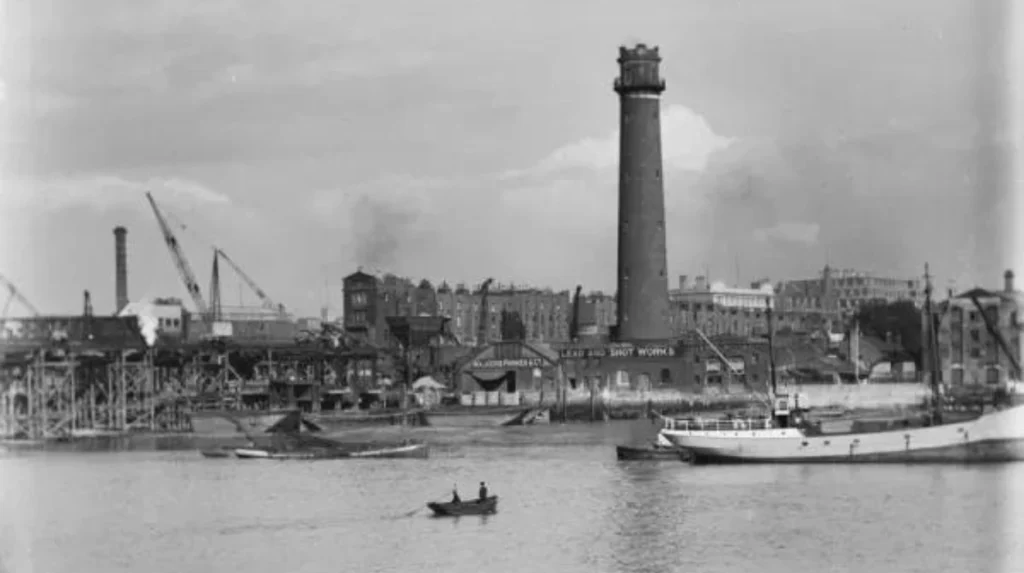
The River Thames shaped Lambeth’s development by providing transport routes, supporting riverside employment and connecting local businesses with central London. Its influence extended from medieval settlement and boatbuilding to industrial expansion, modern infrastructure and the redevelopment of former commercial waterfronts.
The Thames was a practical transport corridor for communities on both sides of the river. Before motorised road transport became widespread, waterborne movement offered a means of carrying bulky goods and connecting riverside settlements.
Lambeth’s position opposite Westminster gave it a distinctive role. The river separated the two banks geographically, but it also connected them through boats, ferries and other forms of water transport. The waterfront consequently became a place of movement, exchange and employment.
How Did River Transport Support Local Businesses?
River transport linked manufacturers, merchants and consumers. Businesses located near the shoreline benefited from access to vessels carrying goods between different parts of London and the wider Thames network.
Wharves enabled cargo to move between boats and land-based transport. Warehouses provided storage, while workshops supplied equipment and services to people working on the river. These activities created demand for skilled workers and supporting businesses.
Lambeth’s historical references to boatbuilding, fishing, wharves and warehouses illustrate this relationship between transport and employment. The waterfront functioned as a connected economic district, with different activities depending on access to the river.
The river also influenced where industrial buildings developed. Sites with convenient access to the water offered advantages for particular manufacturing and distribution activities. As London’s transport infrastructure changed, the relative importance of those sites changed as well.
How Did Industrialisation Change Lambeth’s Waterfront?
Industrialisation increased the concentration of manufacturing and commercial activity along parts of Lambeth’s riverfront. Historical records identify businesses associated with soap production and glazed stoneware, alongside boatbuilding and other river-related trades.
These industries contributed to local employment and the expansion of built-up areas. However, industrial growth also brought environmental and social pressures. Pollution, industrial fumes and poor housing conditions formed part of the history of some riverside districts.
Over time, changes in transport, planning and land use altered the waterfront. Former industrial premises gave way to different commercial, residential and public uses, while embankments and bridges changed how people accessed and experienced the river.
Understanding these changes helps visitors interpret the modern landscape. A contemporary building beside the Thames does not necessarily reveal its site’s earlier use, but historic maps and local records can connect the present location with its industrial past.
How Can Visitors Plan a Lambeth Maritime Heritage Walking Route?
Visitors can explore Lambeth’s maritime heritage on a self-guided walk linking Waterloo, the Thames waterfront, Lambeth Palace and Albert Embankment. Combining riverside observations with historical records creates a practical route through the borough’s transport, industrial and architectural history.
A walking route is an effective way to understand how Lambeth’s historic sites relate to one another. The Thames provides a clear geographical reference, while bridges, historic buildings and embankments help visitors navigate the area.
The following itinerary is a suggested route rather than a formally marked maritime heritage trail. Walking distances and timings depend on the chosen streets, access arrangements and the amount of time spent at each location.
Stop One: Begin in Waterloo
Start around Waterloo and the South Bank. This area provides a useful introduction to the connection between river transport, railways and the development of central London.
Look at how pedestrian routes, railway infrastructure and riverside public spaces occupy the same district. Consider how these different transport systems changed the movement of people and goods over time.
Allow time to examine the river views and identify the bridges connecting Lambeth with the north bank.
Stop Two: Walk Towards Lambeth Palace
Continue along the Thames towards Lambeth Palace. The route provides views of the river and historic institutional buildings.
Lambeth Palace offers an opportunity to examine the relationship between the waterfront and an important medieval complex. If a tour is available and booked in advance, visitors can explore selected historic interiors as part of their visit.
The palace is particularly relevant to visitors interested in the historical geography of the Thames. Its position demonstrates how proximity to Westminster influenced the location of an important religious residence.
Stop Three: Explore Lambeth Bridge
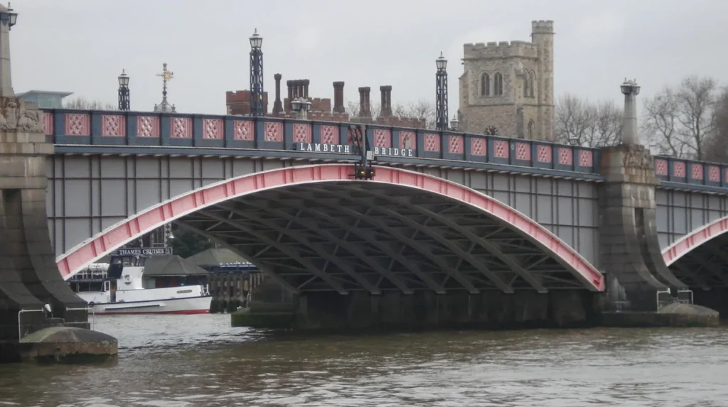
Continue towards Lambeth Bridge and observe the relationship between the river crossing, surrounding buildings and the wider waterfront.
Bridges provide evidence of changing transport needs and engineering. They also help visitors understand the practical geography of the river, including the relationship between routes on opposite banks.
Use the bridge area to compare the built environment with historic maps or photographs found through Lambeth Archives.
Stop Four: Follow Albert Embankment
Proceed along Albert Embankment to examine the district associated with former boatbuilding, wharves and manufacturing.
Look for changes in building age, scale and function. Modern development dominates much of the current landscape, but historical records document the former industrial character of this part of Lambeth.
The embankment provides the strongest connection between the physical riverfront and the documented history of local maritime industries.
Stop Five: Continue Research at Lambeth Archives
Complete the experience by consulting Lambeth Archives, either online before the walk or through an arranged research visit at Brixton Hill.
Search for historical maps, photographs and documents relating to the locations visited. Comparing these materials with present-day views provides a clearer understanding of the waterfront’s transformation.
Visitors with limited time can focus on the South Bank, Lambeth Palace and Albert Embankment. Those with a stronger research interest can set aside additional time for archival work.
Explore More Area Guide
Best Lambeth Attractions for Solo Travellers in South London
How to Plan a Thames-Side Itinerary Around Lambeth’s Cultural Landmarks
Why Does Lambeth’s Maritime Heritage Matter Today?
Lambeth’s maritime heritage explains how the Thames shaped the borough’s economy, settlement and built environment. Preserving historic records and recognising surviving riverside landmarks helps residents and visitors understand the relationship between London’s industrial past and its contemporary waterfront.
The importance of Lambeth’s maritime history extends beyond the preservation of individual buildings. It provides evidence of how communities used the river, how local industries developed and how transport influenced urban growth.
Historic places also contribute to the understanding of London’s wider development. The relationship between Lambeth and Westminster illustrates how the Thames acted both as a physical boundary and as a route connecting communities, institutions and businesses.
What Does Maritime Heritage Contribute to Local Identity?
Maritime heritage gives context to the borough’s changing identity. Modern Lambeth includes cultural venues, residential neighbourhoods, commercial districts and public riverside spaces. Earlier generations experienced many of these areas through different patterns of employment and transport.
Historical records connect these different periods. They reveal the people and industries associated with the river and show how changes in infrastructure affected daily life.
This context is valuable for local residents as well as tourists. It supports community history projects, architectural research and educational visits, while helping people understand why particular streets and buildings developed where they did.
How Can Historical Records Support Waterfront Conservation?
Conservation relies on understanding the significance of places before making decisions about their future. Historic maps, photographs and architectural assessments help establish what existed on a site, how it changed and which features contribute to its historical character.
Lambeth Council publishes conservation-area information and assessments for designated parts of the borough, including the Lambeth Palace conservation area. These documents provide a starting point for understanding the historical importance of buildings and their surroundings.
Archival research also provides evidence when historic industrial sites have been substantially altered. Even when a former wharf or workshop no longer survives, records can preserve information about its location, appearance and use.
For visitors, this means that maritime heritage is not confined to surviving structures. The combination of physical places, historical documentation and the present-day landscape provides a more complete understanding of Lambeth’s development.
How Can Visitors Make the Most of a Maritime History Visit to Lambeth?
Visitors get the most from Lambeth’s maritime history by combining a Thames-side walk with research into historic maps, industrial records and surviving landmarks. Checking access arrangements, comparing old photographs with modern views and allowing time for exploration creates a more informed heritage visit.
The best approach depends on the visitor’s interests and available time. A casual visitor can focus on the public riverside and historic views, while a researcher can investigate particular buildings, industries or former waterfront businesses.
Check Access Before Travelling
The Thames waterfront includes public walking areas, while historic buildings such as Lambeth Palace operate according to their own visiting arrangements. Confirm tour dates, opening times and booking requirements before making a journey.
Lambeth Archives also has specific opening hours and research arrangements. Check the council’s official archive information before travelling to consult documents in person.
Historical maps are particularly useful for investigating a changing waterfront. Compare the position of old streets, industrial premises and wharves with the modern layout.
Photographs add another layer of evidence by showing the appearance of buildings and riverbanks at particular times. Lambeth’s online historical image collection provides a starting point for this research.
A riverside walk provides the physical context for Lambeth’s maritime history. Archival research supplies details that are difficult to identify from the present landscape alone.
Combining the two methods helps visitors distinguish documented history from assumptions based on a building’s appearance or location. It also creates a clearer understanding of how river transport, industry and urban development influenced the borough.
Lambeth’s maritime story is ultimately a story of change. The Thames remains a defining feature of the borough, while its former working waterfront survives through historic buildings, documented industries, changing streets and the records preserved for future generations.
Where can visitors discover Lambeth’s maritime history?
Visitors can explore Lambeth’s maritime history along the River Thames, around Lambeth Palace, near Lambeth Bridge and through historical collections at Lambeth Archives and London Museum.