Lambeth is one of South London’s most accessible boroughs for visitors, with connections through the London Underground, National Rail, London Overground, local bus services, cycling routes and pedestrian networks. Its transport infrastructure connects major destinations such as Waterloo, Vauxhall, Brixton, Clapham, Kennington, Streatham and the South Bank with central London and other parts of the capital.
- Why Is Lambeth Well Connected to the Rest of London?
- How Does Lambeth’s Location Support Public Transport?
- What Makes Lambeth Different from Other London Boroughs?
- Which London Underground Lines Serve Lambeth?
- How Do National Rail Services Connect Lambeth with Other Destinations?
- Why Is Waterloo Station an Important Transport Hub?
- What Connections Are Available at Vauxhall Station?
- How Does Streatham Connect Southern Lambeth?
- What Role Does Clapham High Street Station Play?
- Which Bus Routes Make Exploring Lambeth Easier?
- Which Areas Can Visitors Reach by Bus?
- How Does the Hopper Fare Help Visitors?
- Are Night Buses Available in Lambeth?
- How Do Walking Routes Connect Lambeth’s Main Attractions?
- Which Walking Routes Are Useful Around Waterloo?
- How Can Visitors Explore Vauxhall on Foot?
- Why Is Walking Useful in Brixton?
- How Does Lambeth’s Historical Landscape Influence Modern Walking Routes?
- Can Visitors Explore Lambeth Using Cycling Routes?
- What Is the Role of Santander Cycles in Lambeth?
- Which Cycle Routes Connect Lambeth with Central London?
- How Is Lambeth Improving Cycling Safety?
- Do River Transport Services Provide Connections Near Lambeth?
- Which River Transport Connections Are Useful for Lambeth Visitors?
- What Are the Benefits of Travelling by River?
- How Accessible Are Lambeth’s Transport Stations for Disabled Visitors?
- How Can Visitors Save Money When Travelling Around Lambeth?
- Should Visitors Use Contactless Cards or Oyster Cards?
- How Do Travel Zones Affect Lambeth Journeys?
- How Can Walking Reduce Transport Costs?
- Which Transport Connections Are Best for Tourists Visiting Lambeth?
- Which Station Should Visitors Choose for Popular Attractions?
- What Should Business Travellers Consider?
- How Is Lambeth Developing Its Future Transport Connections?
- What Are Lambeth’s Sustainable Transport Targets?
- What Improvements Are Planned for Walking and Cycling?
- Why Will Public Transport Remain Important for Lambeth?
- How Can Visitors Plan an Efficient Journey Around Lambeth?
- Which Transport Connections Make Lambeth Easy to Explore?
The borough’s transport network supports different types of journeys. Tourists use railway and Underground stations to reach cultural attractions, riverside destinations and entertainment venues. Residents depend on buses and local rail connections for everyday travel. Business travellers benefit from access to Waterloo, Victoria and other major London interchanges.
Walking also plays an important role. Lambeth Council reports that approximately one-third of all trips in the borough are made on foot. The council’s long-term transport strategy prioritises walking, cycling, public transport accessibility and safer streets. Lambeth Council+1
Understanding how these transport connections work helps visitors plan efficient journeys, reduce unnecessary changes and explore different neighbourhoods without relying on a private car.
Why Is Lambeth Well Connected to the Rest of London?
Lambeth benefits from a combination of Underground, National Rail, Overground and bus connections that link its neighbourhoods with central London, major railway terminals and destinations across the capital. Waterloo, Vauxhall and Brixton provide particularly important interchange points for visitors and commuters.
Lambeth occupies a strategic position on the south bank of the River Thames. It sits opposite central London destinations including Westminster and the Victoria Embankment. Its northern neighbourhoods have relatively direct connections to central London, while southern areas have access to suburban railway services and extensive bus routes.
The borough’s transport network includes several different travel systems. Each serves a particular geographical purpose.
How Does Lambeth’s Location Support Public Transport?
Lambeth’s northern section benefits from proximity to Waterloo and the South Bank. Waterloo is one of London’s major railway terminals and provides connections to destinations across South West England and surrounding commuter areas.
Vauxhall offers an interchange between National Rail and the Victoria line. This connection provides access to central London, Victoria, King’s Cross and other destinations along the Underground network.
Brixton provides another important interchange. Its Victoria line station connects with National Rail services and local buses, making it a useful starting point for exploring South London.
Further south, Streatham provides National Rail connections for journeys towards central London and other suburban destinations.
These transport links make Lambeth accessible from different parts of the country and the capital. Visitors arriving at major London railway stations can generally connect with the borough through the wider Underground and National Rail network.
What Makes Lambeth Different from Other London Boroughs?
Lambeth combines central London accessibility with established residential neighbourhoods and local commercial centres. Visitors can travel between riverside attractions, shopping streets, entertainment venues and green spaces without depending entirely on one transport system.
However, connectivity is not uniform throughout the borough. Lambeth Council identifies differences between northern and southern transport provision. It also highlights limited connections between the northern and southern sections and weaknesses in some east–west journeys. Lambeth Council+1
This distinction matters when planning a visit. A journey between Waterloo and the South Bank is straightforward, while travelling between southern neighbourhoods can require a bus or a combination of rail services.
Which London Underground Lines Serve Lambeth?
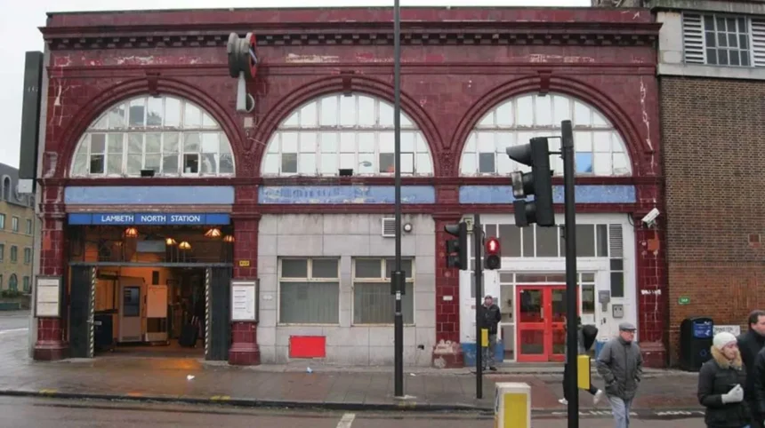
The London Underground provides important connections through the northern and central parts of Lambeth. The Bakerloo, Northern and Victoria lines serve key stations, including Lambeth North, Waterloo, Kennington, Oval, Stockwell, Vauxhall and Brixton, connecting visitors with central London.
The Underground is one of the most convenient ways to explore Lambeth. It connects residential neighbourhoods with major tourist destinations, shopping districts, business centres and railway terminals.
Three Underground lines are particularly relevant to visitors.
Bakerloo Line: Waterloo and Lambeth North
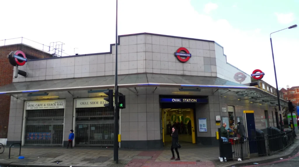
The Northern line serves Kennington and Oval, providing connections towards destinations including London Bridge, Bank, Leicester Square and Camden Town.
Kennington is useful for accessing the southern part of central London. Oval provides access to The Oval cricket ground, officially known as the Kia Oval, which hosts international and domestic cricket.
Visitors attending cricket matches benefit from the station’s proximity to the ground.
Victoria Line: Vauxhall, Stockwell and Brixton
The Victoria line is an important north–south transport connection through Lambeth. Its stations include Vauxhall, Stockwell and Brixton.
The line connects these neighbourhoods with Victoria, Green Park, Oxford Circus, King’s Cross St Pancras and Tottenham.
Brixton is particularly useful for visitors exploring Brixton Market, independent shops, restaurants and local cultural venues. Vauxhall provides access to the National Rail network, while Stockwell offers an interchange with the Northern line.
The Victoria line also operates Night Tube services on Friday and Saturday nights. Travellers should check the current timetable before planning late-night journeys.
How Do National Rail Services Connect Lambeth with Other Destinations?
National Rail connects Lambeth with central London, South London suburbs and destinations beyond the capital. Waterloo, Vauxhall, Streatham and Clapham High Street are useful railway stations, although individual services, operators and journey patterns vary by location.
National Rail provides connections that extend beyond the Underground network. It is particularly useful for visitors arriving from other parts of England and travellers exploring South London’s suburban neighbourhoods.
Why Is Waterloo Station an Important Transport Hub?
London Waterloo Station is one of the most important transport interchanges serving Lambeth.
It is a major terminus for South Western Railway services. These trains connect London with destinations across Surrey, Hampshire, Berkshire and Dorset.
Waterloo also connects National Rail passengers with the Underground, local buses, taxis and cycle-hire facilities.
The station’s facilities include lifts, step-free access to platforms, passenger assistance, toilets, waiting areas and customer information services. These features make it a practical arrival point for visitors carrying luggage or travelling with accessibility requirements.
What Connections Are Available at Vauxhall Station?
Vauxhall railway station provides National Rail services alongside the Victoria line Underground station.
South Western Railway manages the railway station. Its services connect Vauxhall with Waterloo and destinations across the South Western suburban network.
The interchange is particularly useful for people staying around Vauxhall, Nine Elms and South Lambeth. Visitors can transfer between train and Underground services without travelling to Waterloo first.
Vauxhall station has step-free access to all platforms, lifts and passenger assistance facilities.
How Does Streatham Connect Southern Lambeth?
Streatham railway station provides connections for residents and visitors in southern Lambeth. Southern manages the station, which is situated on Streatham High Road.
The station offers services towards central London and other destinations on the wider suburban network. It also connects with local bus services.
Streatham is useful for visitors exploring Streatham Common, local restaurants, independent businesses and nearby green spaces.
The station provides step-free access to its platforms, lifts and passenger assistance facilities. Travellers should check individual train routes because services from Streatham and nearby stations do not all follow the same stopping pattern.
What Role Does Clapham High Street Station Play?
Clapham High Street is a London Overground station in Lambeth. It connects the Clapham area with the wider Overground network and provides an interchange with Clapham North Underground station through a short street-level walk.
This connection is useful for journeys involving destinations beyond the direct Underground routes. However, Clapham High Street station does not have step-free platform access, an important consideration for passengers with mobility requirements.
Which Bus Routes Make Exploring Lambeth Easier?
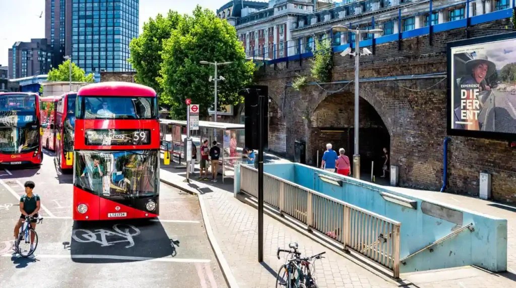
London buses connect Lambeth’s neighbourhoods, railway stations, shopping areas and cultural attractions. They provide practical alternatives where Underground stations are distant, particularly across Brixton, Streatham, Vauxhall, Clapham and Waterloo, while offering direct access to many local streets.
Buses are an important part of Lambeth’s public transport infrastructure. They provide local connections between destinations that do not always have direct railway links.
Unlike the Underground, buses serve many residential streets and local shopping centres. They are therefore useful for visitors exploring neighbourhoods beyond the main tourist routes.
Which Areas Can Visitors Reach by Bus?
Waterloo is a major bus interchange. Services connect the area with destinations across central and South London.
Vauxhall has bus connections towards Victoria, Brixton, Clapham and surrounding neighbourhoods. These routes support journeys between railway stations, residential districts and commercial areas.
Brixton provides extensive local bus connections. Visitors can use buses to explore nearby Streatham, Herne Hill, Clapham and other South London destinations.
Streatham also benefits from bus services connecting its high street with surrounding residential areas and railway stations.
Bus routes and stopping patterns change over time. Visitors should use TfL’s journey planner to identify the most suitable service for their destination.
How Does the Hopper Fare Help Visitors?
Transport for London’s Hopper fare allows passengers to make unlimited bus and tram journeys within one hour of their first touch-in, subject to the scheme’s conditions.
Passengers must use the same contactless card, mobile device or Oyster card for qualifying journeys.
This arrangement is useful for tourists visiting several neighbourhoods in one day. For example, a visitor can travel from Waterloo towards Vauxhall and then make another qualifying bus journey towards Brixton within the relevant hour without paying a separate bus fare.
TfL publishes fare information and the conditions governing the Hopper fare. Its published fare schedule also identifies a change to adult bus fares from 1 November 2026, so visitors should check the current prices before travelling.
Are Night Buses Available in Lambeth?
Night buses provide transport outside normal daytime operating hours. They are useful for people attending evening performances, restaurants, sporting events and entertainment venues.
Brixton, Waterloo and Vauxhall are important locations for late-night travel because of their connections with central London and surrounding neighbourhoods.
The availability of individual night routes depends on the destination and day of travel. Passengers should check live TfL information before leaving an evening event rather than assuming that their daytime bus service operates throughout the night.
How Do Walking Routes Connect Lambeth’s Main Attractions?
Walking is one of the most practical ways to explore central Lambeth because several attractions, railway stations, riverside spaces and cultural destinations are located within relatively short distances. Pedestrian routes also connect residential streets with local shops, parks and transport interchanges.
Walking provides an important connection between Lambeth’s public transport stations and local destinations. It also allows visitors to explore streets and public spaces that are not directly served by railway stations.
Lambeth Council identifies walking as a major part of local travel. Approximately one-third of all trips in the borough are made on foot, while many public transport journeys also involve walking to and from stations.
Which Walking Routes Are Useful Around Waterloo?
Waterloo offers access to several important pedestrian destinations.
Visitors can walk towards the South Bank, where cultural attractions, riverside public spaces and entertainment venues are concentrated. The South Bank provides pedestrian access towards the London Eye, Royal Festival Hall and National Theatre.
The area also connects with Westminster Bridge, Waterloo Bridge and other Thames crossings.
These walking connections make Waterloo a useful starting point for visitors combining sightseeing with public transport.
How Can Visitors Explore Vauxhall on Foot?
Vauxhall has pedestrian connections towards the Thames, Vauxhall Pleasure Gardens and surrounding residential neighbourhoods.
Vauxhall Pleasure Gardens provides a public green space near the transport interchange. Visitors can combine a local walk with a journey towards the riverside and neighbouring areas.
Pedestrian crossings and footways around major roads are important when navigating the area. Visitors should use designated crossings, particularly around busy junctions.
Why Is Walking Useful in Brixton?
Brixton has a concentrated town centre with shops, markets, restaurants, cultural venues and public transport facilities.
Brixton Underground station, Brixton railway station and Brixton Market are located close enough to support combined walking journeys.
Visitors can explore the town centre without repeatedly using buses or trains. Local walking also provides access to nearby public spaces and community facilities.
How Does Lambeth’s Historical Landscape Influence Modern Walking Routes?
Lambeth’s current streets and transport corridors reflect centuries of development around the River Thames, historic settlements, railway expansion and changing patterns of urban growth.
Lambeth Palace, the historic residence of the Archbishop of Canterbury, provides an example of the borough’s longstanding connection with London’s political and religious history.
Modern visitors exploring the riverside and surrounding streets encounter places shaped by these earlier developments. Read about the full [History of Lambeth and Its Historic Neighbourhoods] to understand how the borough developed from its historic riverside settlements into a major part of modern London.
This historical context helps explain the relationship between older streets, bridges, public spaces and today’s transport infrastructure.
Can Visitors Explore Lambeth Using Cycling Routes?
Cycling provides another practical way to explore Lambeth, particularly for visitors travelling between Waterloo, Vauxhall, Brixton and neighbouring South London districts. London’s cycle network, Santander Cycles hire scheme and borough cycling improvements support shorter journeys and connections with central London.
Cycling is part of Lambeth’s wider sustainable transport network. It offers an alternative to buses and trains for journeys where destinations are relatively close together.
The borough has invested in cycling infrastructure, including dedicated cycle routes, safer junctions and improved road layouts.
What Is the Role of Santander Cycles in Lambeth?
Santander Cycles is London’s public bicycle hire scheme, operated through docking stations across the capital.
Visitors can hire bicycles for individual journeys and return them to available docking stations. The scheme is particularly useful for people exploring central London and the riverside.
Waterloo is one of the locations with a staffed Santander Cycles hub during specified operating hours. Other docking stations can be located through TfL’s online cycle-hire map.
The scheme includes pedal bicycles and electric bicycles. Availability, prices and rental conditions depend on the selected service and current TfL arrangements.
Which Cycle Routes Connect Lambeth with Central London?
Lambeth connects with London’s wider Cycleway network. Cycleways are designated cycling routes designed to improve the safety and convenience of bicycle journeys.
Cycleway 8 and Cycleway 5 form part of the wider network around central London and Lambeth Bridge.
TfL also reports the completion of Cycleway 62 across Lambeth Bridge. This route improves cycling connections between north and south London and forms part of wider junction safety improvements.
These connections are particularly relevant to visitors travelling between Lambeth, Westminster and neighbouring central London destinations.
How Is Lambeth Improving Cycling Safety?
Lambeth Council’s Healthy Routes Network aims to improve conditions for walking and cycling.
The programme includes safer streets, improved pedestrian crossings and better cycling connections.
TfL’s improvements around Lambeth Bridge address road safety concerns. Between September 2021 and August 2024, 22 of the 31 recorded collisions at the northern junction involved cyclists. The improvements include cycle infrastructure and pedestrian crossings.
Visitors should follow designated cycling routes, observe road signs and check temporary closures before setting out.
Do River Transport Services Provide Connections Near Lambeth?
River Bus services offer an alternative way to travel along the Thames and connect central London with destinations further east and west. Visitors staying in Lambeth can access nearby river transport locations across the river and around the South Bank.
The River Thames is an important geographical feature of Lambeth. It separates the borough from Westminster and provides pedestrian crossings and river transport opportunities.
River Bus services operate under the Uber Boat by Thames Clippers brand. The network covers 24 piers between Putney and Barking Riverside.
These services provide an alternative to travelling by road or railway. They are particularly relevant to visitors exploring riverside destinations and central London’s waterfront attractions.
Which River Transport Connections Are Useful for Lambeth Visitors?
Visitors exploring northern Lambeth can consider nearby river piers around the South Bank and Westminster.
Westminster Pier provides access to the Westminster area, while London Eye Pier serves the South Bank attractions around the London Eye.
These locations are useful for travellers combining riverside sightseeing with journeys to other parts of London.
The nearest pier depends on the visitor’s starting point. Travellers should check the current departure timetable and the location of the boarding point before travelling.
What Are the Benefits of Travelling by River?
River transport provides connections between destinations that are also accessible by Underground and National Rail.
Passengers can use river services to reach locations along the Thames without travelling through busy road junctions.
The services also connect with wider transport networks around central London. However, river travel does not replace the Underground or local buses for every journey. Departure frequency, operating hours and fares vary by route.
TfL publishes current river service information, while Uber Boat by Thames Clippers provides route-specific timetables and ticket information.
How Accessible Are Lambeth’s Transport Stations for Disabled Visitors?
Accessibility varies between Lambeth’s transport stations. Waterloo and Vauxhall provide step-free access to their railway platforms, while Streatham also offers accessible facilities. Other stations have restrictions, so passengers should check individual routes before travelling.
Accessible transport is an important consideration for visitors with mobility requirements, wheelchair users, older travellers and families with pushchairs.
Lambeth Council identifies station accessibility as an area requiring continued improvement. Its transport strategy highlights that several Underground and railway stations in the borough do not have step-free access.
Which Stations Offer Step-Free Access?
Some important stations have facilities that support accessible journeys.
- Waterloo: Step-free access to all National Rail platforms, with lifts and passenger assistance.
- Vauxhall: Step-free access to all National Rail platforms, with lifts and assistance facilities.
- Streatham: Step-free access to railway platforms, lifts and passenger assistance.
These facilities do not automatically guarantee that every interchange or onward journey is step-free. Passengers should check the complete journey, including Underground connections and street-level routes. National Rail+2
How Can Visitors Plan an Accessible Journey?
Transport for London provides accessibility information and journey-planning tools.
Passengers can check whether stations have lifts, step-free entrances, accessible toilets and other facilities.
The availability of lifts can change because of maintenance or temporary closures. Visitors should check live service information before travelling.
Lambeth Council’s transport strategy also promotes accessible, affordable and welcoming transport services. Its approach includes safer streets, better pedestrian infrastructure and improvements for people with different mobility requirements.
How Can Visitors Save Money When Travelling Around Lambeth?
Visitors can manage transport costs by using contactless payment or Oyster cards, taking advantage of applicable fare caps and combining walking with public transport. Bus journeys offer a particularly useful option for exploring nearby neighbourhoods without purchasing separate rail tickets.
London’s public transport payment system allows visitors to pay for journeys without buying traditional paper tickets for every trip.
Should Visitors Use Contactless Cards or Oyster Cards?
Transport for London accepts contactless bank cards, compatible mobile devices and Oyster cards for pay-as-you-go travel.
Passengers touch in when starting an Underground or railway journey and touch out when leaving the station. On buses, passengers touch in when boarding.
TfL calculates applicable fares according to the journey, travel zones and payment method.
Contactless and Oyster pay-as-you-go journeys also benefit from daily and weekly fare capping. The same card or device must be used consistently for the relevant journeys to calculate the cap correctly.
How Do Travel Zones Affect Lambeth Journeys?
London’s transport network is divided into fare zones. Different stations fall within different zones, and fares depend on the zones travelled through.
Most of the principal Lambeth destinations discussed in this guide are within Zones 1 to 3.
Waterloo and Lambeth North provide access to central London journeys, while Brixton, Vauxhall, Stockwell and several other locations serve wider inner London travel.
Visitors should check the applicable fare before travelling, especially when combining journeys across multiple zones.
How Can Walking Reduce Transport Costs?
Walking between nearby destinations reduces the number of paid public transport journeys.
For example, visitors exploring Waterloo and the South Bank can combine sightseeing on foot with a single Underground or railway journey to reach the area.
Similarly, Brixton’s town centre has several attractions, shops and food destinations within walking distance of its main transport stations.
Combining walking with public transport also reduces dependence on taxis and private hire vehicles.
Which Transport Connections Are Best for Tourists Visiting Lambeth?
The best transport connection depends on the visitor’s destination. Waterloo suits South Bank sightseeing, Vauxhall provides convenient Underground and railway interchanges, Brixton serves local markets and cultural attractions, while Streatham and Clapham High Street connect visitors with southern neighbourhoods.
Choosing the right arrival station reduces unnecessary changes and makes sightseeing more straightforward.
Which Station Should Visitors Choose for Popular Attractions?
The following locations provide useful starting points for exploring Lambeth.
Imperial War Museum
Lambeth North is a convenient Underground station for reaching the museum. Waterloo also provides access through a walk or local bus journey.
The Kia Oval
Oval Underground station provides convenient access to the international cricket ground.
Brixton Market
Brixton Underground and railway stations provide access to the market, restaurants and surrounding shopping streets.
Vauxhall Pleasure Gardens
Vauxhall Underground and National Rail stations provide convenient connections to the gardens.
Streatham Common
Streatham’s railway station and local bus connections help visitors reach the surrounding green space.
What Should Business Travellers Consider?
Business travellers benefit from Waterloo and Vauxhall because both provide access to central London employment districts.
Waterloo offers National Rail, Underground and bus connections. Vauxhall provides an interchange between railway and Victoria line services.
Visitors working remotely can also use the transport network to reach cafés, libraries and commercial areas around Brixton, Waterloo and Clapham.
Journey planning is particularly important during weekday peak periods, when central London railway and Underground services experience higher passenger demand.
How Is Lambeth Developing Its Future Transport Connections?
Lambeth’s future transport development focuses on safer walking routes, improved cycling infrastructure, accessible streets and more sustainable journeys. The council’s transport strategy supports better connections between neighbourhoods and aims to reduce unnecessary dependence on private cars.
Transport infrastructure continues to evolve as London’s population, employment patterns and travel requirements change.
Lambeth Council’s Transport Strategy establishes a long-term framework for improvements to the borough’s mobility network. It prioritises accessibility, public health, environmental sustainability and better connections between local destinations.
What Are Lambeth’s Sustainable Transport Targets?
Lambeth’s transport strategy aligns with the Mayor of London’s wider transport objectives.
The council identifies a target for 85% of trips in Lambeth to be made using sustainable transport modes. These include walking, cycling and public transport.
The wider Mayor’s Transport Strategy sets an objective for four out of five trips across London to use these sustainable modes by 2041.
These targets demonstrate the importance of reducing car dependency and improving connections between public transport, cycling and walking infrastructure.
What Improvements Are Planned for Walking and Cycling?
The Healthy Routes Network is an important part of Lambeth’s transport development programme.
Its objectives include safer pedestrian crossings, improved cycling infrastructure and better connections between neighbourhoods.
TfL’s improvements at Lambeth Bridge and Streatham Hill demonstrate how these objectives translate into infrastructure projects.
The Streatham Hill improvement programme includes protected cycle lanes, safer pedestrian crossings and continuous bus lanes. These measures support different types of road users while improving local connectivity.
Why Will Public Transport Remain Important for Lambeth?
Public transport will remain central to Lambeth’s development because the borough connects residential communities, employment districts, educational institutions and visitor attractions.
Improved connections between railway stations, bus stops, walking routes and cycling infrastructure will help passengers complete journeys more efficiently.
The council also recognises that northern and southern Lambeth require stronger connections. Addressing these geographical differences remains important for balanced transport development.
Explore More Area Guide
How to Navigate Lambeth During Major London Events
Lambeth Public Toilets: Visitor Guide to Facilities and Access
How Can Visitors Plan an Efficient Journey Around Lambeth?
Visitors can explore Lambeth efficiently by identifying their nearest railway or Underground station, checking live TfL service information and combining public transport with walking. Choosing suitable interchanges and checking accessibility and fares before departure helps avoid unnecessary delays.
A practical journey plan should consider the location of attractions, travel time, transport changes and the availability of alternative services.
Which Digital Tools Help Visitors Navigate Lambeth?
Transport for London provides several resources for planning journeys.
- TfL Journey Planner: Identifies suitable Underground, bus, rail and walking connections.
- TfL Go: Provides transport maps, journey information and service updates.
- National Rail: Provides railway timetables, station facilities and train information.
- Santander Cycles: Helps visitors locate bicycle-hire docking stations.
- Uber Boat by Thames Clippers: Provides river service routes and departure information.
Visitors should check live travel updates before leaving their accommodation, particularly during weekends, public holidays and major London events.
What Should Visitors Check Before Travelling?
Several practical considerations improve the reliability of journeys around Lambeth.
First, check whether the chosen Underground or railway station is operating normally. Engineering works and temporary closures affect journey times.
Second, identify the correct interchange. A journey involving Vauxhall, Waterloo or Brixton can require different connections depending on the destination.
Third, check station accessibility if travelling with a wheelchair, pushchair or heavy luggage.
Finally, consider walking distances between attractions. Some destinations are close enough to explore on foot rather than paying for another transport journey.
Which Transport Connections Make Lambeth Easy to Explore?
Lambeth is well connected through a combination of London Underground, National Rail, London Overground, bus, cycling and walking infrastructure. Waterloo, Vauxhall and Brixton are particularly important transport interchanges, while Kennington, Oval, Stockwell, Streatham and Clapham High Street provide additional access to local neighbourhoods.
The Underground supports fast connections with central London. National Rail extends journeys into South London and destinations beyond the capital. Local buses connect residential streets and shopping areas, while walking and cycling provide practical options for shorter journeys.
River transport adds another way to explore destinations along the Thames, and accessible station facilities support visitors with different mobility requirements.
For tourists, the most effective approach is to select transport connections according to the attractions they intend to visit. For residents and business travellers, combining different transport modes provides flexibility across the borough.
Lambeth’s continuing investment in sustainable transport, safer streets and improved cycling infrastructure will remain important in making the borough easier to navigate and explore.
What is the best way to travel around Lambeth?
The best way to travel around Lambeth is by combining the London Underground, National Rail and local buses. Walking and cycling are also convenient for exploring nearby attractions, markets and riverside destinations.