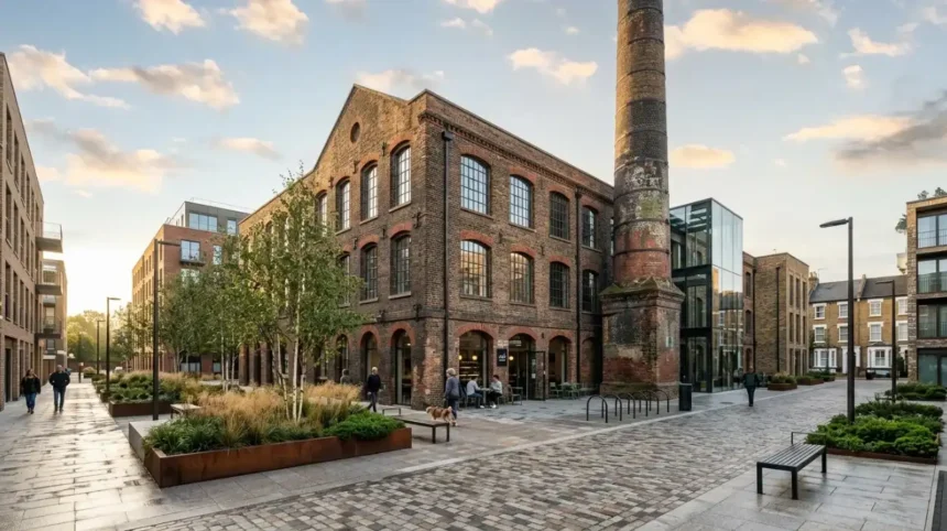
Lambeth’s former industrial neighbourhoods reveal how manufacturing, river transport, railways and commercial development transformed South London. The London Borough of Lambeth stretches along the south bank of the River Thames, opposite central London. Its historic districts include Waterloo, Lambeth, Vauxhall, Kennington, Brixton and parts of Streatham.
- What industries shaped Lambeth’s former industrial neighbourhoods?
- How did the River Thames influence Lambeth’s industrial development?
- What can visitors discover about Lambeth’s historic pottery industry?
- Where can visitors find evidence of industrial life along the Albert Embankment?
- How did railways transform Vauxhall and the surrounding industrial districts?
- What do Waterloo’s historic streets reveal about Lambeth’s commercial past?
- What remains of Lambeth’s former gasworks and manufacturing sites?
- How can visitors explore Lambeth’s industrial heritage through archives and museums?
- How did industrial decline and urban regeneration change Lambeth’s neighbourhoods?
- How can visitors plan a walk through Lambeth’s former industrial neighbourhoods?
- Why does Lambeth’s industrial heritage matter to visitors today?
During the nineteenth century, Lambeth developed as a centre for pottery production, engineering, warehousing, food processing and riverside commerce. The Thames supported the movement of raw materials and finished goods, while railways and roads connected workshops and factories with London’s expanding markets.
Industrial Lambeth did not develop as a single manufacturing district. Different neighbourhoods supported different economic activities. Riverside areas concentrated on trade, storage and production, while railway corridors encouraged commercial growth and housing development further inland.
Today, visitors discover this history through surviving industrial buildings, historic streets, railway infrastructure, museums, converted commercial premises and regenerated riverside spaces. Understanding these locations explains how Lambeth changed from a working industrial landscape into a diverse urban borough.
What industries shaped Lambeth’s former industrial neighbourhoods?
Lambeth’s industrial economy developed around pottery, glassmaking, gas production, soap manufacturing, flour milling and river commerce. These industries used the Thames for transport and occupied land near bridges, roads and railway corridors. Their factories and workshops supported employment and influenced the borough’s housing, streets and commercial growth.
Lambeth’s industrial development accelerated as London’s population increased and demand for construction materials, household goods and essential services expanded. Local manufacturers supplied products required by homes, businesses and public infrastructure.
Pottery became one of the area’s best-known industries. Manufacturers produced stoneware vessels, drainage pipes, storage containers and decorative ceramics. These goods served domestic markets and supported the expansion of Victorian sanitation systems.
Glassmaking also formed part of Lambeth’s early industrial history. Vauxhall had a plate-glass works by the seventeenth century, demonstrating that commercial production existed before the major industrial expansion of the nineteenth century.
Other businesses included distilleries, soap works, flour mills, timber yards and gas facilities. Their activities generated demand for transport, storage, construction and manual labour.
The industries occupied different sites according to their operational needs. Factories handling bulky materials benefited from river access, while gas works required substantial land and connections to the urban distribution network.
This industrial structure linked Lambeth’s local economy to London’s wider development. Manufacturers supplied nearby residents and commercial customers, while transport infrastructure connected production sites to markets throughout the capital.
How did the River Thames influence Lambeth’s industrial development?
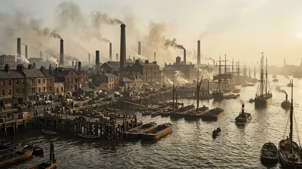
The River Thames provided Lambeth with a transport corridor for moving materials and finished goods. Its south-bank location encouraged the growth of wharves, warehouses, boat-related businesses and riverside factories. These activities connected local production with London’s expanding commercial economy and influenced the layout of historic neighbourhoods.
Before modern road freight became dominant, river transport offered an important way to move heavy and bulky goods. Lambeth’s riverside supported activities that depended on access to vessels, loading areas and storage facilities.
Coal, timber, building materials and manufactured products formed part of London’s wider river economy. Wharves provided places where goods transferred between boats, warehouses, workshops and urban distribution networks.
The riverside also attracted industrial processes that required deliveries of raw materials and regular movement of finished products. Pottery production, for example, relied on materials such as clay and fuel. Warehousing supported the storage and onward distribution of commercial goods.
Visitors exploring the Albert Embankment can examine the relationship between the river and the borough’s historic industrial geography. The modern embankment landscape contains contemporary buildings, public spaces and transport connections, while historical records document former industrial uses.
Lambeth’s riverside transformation also illustrates the relationship between infrastructure and land use. As bridges, embankments and railway connections developed, the riverfront became increasingly integrated with the expanding city.
The River Thames remains an important geographical reference for understanding the borough. Reading its landscape alongside historic maps helps visitors identify where former industries occupied land that now accommodates offices, housing and public facilities.
What can visitors discover about Lambeth’s historic pottery industry?
Lambeth’s pottery industry produced practical stoneware and decorative ceramics for domestic, commercial and public use. The Doulton business became one of the area’s most significant manufacturers, producing drainage goods and artistic pottery. Its history connects Lambeth with Victorian manufacturing, technical innovation and the development of British decorative arts.
The Doulton business began in London in the early nineteenth century. Royal Doulton’s company history records John Doulton’s investment in a Lambeth pottery business in 1815, while the Doulton and Watts partnership formed in 1820. The business subsequently expanded its range of manufactured products.
Its early production included drainage pipes, storage jars and other stoneware items. These products served practical purposes at a time when London was expanding and public sanitation was becoming an increasingly important urban concern.
The company’s work later included decorative ceramics. Henry Doulton supported the development of artistic pottery, and the Lambeth factory employed artists and designers who contributed painted and decorated pieces. Royal Doulton’s historical account states that the Lambeth Pottery employed more than 200 artists and designers during the 1880s.
The factory therefore represented more than a place of mass production. It connected skilled manual work, design education and commercial manufacturing. The finished ceramics demonstrate how an industrial enterprise could combine functional products with artistic craftsmanship.
Lambeth’s pottery industry also included other producers. The London Museum records manufacturers such as James Stiff and Sons and Stephen Green’s Imperial Pottery alongside Doulton. Its historical illustration of Lambeth potteries, published in 1872, provides evidence of the area’s established manufacturing presence.
The Lambeth Doulton factory closed in the mid-twentieth century, and production moved away from the borough. The Science Museum Group records the Lambeth factory’s closure in 1953, while Royal Doulton’s company timeline places the end of its Lambeth operations in 1955. These dates reflect differing company-history accounts and the transition of production away from the original site.
Visitors seeking evidence of the pottery industry should explore museum collections, historical photographs and archival records rather than assume the original factory survives as a visitor attraction. Ceramic objects and illustrations offer a direct connection to Lambeth’s former workshops.
Where can visitors find evidence of industrial life along the Albert Embankment?
The Albert Embankment provides a useful starting point for understanding Lambeth’s former riverside industries. Historical records identify pottery works, soap manufacturing, flour milling, timber yards, distilleries and gas production along this stretch. Modern buildings occupy many former industrial sites, making maps and conservation records valuable research tools.
The Albert Embankment runs along the Thames between Lambeth Bridge and Vauxhall. Its present appearance reflects several phases of urban redevelopment, including changes to riverside access, commercial buildings and transport infrastructure.
A Lambeth Council conservation-area designation report documents industrial uses recorded on nineteenth-century Ordnance Survey maps. These include a large gin and vinegar distillery, a coal wharf, London Pottery Works, Lambeth Soap Works, a flour mill complex and an India Rubber Works.
The report also records Phoenix Gas Works in the vicinity of what is now St George’s Wharf. These references demonstrate the concentration of manufacturing and utility infrastructure near the river during the nineteenth century.
The sites illustrate how the riverside served several connected economic functions. Pottery and soap manufacturing produced goods, flour milling processed food, timber yards supported construction, and gas works supplied energy for the expanding city.
The modern landscape does not preserve every factory building. Redevelopment replaced many industrial premises with offices, residential towers and other uses. Historical evidence therefore becomes essential when identifying the original function of individual sites.
Visitors can use the council’s conservation-area documents to compare historic street layouts with present-day locations. This approach distinguishes documented industrial sites from buildings that simply look old or retain traditional architectural features.
The Albert Embankment is also an example of how public access and modern development coexist with industrial heritage. A riverside walk provides geographical context, while maps and historical photographs explain the changes that the built environment alone no longer reveals.
How did railways transform Vauxhall and the surrounding industrial districts?
Railway construction transformed Vauxhall by improving passenger and goods connections while dividing established streets and industrial sites. The railway reached Vauxhall during the nineteenth century, and Vauxhall Station opened in 1848. New transport links encouraged urban growth and altered the balance between riverside industry and inland housing.
Before railway expansion, parts of Vauxhall retained a mixture of market gardens, residential streets and commercial premises. Development increased following the opening of Westminster Bridge in 1750 and Vauxhall Bridge in 1816.
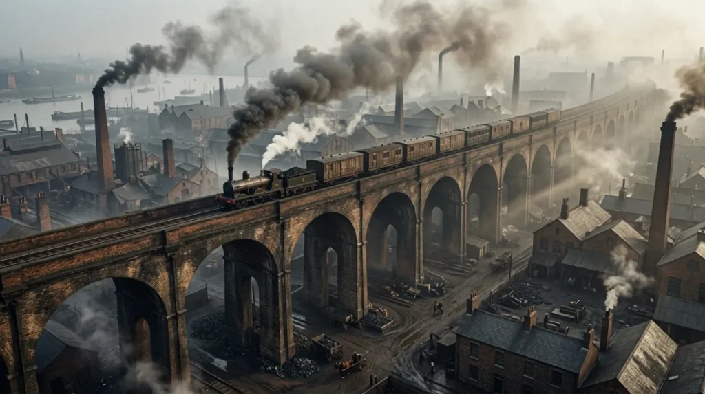
The railway brought a different scale of change. Railway lines and viaducts required substantial land, and construction altered the continuity of existing streets. A London development framework, drawing on historical research, records that railway construction removed established manufacturing sites and permanently changed the character of the Vauxhall and Lambeth districts.
Vauxhall Station opened in 1848. Railway access strengthened the area’s connection with central London and the wider transport network. The railway corridor also influenced where businesses and housing developed.
The resulting urban pattern reflected different land-use pressures. Industrial and commercial activity remained prominent along parts of the river, while residential development expanded inland. This distinction was not absolute, but it helps explain the neighbourhood’s historic geography.
Visitors can observe the railway infrastructure around Vauxhall today. Elevated tracks, station approaches and transport corridors provide visible evidence of how railway engineering shaped the area.
The industrial significance of these structures extends beyond travel. Railways changed the movement of workers, materials and goods, affected land values and encouraged new patterns of development. Their impact remains visible in the relationship between station areas, busy roads and adjoining streets.
What do Waterloo’s historic streets reveal about Lambeth’s commercial past?
Waterloo’s historic streets reveal how bridges, railway connections and commercial development reshaped northern Lambeth. The Waterloo conservation area includes parts of Cornwall Road, Stamford Street and Waterloo Road. Its buildings reflect more than a century of change from the late eighteenth through the early twentieth century.
Waterloo developed in close relationship with the River Thames and the expansion of central London. The opening of Westminster Bridge in 1750 encouraged urban development south of the river, helping to connect the area with growing commercial districts.
During the nineteenth century, Waterloo experienced further change as railways, roads and commercial buildings expanded. The mixture of building types recorded in the conservation-area profile demonstrates that the district did not develop around one industry alone.
Commercial premises, residential terraces and larger buildings occupied a landscape shaped by changing transport needs and economic activity. Workshops, businesses and services operated within a neighbourhood that increasingly connected central London with the south bank.
Waterloo Station became a major landmark in the district’s development. Its growth reflects the wider importance of rail travel in London’s expansion. Historic England also identifies the station’s Victory Arch, built between 1919 and 1922 to commemorate 585 London and South Western Railway employees who died in the First World War.
The arch provides a connection between industrial-era transport and the social history of railway employment. It commemorates workers whose lives and labour formed part of the railway network’s operation.
Visitors can explore the Waterloo conservation area on foot, observing the relationship between older streets, transport infrastructure and later buildings. The official conservation-area profile helps identify the designated area and its architectural character.
Waterloo’s history also shows that industrial heritage includes commercial and transport systems, not only factories. Offices, stations, railway structures and working streets help explain how Lambeth’s economy changed over time.
What remains of Lambeth’s former gasworks and manufacturing sites?
Former gasworks and manufacturing sites reveal how Victorian Lambeth supplied energy, building materials and everyday products to a growing city. Historic records identify Phoenix Gas Works, soap factories, flour mills and rubber manufacturing near the Albert Embankment. Redevelopment has changed the landscape, but archival evidence preserves these industrial connections.
Gas production was essential to nineteenth-century urban life. Gasworks processed fuel to provide lighting and other services before electricity became widely established. These industrial facilities required large sites, specialised equipment and connections to distribution networks.
Historic England’s local heritage records identify the former No. 1 gasholder at Kennington Lane Gasholder Station. The structure was built between 1877 and 1879 for the Phoenix Gas Light and Coke Company and enlarged between 1891 and 1892.
The gasholder illustrates the scale of infrastructure required to support a growing urban population. Gas storage formed part of a wider system that included production facilities, pipes and distribution networks.
Lambeth’s industrial history also includes food processing and household manufacturing. Flour mills supplied a staple food product, while soap works served domestic and commercial demand. India rubber manufacturing represented another branch of the borough’s industrial economy.
Visitors should distinguish between a surviving historic structure and a former industrial site that has been redeveloped. A modern office building on a former factory site does not necessarily preserve the original industrial architecture.
Lambeth Council’s conservation-area reports provide evidence for identifying these locations. Historic England’s heritage records also help visitors investigate listed structures and architectural features.
The most effective way to understand these sites is to combine a physical visit with documentary research. Historic maps, dated photographs and planning records explain the relationship between former industrial operations and the buildings that occupy the land today.
How can visitors explore Lambeth’s industrial heritage through archives and museums?
Lambeth Archives is a key resource for researching the borough’s industrial past. Its collections include historical maps, photographs, documents and artefacts relating to local people, businesses, transport and buildings. Visitors can use these materials to investigate former factories, trace neighbourhood changes and understand the lives of industrial workers.
Lambeth Archives serves as the borough’s local record office and local studies library. Its collections document the development of Lambeth over several centuries and support research into buildings, businesses, social history and transport.
The archive holds records relating to local government, schools, estates, churches, businesses, societies and charities. Its historical material also covers subjects such as women’s history, Black history, LGBTQ+ history, archaeology and architecture.
These resources help visitors reconstruct industrial neighbourhoods that have undergone substantial redevelopment. Historical maps establish where factories stood, while photographs document building designs, street layouts and former working environments.
Business records and local documents provide additional context. They help researchers investigate who operated a factory, which products it manufactured and how its activities related to the surrounding community.
The London Museum offers another route into Lambeth’s manufacturing history through its collections. Its record of a nineteenth-century illustration of Lambeth potteries documents the area’s manufacturing activity and the presence of firms including Doulton and James Stiff and Sons.
The Science Museum Group’s collection also records Royal Doulton as a ceramics manufacturer based in Lambeth. Such museum records connect the borough’s industrial history with objects that survive beyond the original factory buildings.
Before visiting an archive, identify a particular neighbourhood, company or street. Search the institution’s catalogue for maps, photographs and business records, then check opening arrangements and any requirements for consulting original documents.
This approach turns a general heritage visit into a focused investigation of Lambeth’s former industrial economy.
How did industrial decline and urban regeneration change Lambeth’s neighbourhoods?
Industrial decline changed Lambeth as manufacturing premises gave way to other urban uses. Former factory and warehouse sites became available for housing, offices, infrastructure and public spaces. Regeneration reshaped the riverside and transport corridors, while conservation records and surviving structures continue to document the borough’s industrial origins.
Lambeth’s industrial landscape changed gradually rather than disappearing at one moment. Manufacturing businesses faced changing production methods, urban land pressures, transport requirements and environmental regulation.
The closure of the Lambeth pottery provides a clear example. Royal Doulton’s company history records that restrictions on salt-glaze production in 1955 forced the closure of the Lambeth factory and the transfer of production to Stoke-on-Trent.
Other industrial sites experienced different forms of change. Railway infrastructure remained essential to transport, while former manufacturing plots became attractive for commercial and residential development.
The Albert Embankment demonstrates this transition. Historic records identify nineteenth-century industrial uses in areas now occupied by modern developments. The contrast between historical maps and the contemporary riverside reveals how land use changed as London’s economy evolved.
Regeneration also raises questions about heritage conservation. Historic buildings and structures provide evidence of past working life, but redevelopment does not always preserve the original factory, machinery or internal layout.
Conservation-area designations help identify places where the historic character of streets and buildings deserves particular attention. Lambeth Council’s conservation records for Waterloo and the Albert Embankment provide useful starting points for understanding these changes.
For visitors, regeneration is part of the story rather than a separate subject. Modern housing, offices and public spaces occupy land shaped by manufacturing, river trade and railway construction.
Examining these changes explains how Lambeth developed from a collection of riverside settlements and expanding residential districts into part of a densely connected London borough.
Explore More Area Guide
Where to Explore Lambeth’s Working-Class Heritage in South London
Explore Lambeth’s Public Monuments and Historic Memorials
How can visitors plan a walk through Lambeth’s former industrial neighbourhoods?
Visitors can explore Lambeth’s industrial history through a self-guided route connecting the Albert Embankment, Vauxhall and Waterloo. The route combines riverside landscapes, railway infrastructure, historic streets and archival research. Comparing present-day buildings with historic maps provides a practical way to identify former industrial sites.
Begin along the Albert Embankment, where historical records document the former pottery works, wharves, gasworks and manufacturing premises. Observe the modern riverside landscape and note how the Thames connects the different sites.
Continue towards Vauxhall to examine the relationship between railway infrastructure, bridges and urban development. Vauxhall Station provides a reference point for understanding the impact of nineteenth-century railway construction.
From Vauxhall, travel towards Waterloo using public transport or a suitable walking route. Explore the streets within the Waterloo conservation area, particularly the parts of Cornwall Road, Stamford Street and Waterloo Road identified by Lambeth Council.
Allow time to examine historic maps before or after the walk. The Albert Embankment designation report provides documented examples of former industrial uses, while the Waterloo conservation-area profile explains the area’s architectural development.
Lambeth Archives is particularly useful for visitors who want to investigate specific businesses or buildings. Check its current opening arrangements before travelling, as research facilities and exhibitions operate according to the archive’s published schedule.
A productive visit does not require access to a former factory interior. The aim is to connect present-day streets and transport corridors with documented historical activities.
As you explore the modern neighbourhoods, you are crossing land shaped by generations of manufacturing and trade. Read the full [Lambeth’s Industrial History and Neighbourhood Development] to understand how the borough’s industries, transport links and communities developed over time.
Why does Lambeth’s industrial heritage matter to visitors today?
Lambeth’s industrial heritage explains the origins of its modern streets, transport connections and riverside developments. Pottery, gas production, warehousing and railway construction influenced local employment and urban growth. Exploring these histories helps visitors understand how industrial activity shaped neighbourhood identity and why historic records remain important today.
The borough’s industrial past connects local history with wider developments in London. Manufacturing supplied household goods and construction materials, river transport supported commerce, and railways transformed movement across the capital.
The evidence is distributed across several sources rather than concentrated in one industrial museum. Visitors can combine surviving infrastructure, conservation-area reports, historic photographs and museum collections to build a clearer understanding of the past.
This method also reveals the relationship between industrial and social history. Factories employed skilled craftspeople and manual workers, while railway development changed commuting patterns and neighbourhood layouts. Manufacturing sites formed part of the wider urban environment rather than operating in isolation.
Industrial heritage remains relevant to contemporary planning. Conservation records help decision-makers assess the historical significance of buildings and streets when considering redevelopment. They also provide residents and visitors with evidence of how local places have changed.
Lambeth’s former industrial neighbourhoods therefore offer more than a record of obsolete factories. They explain the economic processes that shaped South London and show how infrastructure, commerce and manufacturing influenced the city’s growth.
For visitors, the strongest approach combines walking with historical research. The Albert Embankment, Vauxhall and Waterloo provide complementary perspectives on riverside industry, railway development and commercial change. Together, they reveal the industrial foundations beneath Lambeth’s contemporary urban landscape.
What industries were historically important in Lambeth?
Lambeth was known for pottery production, glassmaking, gas manufacturing, soap works, flour milling, rubber manufacturing and riverside trade. These industries supported London’s growing population during the eighteenth and nineteenth centuries.