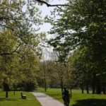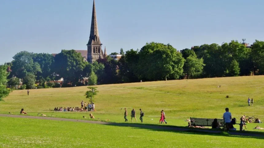
Lambeth is one of London’s most varied inner boroughs. It stretches from the South Bank and Waterloo to Brixton, Herne Hill, Streatham, West Norwood and the southern edge of Crystal Palace. Its urban form includes major transport corridors, dense residential districts, historic terraces, Victorian villas, local shopping parades, parks and conservation areas.
- Which Lambeth neighbourhoods have the strongest village-like character?
- Why is Herne Hill one of the best places to experience village-like Lambeth?
- What makes Larkhall feel like a village within Lambeth?
- Why is Stockwell Green worth visiting for historic streetscapes?
- Can visitors find village-like streets around Tulse Hill?
- What makes West Norwood feel like a local village centre?
- Is Gipsy Hill a good place to discover Lambeth’s quieter character?
- How does Streatham Common create a village-like experience?
- Why should visitors include parts of Clapham in a Lambeth village-like itinerary?
- How do Lambeth’s conservation areas help preserve its village-like neighbourhoods?
- Which Lambeth village-like areas are best for a walking itinerary?
- What should visitors look for when exploring Lambeth’s village-like areas?
- How is Lambeth’s village-like character likely to remain relevant for visitors?
For visitors, this variety creates a useful distinction between Lambeth’s major destinations and its village-like neighbourhoods. A village-like area in London is not necessarily a legally defined village. It describes a neighbourhood with a recognisable local centre, independent shops, traditional streets, residential architecture, community spaces, greenery and a slower pedestrian rhythm than surrounding arterial roads.
Lambeth Council currently identifies neighbourhood areas including Brixton, Clapham, Norwood, Streatham, Stockwell and North Lambeth. It also recognises specific neighbourhood-planning areas such as Herne Hill, West Norwood and Tulse Hill.
The borough contains 62 conservation areas covering approximately 30% of Lambeth, providing particularly strong evidence of the architectural and historic character found across its neighbourhoods. These designated areas include Herne Hill, Gipsy Hill, Larkhall, Stockwell Green, Streatham Common, West Norwood and several smaller historic streetscapes.
For visitors searching for Lambeth’s village-like character, the strongest places to explore are Herne Hill, Larkhall, Stockwell Green, Tulse Hill, West Norwood, Gipsy Hill, Streatham Common and selected parts of Clapham.
Which Lambeth neighbourhoods have the strongest village-like character?
Herne Hill, Larkhall, Stockwell Green, West Norwood, Gipsy Hill, Tulse Hill and Streatham Common provide some of Lambeth’s clearest village-like environments, combining local high streets, historic housing, green spaces, independent businesses, community facilities and distinctive architectural character.
The term “village-like” describes an urban character rather than an official administrative classification. Lambeth’s neighbourhoods developed at different times and retain different combinations of historic buildings, commercial centres, parks and residential streets.
Several of the strongest examples are also represented within Lambeth’s conservation-area system. The council lists Herne Hill, Gipsy Hill, Larkhall, Stockwell Green, Streatham Common and West Norwood among its designated conservation areas.
This protection matters because conservation areas are designated for areas of special architectural or historic interest where preserving or enhancing character and appearance is desirable. They receive additional planning protection beyond ordinary planning controls.
Visitors therefore have several ways to recognise village-like character. A compact shopping parade creates a local centre. Older terraces create visual continuity. A church, pub, square or park provides a focal point. Narrow residential streets create a quieter pedestrian environment. Independent businesses reinforce local identity.
Lambeth’s density also makes these neighbourhoods particularly accessible. The borough recorded around 317,700 residents in the 2021 Census, an increase of approximately 14,600 from 2011. The Office for National Statistics also placed Lambeth among the top 2% most densely populated English local authority areas at the 2021 Census.
That density does not eliminate village-like environments. Instead, it places compact neighbourhood centres within a much larger metropolitan landscape.
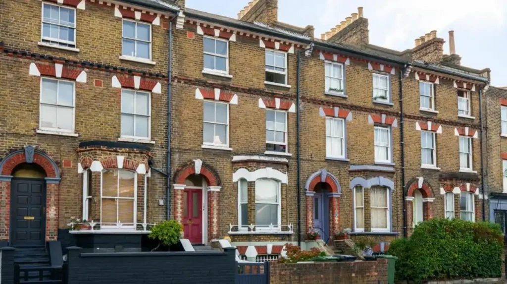
Why is Herne Hill one of the best places to experience village-like Lambeth?
Herne Hill combines a traditional local centre, Victorian and Edwardian residential streets, railway heritage, green space and a strong neighbourhood identity. Its conservation area and historic development make it one of Lambeth’s clearest examples of village-like urban character.
Herne Hill sits on Lambeth’s southern side beside the boundary with Southwark. Its central streets provide a compact environment where shops, cafés, services and residential buildings sit close together.
The area has a particularly strong historical explanation for its current appearance. Lambeth’s heritage records state that an 18th-century map by John Rocque showed Herne Hill as a largely rural area. Its character changed substantially after the railway arrived in 1862. Smaller houses were constructed and the population expanded as commuting into London became easier. The population doubled between 1862 and 1901.
This transition from rural district to commuter neighbourhood explains much of the streetscape visitors see today. Historic houses sit alongside later Victorian development, while the railway remains an important element of the local geography.
Herne Hill also has its own designated conservation area. Lambeth Council identifies Herne Hill as Conservation Area 61, with the designation protecting the area’s architectural and historic character.
For visitors, the best approach is to explore beyond the immediate station area. Walk through the local streets, examine the terraces and look for changes in building scale and architectural detail.
Herne Hill also connects naturally with Brockwell Park, one of the borough’s major green spaces. This combination of a local commercial centre, residential streets and substantial parkland creates the compact neighbourhood experience associated with village-like London districts.
Herne Hill is particularly suitable for travellers who want a quieter alternative to Lambeth’s largest visitor destinations without leaving central London’s wider transport network.
As you explore Herne Hill’s modern streets, you are crossing land with a deep heritage. Read about the full [Insert Anchor Text for Herne Hill History Article Here] to understand its origins.
What makes Larkhall feel like a village within Lambeth?
Larkhall feels village-like because its residential streets connect with a compact local centre containing shops, cafés and community facilities, while historic terraces and green spaces create a strong separation from the larger roads surrounding this part of Stockwell.
Larkhall is situated around the Stockwell area and has a distinct neighbourhood identity within Lambeth. Its character comes from the relationship between residential streets and the local shopping environment.
The area is represented in Lambeth Council’s conservation-area system as Larkhall Conservation Area. The designation forms part of a much wider network of protected historic environments across the borough.
Larkhall is particularly useful for visitors interested in architectural streetscapes. Residential roads contain terraces and villas characteristic of London’s 19th-century suburban expansion. The local centre provides a more intimate scale than major commercial destinations such as Brixton Road.
The neighbourhood also demonstrates how a village-like environment can exist without a historic village boundary. The identity comes from the combination of local commerce, housing, community activity and pedestrian-scale streets.
Larkhall is close to Stockwell and Clapham, so it works well as part of a wider walking itinerary. Visitors can combine Larkhall with Stockwell Green and nearby historic streets rather than treating each neighbourhood as an isolated destination.
Its compact character also suits visitors who want to spend an hour or two exploring local London rather than following a conventional attraction-based itinerary.
Why is Stockwell Green worth visiting for historic streetscapes?
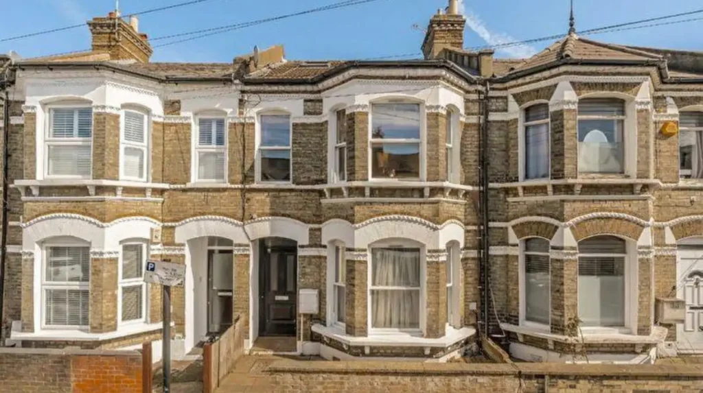
Stockwell Green is a compact historic neighbourhood centred on a gently curving road lined with early-to-mid-19th-century houses, later residential development and St Andrew’s Church, giving visitors a concentrated example of Lambeth’s traditional architectural character.
Stockwell Green provides one of the clearest examples of a small historic enclave inside a densely developed London district.
Lambeth Council describes the Stockwell Green Conservation Area as a small and dense collection of around 80 properties bounded by Stockwell Road, Landor Road and Combermere Road. Stockwell Green itself follows a slightly curving road lined with early-to-mid-19th-century houses.
This is precisely the type of environment that creates a village-like impression. The area is compact. The historic buildings have a consistent relationship with the street. The road bends rather than following the large-scale geometry of a major modern arterial route.
St Andrew’s Church on Landor Road adds another visual landmark. Later development surrounds the earlier buildings, demonstrating how historic neighbourhoods were absorbed into the expanding London metropolis.
Stockwell Green is therefore more valuable as a streetscape destination than as a conventional attraction. Visitors should focus on architectural details, building proportions, frontages, doors, windows, rooflines and the relationship between buildings and pavement.
The area also connects naturally with other parts of Stockwell. Lambeth identifies Stockwell as a distinct neighbourhood for community and infrastructure planning, alongside North Lambeth, Clapham, Brixton, Streatham and Norwood.
A walking route through Stockwell Green can therefore form part of a wider exploration of south London’s historic residential districts.
Can visitors find village-like streets around Tulse Hill?
Tulse Hill offers village-like character through quieter residential roads, local shopping areas, green spaces and historic streets that sit away from major traffic corridors, with modern transport measures supporting walking and cycling through parts of the neighbourhood.
Tulse Hill occupies an important position between Brixton, Herne Hill, West Norwood and Streatham. Its character is strongly residential, with local centres embedded within a larger urban landscape.
The neighbourhood has its own neighbourhood-planning identity in Lambeth. The council lists Tulse Hill alongside Herne Hill and West Norwood among areas with dedicated neighbourhood-planning activity.
Tulse Hill also demonstrates how contemporary street design contributes to village-like environments. Lambeth introduced the Tulse Hill Low Traffic Neighbourhood in 2020 as a trial and made it permanent in June 2022. The scheme restricts through-traffic on selected streets and supports walking, wheeling, scooting and cycling.
The council has also delivered public-realm improvements around the Elm Park shopping parade and identified locations for upgraded traffic filters and additional landscaping.
These changes are important for visitors because village-like character is not only about old buildings. Street layout, traffic levels, greenery, pavements and local shopping areas all influence how a neighbourhood feels when explored on foot.
Tulse Hill therefore provides a useful example of a neighbourhood where historic urban form and contemporary transport policy operate together.
What makes West Norwood feel like a local village centre?
West Norwood combines a substantial local high street, residential terraces, historic buildings, green spaces and established community facilities, creating a self-contained neighbourhood atmosphere within Lambeth that differs noticeably from the borough’s central commercial districts.
West Norwood forms part of Lambeth’s Norwood neighbourhood structure. The council’s neighbourhood framework places West Norwood within the wider Norwood area, alongside places including Gipsy Hill, Knight’s Hill and West Dulwich.
The area is also represented by the West Norwood Conservation Area, confirming the architectural importance of parts of its built environment.
West Norwood works particularly well for visitors interested in everyday London rather than major tourist landmarks. Its high street provides the commercial focus, while surrounding residential roads contain historic housing and quieter streets.
The neighbourhood also benefits from its relationship with open space. West Norwood Cemetery and nearby green areas add historical and landscape interest, while the wider Norwood area provides connections towards Gipsy Hill and Crystal Palace.
The result is a district with a clear local centre rather than a purely commuter-oriented environment.
Visitors should explore the high street and then move into the adjoining residential roads. This reveals the contrast between commercial and domestic architecture and makes it easier to understand how West Norwood developed as a suburban centre.
Is Gipsy Hill a good place to discover Lambeth’s quieter character?
Gipsy Hill is a strong choice for visitors seeking quieter Lambeth streets, with historic residential architecture, local shops, elevated south London views and a designated conservation area that protects important elements of its neighbourhood character.
Gipsy Hill sits in the southern part of Lambeth near the boundary with Southwark and the wider Crystal Palace area. Its elevated position contributes to the visual character of the neighbourhood.
Lambeth Council lists Gipsy Hill Conservation Area among the borough’s designated conservation areas.
The neighbourhood is predominantly residential but contains local commercial activity around its central streets. This combination creates the familiar village-like pattern of homes, shops, services and community spaces within a compact geographic area.
Gipsy Hill is also useful as a gateway to the wider Norwood and Crystal Palace area. Visitors can combine the neighbourhood with West Norwood or continue towards Crystal Palace Park, which lies across the borough boundary.
Its streetscape is particularly suited to walking photography. Victorian and later houses provide changes in scale, frontage, materials and roofline. The elevated terrain also creates different perspectives across the surrounding districts.
For travellers who have already visited central Brixton or the South Bank, Gipsy Hill provides a distinctly residential side of Lambeth.
How does Streatham Common create a village-like experience?
Streatham Common combines open green space, historic residential streets, local shops and established community facilities, creating one of Lambeth’s strongest landscape-led neighbourhood identities and providing visitors with a clear transition between urban streets and a large common.
Streatham Common is one of the most distinctive green spaces in southern Lambeth. The surrounding area has a dedicated Streatham Common Conservation Area, reflecting its architectural and historic importance.
The common provides the central landscape element. Residential streets and local commercial areas sit around it, creating a neighbourhood structure that differs from districts dominated by major arterial roads.
The wider Streatham area is also one of Lambeth’s formal neighbourhood groupings. The council identifies Streatham as a neighbourhood comprising wards including Streatham Hill East, Streatham St Leonard’s, Streatham Wells and Streatham Common & Vale.
For visitors, Streatham Common works best as part of a walking route. Start around the common, explore the surrounding residential streets and then continue towards the local high street.
The area demonstrates how a substantial green space can strengthen local identity. The common creates a shared geographical reference point for nearby streets and gives the district a recognisable centre of landscape rather than relying entirely on commercial development.
It is particularly suitable for visitors who want to combine architecture with open space.
Why should visitors include parts of Clapham in a Lambeth village-like itinerary?
Clapham contains several distinct historic and residential environments, including conservation areas around Clapham, Clapham High Street, Clapham Park and Abbeville Road, where local commerce, period housing and green space create strong neighbourhood identities.
Clapham is larger and busier than some of Lambeth’s smaller village-like districts. However, several parts of Clapham retain a strong local identity.
Lambeth Council lists Clapham, Clapham High Street, Clapham Park and Northbourne Road, and Abbeville Road among its conservation areas.
This creates several different streetscape experiences within the wider Clapham area. Abbeville Road provides a particularly strong local-centre environment, while Clapham Common supplies a large open landscape around which residential streets developed.
Clapham therefore demonstrates an important principle for visitors: village-like character does not require an entire neighbourhood to share one architectural style. A district can contain busy transport routes, high-density housing and major commercial streets while retaining smaller pockets with a strong local identity.
Visitors interested in architectural detail should move away from the busiest roads and explore the side streets around the common and local centres.
Clapham is also well connected to Stockwell, Brixton and Streatham, making it practical to incorporate into a longer south London itinerary.
How do Lambeth’s conservation areas help preserve its village-like neighbourhoods?
Lambeth’s conservation areas protect places with special architectural or historic interest by controlling demolition and guiding development, helping retain the buildings, streets, spaces and visual relationships that give neighbourhoods such as Herne Hill, Stockwell Green and West Norwood distinctive identities.
Conservation-area status is one of the most important mechanisms behind Lambeth’s surviving historic streetscapes.
Lambeth Council currently identifies 62 conservation areas, covering approximately 30% of the borough. The list includes major districts and smaller enclaves, ranging from Brixton and Clapham to Stockwell Green, Herne Hill, Larkhall, Streatham Common and West Norwood.
The purpose of a conservation area is not to freeze a neighbourhood in time. Its legal and planning framework provides additional control over changes that affect the character and appearance of the area. Lambeth states that conservation areas receive special protection and that demolition of a building within a conservation area requires planning permission.
This framework helps explain why some Lambeth streets retain coherent groups of historic buildings despite substantial redevelopment elsewhere in London.
Protected squares also contribute to this character. Lambeth’s schedule under the London Squares Preservation Act 1931 includes spaces such as Windrush Square, Cleaver Square, Stockwell War Memorial Garden, Crescent Grove and parts of Clapham Common.
For visitors, these designations provide a useful guide to areas where architecture and public space have recognised historic significance.
Which Lambeth village-like areas are best for a walking itinerary?
A practical village-like Lambeth itinerary starts in Herne Hill, continues through Brockwell Park towards Tulse Hill, then moves south towards West Norwood or Gipsy Hill, with Stockwell Green and Larkhall providing alternatives for historic streets closer to central London.
Lambeth’s neighbourhoods are sufficiently close together to create multi-stop walking and public-transport itineraries.
A Herne Hill and Brockwell Park route provides the strongest combination of historic residential streets, a local centre and major green space. Herne Hill’s railway history also explains the area’s transition from rural land to a Victorian commuter neighbourhood.
A Stockwell and Larkhall route focuses more strongly on architecture and local centres. Stockwell Green is particularly compact, with around 80 properties within its conservation-area boundary.
A Tulse Hill and West Norwood route provides a more southern perspective. It combines residential streets, local shopping areas and neighbourhood-scale public spaces. Tulse Hill also demonstrates contemporary changes to streets through its permanent low traffic neighbourhood.
A Gipsy Hill and Streatham Common route focuses on quieter residential character and large open landscapes.
These routes also illustrate the diversity of Lambeth. There is no single architectural or social model for a village-like neighbourhood. Each district developed through different phases of London’s expansion.
Explore More Area Guide
Best Things to Do Around Norwood, Lambeth 2026
Best Things to Do Around Streatham, Lambeth 2026
What should visitors look for when exploring Lambeth’s village-like areas?
Visitors should focus on local centres, historic terraces, conservation-area boundaries, churches, pubs, independent shops, public squares, parks, railway history and quieter residential streets because these features reveal how Lambeth’s neighbourhood identities developed within the wider London metropolis.
The strongest way to explore these areas is to observe relationships rather than individual buildings.
Start with the local centre. Shops, cafés and services reveal where residents traditionally gathered and conducted everyday activities.
Next, examine the residential streets. Consistent terraces, repeated architectural details and historic building lines show how neighbourhoods were planned and developed.
Then identify green spaces. Brockwell Park, Clapham Common and Streatham Common demonstrate how open land shapes surrounding urban form.
Finally, look at transport infrastructure. Herne Hill’s railway transformed its development after 1862, while modern low traffic neighbourhoods are changing movement patterns in places such as Tulse Hill.
This approach gives visitors a more accurate understanding of Lambeth than simply visiting individual attractions.
It also explains why village-like character remains relevant in a dense London borough. Lambeth’s population reached nearly 320,000 in 2021, while the borough remained among England’s most densely populated local authority areas.
The continued protection of historic streets and the development of pedestrian-friendly neighbourhood infrastructure allow distinctive local environments to remain part of this dense metropolitan landscape.
How is Lambeth’s village-like character likely to remain relevant for visitors?
Lambeth’s village-like neighbourhoods remain relevant because conservation policies, neighbourhood planning, local centres, green spaces and walking-focused transport measures continue to support distinctive places within a densely populated London borough.
Lambeth’s future neighbourhood identity is shaped by both heritage protection and contemporary planning.
Neighbourhood planning gives local communities a formal mechanism to develop shared visions and influence development. Lambeth currently identifies neighbourhood-planning activity in areas including Herne Hill, West Norwood, Tulse Hill and Kennington, Oval and Vauxhall.
The borough also continues to develop low traffic neighbourhoods. Lambeth currently lists five permanent LTNs: Oval to Stockwell, Railton, Ferndale, Tulse Hill and Streatham Hill. The council is also progressing proposals involving areas such as Streatham Wells and Brixton Hill.
These policies matter because neighbourhood character depends on more than historic buildings. Traffic levels, pedestrian space, greenery, local commerce and public-realm design all influence how visitors experience an area.
The long-term importance of Lambeth’s village-like districts therefore comes from their combination of heritage and everyday urban life.
For visitors, the best destinations are not always the borough’s largest attractions. Herne Hill, Larkhall, Stockwell Green, Tulse Hill, West Norwood, Gipsy Hill, Streatham Common and selected parts of Clapham provide opportunities to see Lambeth at neighbourhood scale.
These areas show how historic streets, local centres, green spaces and modern planning coexist within one of London’s most densely populated boroughs.
Which areas of Lambeth have a village-like feel?
Herne Hill, Larkhall, Stockwell Green, Tulse Hill, West Norwood, Gipsy Hill and Streatham Common are among Lambeth’s strongest village-like neighbourhoods. They combine local centres, historic housing, green spaces and distinctive streetscapes.