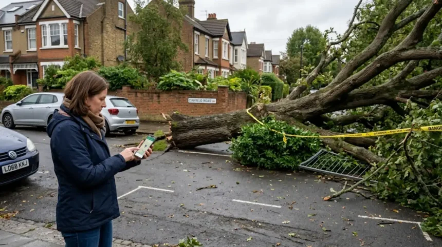
A fallen street tree in Bromley is reported through the council’s street-tree problem system, where residents use the map to pin the exact location and submit the issue. Bromley Council says emergencies such as fallen trees or large branches on the road or pavement can also be reported by phone on 0300 303 8658, and the contractor removes them as quickly as possible.
- What is Bromley’s tree reporting map?
- How do you report a fallen street tree?
- What details should you include?
- When is a fallen tree an emergency?
- Why does Bromley use a map-based system?
- What happens after you submit?
- What counts as a street tree?
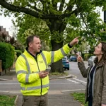
- How does this fit into Bromley’s wider tree service?
- What should residents know before they report?
- Why does accurate location data matter?
- What does this mean for South London residents?
- A simple reporting sequence
What is Bromley’s tree reporting map?
Bromley’s tree reporting map is an online location-based reporting system for street and park problems. It lets residents click the map at the exact site of a tree issue, see existing reports in the area, and submit a new problem for council action.
The map is part of Bromley Council’s online problem-reporting service. It is designed for issues in streets and parks, including tree-related faults, so the report reaches the right team with the right location information.
For a fallen street tree, the map matters because location accuracy determines response speed. A tree blocking a pavement, road, cycle lane, or access point needs a precise pin, especially where the same street contains multiple trees or junctions.
How do you report a fallen street tree?
Open Bromley’s street and parks problem page, find the fallen tree on the map, click the exact spot, and submit the report with the problem details. If the tree is on the road or pavement and creates an immediate hazard, call Bromley Council on 0300 303 8658 instead of waiting for an online form.
The reporting flow is simple. First, go to the council’s problem-reporting page. Next, zoom into the street and click the map at the location of the fallen tree. Then add the details requested by the form and send the report.
If the fallen tree is an emergency, the council’s instructions are direct. Fallen trees or large branches on the road or pavement are handled through the emergency telephone route, and the contractor removes them as quickly as possible.
What details should you include?
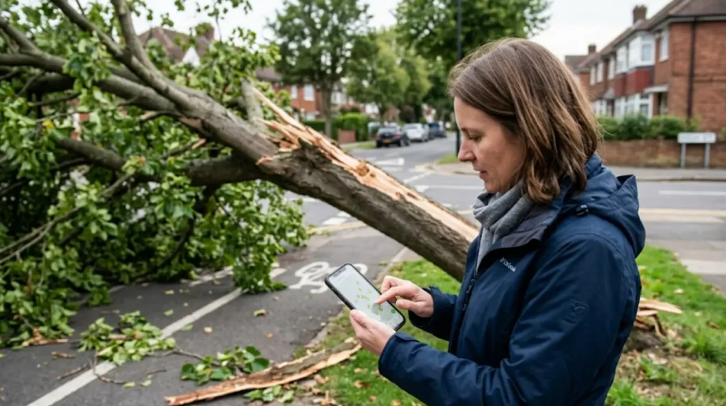
Include the exact location, the type of tree problem, and any danger created by the fallen tree. Clear location details help the council identify the site faster and assign the right response.
A useful report contains the street name, nearby house number or landmark, and whether the tree is blocking traffic, pedestrians, or access to property. The council’s map helps with location, but written details still improve accuracy.
If the tree has already been partly cleared, note the remaining hazard. Examples include branches across a pavement, roots lifting the surface, or a trunk leaning into the road. Those details matter because the council’s response depends on risk and obstruction.
When is a fallen tree an emergency?
A fallen tree is an emergency when it blocks a road or pavement, creates a danger to people, or prevents safe movement. Bromley Council specifically lists fallen trees and large branches on the road or pavement as emergency reports.
Emergency reporting exists because street trees can create immediate hazards. A fallen trunk can obstruct visibility, stop bus or emergency access, and force pedestrians into traffic. In those cases, the fastest route is the emergency phone number rather than a standard non-urgent report.
For lower-risk situations, the map-based report still works. A tree that has fallen into a verge, park edge, or non-blocking side area still needs reporting, but the urgency differs from a road obstruction.
Why does Bromley use a map-based system?
Bromley uses a map-based system because street tree problems depend on precise location. The map shows existing reports and lets residents report a new issue at the exact point where the tree stands or has fallen.
Tree reporting is often location-sensitive. One street can contain many trees, and a vague description such as “near the shops” creates delays. A map pin reduces that uncertainty and improves routing to the correct inspection or maintenance team.
This approach also helps residents understand the local picture. The map lets users view problems already reported in that area, which adds context and reduces duplicate descriptions for the same fallen tree.
What happens after you submit?
After you submit the report, Bromley Council receives the location and issue details for action. For emergencies, the council says its contractor removes fallen trees or large branches as quickly as possible.
The practical next step is council triage. Emergency hazards receive priority because they affect public safety and access. Non-emergency tree issues move through the normal reporting path used for streets and parks.
For residents, the key point is that the online report starts the response record. It creates a digital trail tied to the map location, which is useful for follow-up if the problem remains unresolved.
What counts as a street tree?
A street tree is a tree growing in or beside the public highway, usually in the verge, pavement, or roadside planting strip. In Bromley’s reporting system, these are treated as public realm tree issues rather than private garden matters.
London’s public-tree network is extensive. The London Tree Map covers over 1,100,000 public realm trees across the capital, and most of them are street trees. That scale shows why councils rely on structured reporting systems rather than informal messages.
In practical terms, a street tree belongs in the public maintenance system when it affects a public road, pavement, or park route. If a tree stands on private land but leans into a public highway, the report still needs to reach the local authority for assessment.
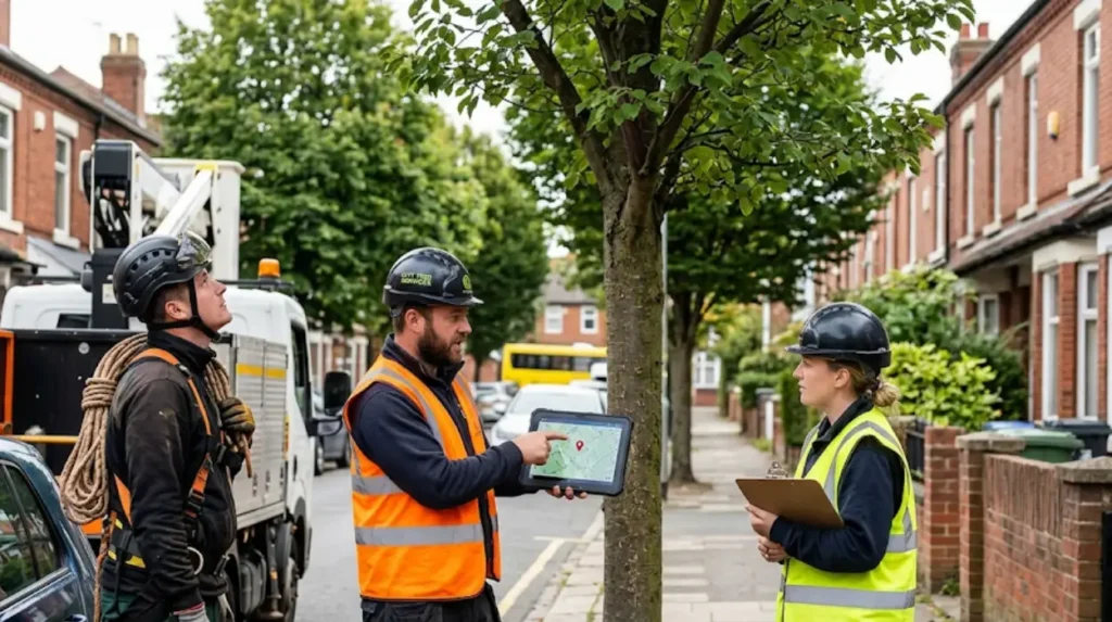
How does this fit into Bromley’s wider tree service?
Bromley’s fallen-tree reporting map is part of a broader tree service that handles problems in streets and parks. The same service route helps residents report hazards, see local issues, and submit tree-related concerns in one place.
That wider system matters because tree problems are not limited to collapse. Councils also handle broken branches, unsafe leaning trees, root damage, and other hazards through the same public reporting structure. The map keeps those reports organized by place.
For South London residents, this means one consistent process instead of different channels for every issue. The combination of map reporting and emergency phone reporting covers both urgent and routine cases.
What should residents know before they report?
Residents should know whether the tree blocks movement or creates danger, because that decides whether to use the map or the emergency phone line. The correct route speeds up the council’s response.
They should also check the immediate area for visible risks such as power lines, damaged street furniture, or debris on the carriageway. If the scene looks dangerous, the emergency route is the safer option. Bromley’s guidance specifically highlights fallen trees and large branches on roads or pavements as emergency matters.
If the issue is not urgent, the map form remains the best method. It records the exact site, which helps the council match the report to the correct tree or location in its maintenance records.
Explore More Help & Resources
How to renew your Lambeth parking permit: 2026 emissions tax
How to apply for a Kingston resident permit in a new CPZ
Why does accurate location data matter?
Accurate location data matters because tree response teams work from the exact pin or description in the report. A precise report reduces delays, limits confusion, and improves the chance of a fast inspection or clearance.
This is especially important in boroughs with dense residential streets, schools, bus routes, and shopping roads. A tree reported on the wrong side of a junction or near the wrong landmark can send crews to the wrong site. The map reduces that risk by tying the report to coordinates.
Accurate location data also helps residents who follow up later. If the same tree causes a second incident, the original map-based record gives a clear reference point for repeat action.
What does this mean for South London residents?
For South London residents, Bromley’s system gives a direct, map-based way to report fallen street trees and a phone route for emergencies. That combination supports faster response, clearer location data, and safer public streets.
The most useful habit is simple. Use the map for non-urgent or routine tree issues. Use the phone number when the tree or branch blocks a road or pavement, or creates an immediate danger. That distinction matches Bromley Council’s own reporting guidance.
In a borough-scale environment, the map also supports transparency. Residents can see problems already reported nearby, which helps them understand whether an issue is isolated or part of a wider local tree concern.
A simple reporting sequence
The reporting sequence is: identify the hazard, open the council map, click the exact location, add the details, and submit the report. For urgent road or pavement blockages, skip the form and call 0300 303 8658.
That sequence is the clearest way to handle a fallen street tree in Bromley. It keeps the report tied to the correct place, matches the council’s published process, and separates emergency hazards from routine maintenance issues.
For readers searching for the fastest route, the essential rule is direct. Map for location-based reporting, phone for emergencies.
How do I report a fallen street tree in Bromley?
A fallen street tree can be reported through Bromley Council’s street and parks problem reporting system. Residents should locate the tree on the online map, pin the exact location, add details about the issue, and submit the report for council action.