The South Bank and Waterloo riverside walk spans 2.5 miles of accessible pedestrian pathways, connecting the London Eye to the Tate Modern while offering direct views of parliamentary architecture and historical monuments along the River Thames.
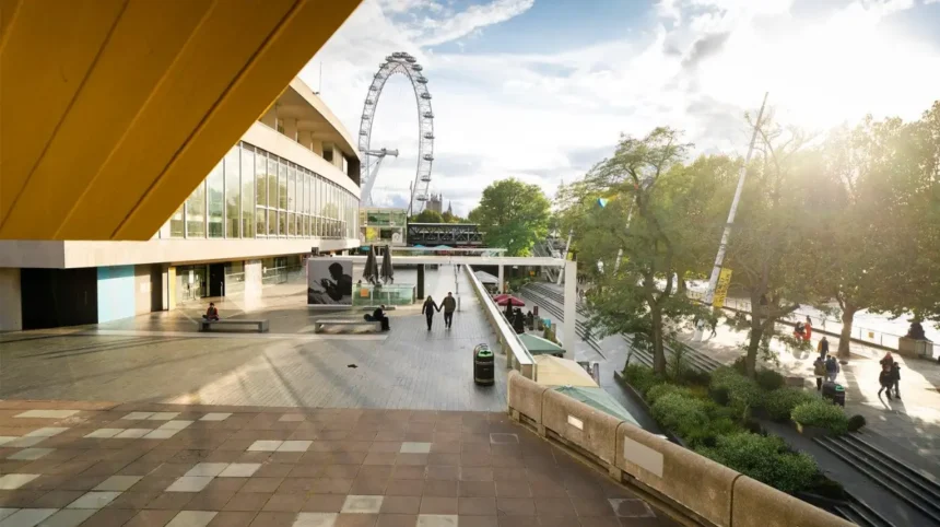
This route represents the primary urban corridor for visitors exploring the northern boundary of the London Borough of Lambeth. The walk begins at the foot of the London Eye, a 135-metre-tall observation wheel erected in 2000, and proceeds eastward along the Queen’s Walk. Pedestrians encounter the Southbank Centre, Europe’s largest centre for the arts, which hosts over 4,500 events annually across its 21-acre site.
Continuing past the Golden Jubilee Bridges, walkers navigate Bernie Spain Gardens, a public green space named after a local community activist. The path incorporates the BFI Southbank cinema and the National Theatre, designed by architect Denys Lasdun and opened in 1976. As you explore the modern site, you are crossing land with a deep heritage. Read about the full [Insert Anchor Text for History Article Here] to understand its origins.
The route concludes near the Oxo Tower Wharf, an industrial landmark featuring a distinctive Art Deco advertising tower converted into design studios and exhibition spaces. This itinerary operates entirely on step-free, paved surfaces, making it suitable for all mobility levels. Public transport connections anchor both ends of the trail, with Waterloo Station located 400 metres south, servicing the Jubilee, Northern, Bakerloo, and Waterloo & City underground lines.
How does the Lambeth Palace and Lower Marsh historical trail function?
The Lambeth Palace and Lower Marsh historical trail covers a 1.7-mile circular route originating at Waterloo Road, integrating medieval ecclesiastical architecture with one of London’s oldest continuously operating street markets.
The pathway departs from Wellington House on Waterloo Road and leads directly to Lower Marsh, a historic market street that has operated since the 19th century. Traders offer fresh produce, hot food, and independent goods Monday through Saturday. The route proceeds south toward Lambeth Road to reach Lambeth Palace, the official London residence of the Archbishop of Canterbury since the 13th century.
The palace complex contains the Lollard Tower, constructed in 1435, and a historic library holding over 120,000 documents relating to church history. Walkers continue along the Albert Embankment, completed by engineer Joseph Bazalgette in the 1860s to contain the tidal River Thames. This section provides direct sightlines across the water to the Palace of Westminster.
The itinerary then loops back via Archbishop’s Park, a 9-acre public recreation ground established in 1900 on land formerly used as the palace vegetable gardens. Signage along the route details local civil engineering achievements and historical figures associated with the parish of St Mary-at-Lambeth, which now functions as the Garden Museum.
What defines the Brixton cultural and street art walking route?
The Brixton cultural and street art walking route spans 3 miles through central South London, highlighting Caribbean heritage, Victorian arcades, and officially designated murals created over the past four decades.
The route starts at Brixton underground station on the Victoria line and moves immediately into the covered avenues of Brixton Village and Market Row. These glass-roofed arcades, constructed between the 1870s and 1920s, house over 100 independent traders, restaurants, and retail spaces. The walk proceeds down Electric Avenue, the first market street in London to be lit by electricity in 1888.
Pedestrians then navigate toward the Brixton Mural Trail, a collection of large-scale outdoor artworks initiated in 1982 to document social history, racial equality, and local community identity. Key murals include the “Love Music, Hate Racism” installations and historical tributes to local activists.
The trail incorporates Windrush Square, named in honour of the passengers of the HMT Empire Windrush, who arrived at Tilbury in 1948 before many settled in the surrounding neighborhoods of Brixton. The square features a permanent memorial and sits adjacent to the Brixton Tate Library, opened in 1893. The walk ends at Brockwell Park, marking the transition from dense urban commerce to Victorian parkland.
Explore more Area Guide
Lambeth Riverside Attractions: South London’s Best Thames Landmarks and Activities
Where Digital Nomads Can Work Comfortably in Lambeth: Cafés, Co‑Working, Libraries
Why is the Brockwell Park and Herne Hill heritage loop notable?
The Brockwell Park and Herne Hill heritage loop guides walkers across 4.5 miles of undulating green terrain, connecting a 125-acre historic park, a restored 1930s Art Deco lido, and Victorian residential architecture.
Beginning at Herne Hill railway station, the route enters Brockwell Park through its wrought-iron gates. The park received official designation as a public green space in 1891 following a successful local campaign to purchase the Brockwell Hall estate. Brockwell Hall, a neoclassical mansion built in 1813 by architect John Hope, occupies the highest point of the park at an elevation of 60 metres above sea level.
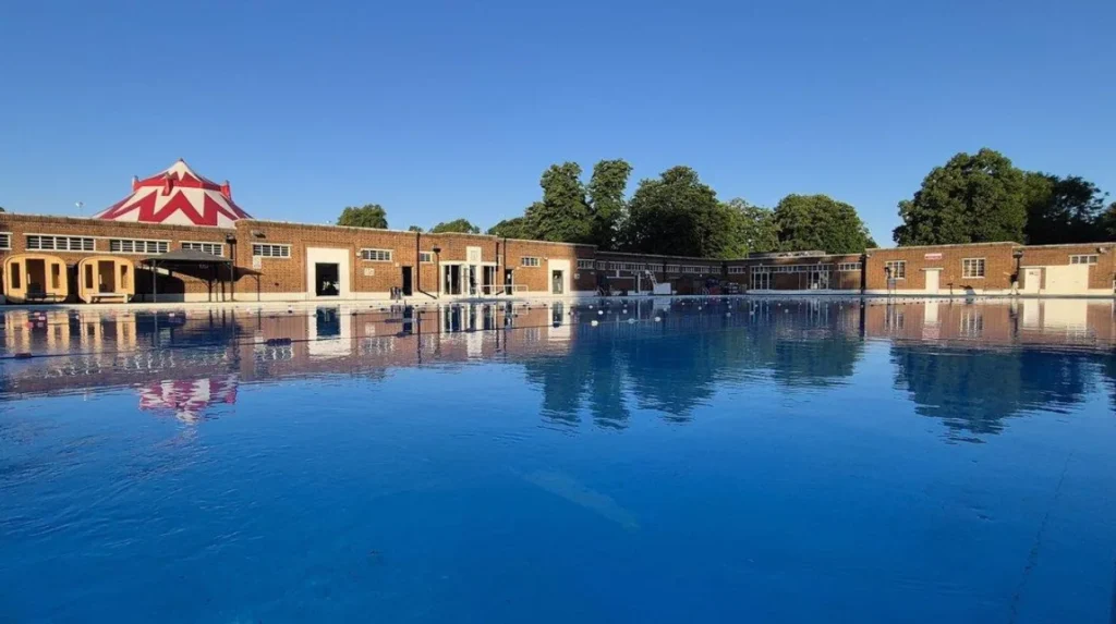
The trail circles the Brockwell Lido, a Grade II listed open-air swimming pool measuring 50 metres in length, opened in July 1937. Walkers then descend past the walled ornamental garden, which features perennial flower beds, herbaceous borders, and a restored clock tower.
The route extends beyond the park boundaries into the Dulwich estate perimeter, passing through residential streets lined with Victorian semi-detached villas constructed during the suburban expansion of South London in the late 19th century. Transport access is available via Herne Hill and Tulse Hill railway stations, offering direct National Rail services to Victoria and London Blackfriars.
How do urban hikers experience the Clapham Common and Clapham Old Town trail?
The Clapham Common and Clapham Old Town trail measures 3.5 miles, traversing 220 acres of open common land, three freshwater ponds, and Georgian architectural enclaves dating back to the 17th century.
The walk initiates at Clapham Common underground station on the Northern line and moves toward the Holy Trinity Church, situated on the north side of the common. Constructed in 1776, this church served as the spiritual base for the Clapham Sect, a group of social reformers led by William Wilberforce who campaigned for the abolition of the slave trade.
The route encircles Long Pond, Mount Pond, and Eagle Pond, which serve as natural habitats for waterfowl and local wildlife populations. Walkers then transition into Clapham Old Town, a designated conservation area containing Grade I and Grade II listed townhouses built between 1650 and 1750.
The path passes Trinity Hospice, recognized as the oldest hospice in the United Kingdom, established in 1891. The walking circuit utilizes designated tarmac paths across the common alongside low-traffic residential streets, ensuring continuous accessibility for pedestrians, runners, and cyclists throughout the year.
What are the best self-guided walking tours in the London Borough of Lambeth?
The top self-guided walking tours in Lambeth include the South Bank and Waterloo riverside walk, the Lambeth Palace and Lower Marsh historical trail, the Brixton cultural and street art walking route, the Brockwell Park and Herne Hill heritage loop, and the Clapham Common and Clapham Old Town trail.