Key Points
- Scheme Approval: Plans for the new Cycleway 64 route connecting Greenwich Park and Elverson Road DLR station in Lewisham have been formally approved following a public consultation held earlier this year.
- Route Trajectory: The cycle path begins at the King William Walk exit by Greenwich Park, navigating Nevada Street, Burney Street, and Royal Hill before crossing Greenwich South Street near Greenwich Fire Station.
- Southern Connection: South of Greenwich South Street, the route progresses along John Penn Street and utilizes an existing alleyway path alongside Blackheath Retail Park to reach Elverson Road DLR station.
- Key Design Enhancements: Structural modifications include a dedicated segregated cycle crossing on Greenwich South Street, footway widening for shared use, a new contraflow cycle lane on Burney Street, an upgraded contraflow lane on Nevada Street, and altered junction priority at Crooms Hill and Nevada Street.
- Traffic and Parking Impact: The design features raised junctions and wider footways to calm general motor traffic, with an overall net reduction of just one parking space.
- Funding Infrastructure: Delivery of the scheme is financed jointly through Transport for London (TfL) funding allocations and local developer contributions.
Greenwich (South London News) November 3, 2026 – Approval has been officially granted for an indicative design establishing Cycleway 64, a dedicated cycle route linking Greenwich Park directly to Elverson Road DLR station in Lewisham. The decision follows extensive public consultation carried out earlier this year by local authority transport planning officers.
As reported by J. Smith of From The Murky Depths, the new cycling infrastructure is designed to create a safer, continuous link between key destination points across the Royal Borough of Greenwich and the neighbouring Borough of Lewisham. The approved alignment begins adjacent to Greenwich Park at the King William Walk exit. From there, cyclists will travel along Nevada Street and Burney Street before turning onto Royal Hill.
The path then crosses Greenwich South Street in the immediate vicinity of Greenwich Fire Station. Proceeding southward, the route follows John Penn Street and integrates with an established cycle alleyway passing Blackheath Retail Park, ultimately terminating at Elverson Road DLR station.
Which Highways Infrastructure Changes Will Be Implemented Along the Alignment?
To facilitate the new cycleway, Greenwich Council has detailed a series of civil engineering alterations aimed at improving safety and connectivity for non-motorised road users.
As reported by J. Smith of From The Murky Depths, an official council officer report outlines several specific infrastructure modifications along the route corridor:
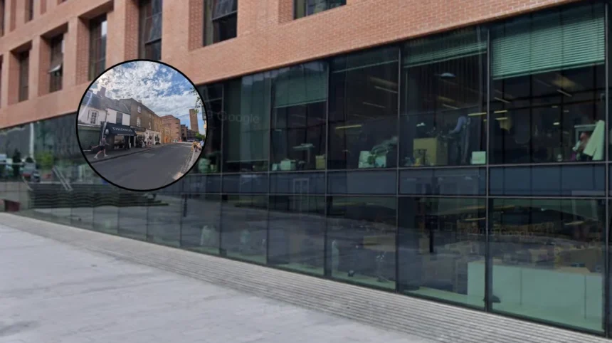
- Segregated Crossing: Construction of a brand-new, light-controlled segregated cycle crossing across Greenwich South Street near the fire station.
- Footway Widening: Expansion of footway widths at crucial choke points along the alignment to establish shared walking and cycling spaces.
- Contraflow Provisions: Installation of a new contraflow cycle lane on Burney Street, alongside significant upgrades to the existing contraflow cycle lane on Nevada Street.
- Junction Realignment: A change in priority at the Crooms Hill and Nevada Street junction, explicitly redesigned to favour east-west cycle movements.
- Clear Navigation: Installation of comprehensive wayfinding signage throughout the length of the corridor to direct cyclists clearly between Greenwich Park and Lewisham.
How Will the Scheme Affect Local Motor Traffic and Parking Provision?
The implementation of Cycleway 64 will introduce physical measures designed to manage motor vehicle speeds while preserving local parking capacity as far as possible.
As reported by J. Smith of From The Murky Depths, the Greenwich Council report notes regarding general traffic that “the design is expected to have some impact on general traffic. Wider footways and raised junctions will have a slowing effect on general traffic.”
In terms of kerbside space, municipal assessments confirm that the physical realignments will result in a net loss of only one vehicle parking space across the entire scheme footprint. Capital financing for the project’s construction is sourced through a combination of Transport for London (TfL) active travel grants and section developer contributions secured by the local authority.
Background of the Greenwich Park to Lewisham Cycle Connection
The authorization of Cycleway 64 marks a key milestone in south-east London’s expanding active travel grid. Over the past decade, Transport for London, alongside the Royal Borough of Greenwich and Lewisham Council, has sought to address major gaps in east-west and north-south cycle connectivity. Historically, cyclists travelling between the historic centre of Greenwich and the transit hubs of Lewisham faced busy, non-segregated arterial roads such as Greenwich South Street (A2211) and Blackheath Hill (A2).
To resolve these safety barriers, municipal planners initiated feasibility work to identify quietway corridors capable of bypassing high-volume traffic corridors. Following initial public engagements and localized traffic modeling, the King William Walk to Elverson Road corridor was prioritized due to its direct link between Greenwich Park, residential zones, retail centres, and the Docklands Light Railway network. Public consultation was formally conducted earlier this year, gathering feedback from residents, local businesses, and cycling advocacy bodies such as Greenwich Cyclists and Lewisham Cyclists, ultimately shaping the indicative design approved by municipal highway authorities.
Predictions: How This Development Will Affect Local Audiences
The approval and eventual construction of Cycleway 64 is anticipated to generate distinct structural and practical impacts across several local stakeholder groups:
1. Cyclists and Active Travel Commuters
Local commuters moving between Greenwich, Lewisham, and Canary Wharf via the DLR stand to gain a significantly safer, fully signed, and protected transit corridor. The introduction of contraflow lanes on Burney Street and Nevada Street removes previous detours, reducing journey times and lowering the collision risk at major intersections like Greenwich South Street.
2. Pedestrians and Local Residents
Residents along Nevada Street, Burney Street, and Royal Hill will experience traffic-calming benefits due to raised junctions and expanded footways. While sidewalk widening enhances accessibility for pedestrians, pushchairs, and wheelchair users, residents relying on on-street kerbside parking will experience minimal disturbance, given that the scheme incurs a net loss of just one parking bay.
3. Motorists and Commercial Traffic
Drivers navigating Greenwich town centre and Greenwich South Street can anticipate slightly reduced vehicle speeds. The introduction of raised junctions and a new signalized segregated crossing near the fire station will act as a physical traffic-calming mechanism, potentially discouraging cut-through traffic while slightly increasing travel times during peak hours.