Key Points
- Rotherhithe Street is famous for being the longest straight street of London that has one name throughout its whole route.
- The street runs alongside the River Thames in the south part of London for about 1.5 miles (2.4 kilometers) close to the outer bend of the Rotherhithe Peninsula.
- In contrast to roads like the A5 and Edgware Road, Rotherhithe Street does not have any changes of name titles at all during its whole course.
- This is based on strict criteria set up for urban roads in terms of having walking access, buildings on both sides of it, and remaining within the borders of Greater London.
- Historically, the street is famous for its long seafaring history, pubs, transformed Victorian dockland warehouses, and urban greenery.
South London (South London News) August 6, 2026 – Rotherhithe Street, a historic thoroughfare running along the River Thames in South London, has been identified as the longest continuous street in London that maintains a single, unchanged name throughout its entire length. Stretching around the perimeter of the Rotherhithe peninsula, the road weaves past centuries-old maritime landmarks, residential developments, and riverside green spaces while retaining its exact name title from end to end.
- Key Points
- What Makes Rotherhithe Street the Longest Street in London?
- How Does Rotherhithe Street Compare to Major London Arterial Routes?
- What Historic Buildings and Greenery Line Rotherhithe Street?
- Background of the Rotherhithe Street Development
- Prediction: How This Development Affects London Residents, Visitors, and Local Urban Planning
What Makes Rotherhithe Street the Longest Street in London?
London contains thousands of miles of interconnecting roadways, major thoroughfares, and historic passages. However, geographical analyses of the capital’s road network reveal that most long-distance routes undergo multiple name changes as they traverse different postal districts or boroughs.
Major transport corridors like the A5 or Edgware Road span considerably greater physical distances across the capital. Yet these arterial routes change names repeatedly—transitioning through distinct section titles as they head outward toward the edge of London. Rotherhithe Street avoids this urban pattern entirely, maintaining its single continuous identity for approximately 1.5 miles along the South Bank curve.
To determine which thoroughfare officially claims the title of London’s longest street, clear urban planning parameters and dictionary definitions must be established:
- Name Continuity: The road must not undergo any name change, hyphenation, or positional title alteration along its continuous path.
- Geographical Boundaries: The entirety of the street must sit fully within the official boundaries of Greater London.
- Street Classification: The route must fulfill the traditional definition of a “street,” meaning it must feature pedestrian access and accommodate buildings, dwellings, or commercial structures along both sides rather than existing merely as an isolated dual carriageway or highway bypass.
How Does Rotherhithe Street Compare to Major London Arterial Routes?
When evaluating the vast network of roadways spanning the capital, urban historians and transport analysts draw a clear line between major A-roads and traditional suburban or urban streets. While A-roads carry vehicular traffic over substantial distances, their administrative names shift frequently across borough lines.
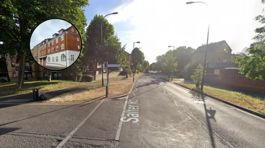
Rotherhithe Street, by contrast, winds continuously along the water’s edge in the London Borough of Southwark. It tracks the dramatic bend of the Thames opposite the Isle of Dogs, serving local residential traffic, pedestrian promenades, and historic docks without losing its designation at any intersection.
What Historic Buildings and Greenery Line Rotherhithe Street?
Beyond its geographical length, the street retains an array of historic architecture that documents London’s transition from a working maritime port to modern residential neighborhoods.
Key historical and environmental features along the street include:
- Maritime Architecture: Converted 19th-century brick warehouses line parts of the street, reflecting its past as an active shipping and docking hub.
- Historic Public Houses: The road houses notable centuries-old establishments, including The Mayflower, a pub dating back to 1550 located near the mooring point where the Pilgrim Fathers set sail for America in 1620.
- Riverside Greenery: The route connects several green spaces and ecological pockets, including St Mary Church Street’s surrounding parkland and path access points leading directly to Russia Dock Woodland and the Thames Path.
Background of the Rotherhithe Street Development
Historically, Rotherhithe was a core maritime hamlet centered on shipbuilding, timber trade, and dock work. The street grew organically alongside the natural curvature of the riverbank, serving as the main spine connecting riverside wharves, dry docks, and worker housing.
During the 19th and early 20th centuries, the construction of the Surrey Commercial Docks transformed the peninsula into a vast industrial logistics area. Rotherhithe Street framed the outer perimeter of these massive floating dock basins. Following the closure of the commercial docks in the 1970s, the area underwent substantial urban regeneration throughout the 1980s and 1990s under the London Docklands Development Corporation (LDDC). Unlike other industrial zones that saw their historic street layouts dismantled, Rotherhithe Street’s winding footprint was preserved, retaining its long, continuous alignment as warehouses were converted into residential apartments and modern housing was integrated into the historic riverside landscape.
Explore More Local South London News
Lewisham Gateway Regeneration Advances with New Council Planning Submission, Lewisham 2026
SUEZ Food Waste Plant Approved After Appeal in Sutton, South London 2026
Prediction: How This Development Affects London Residents, Visitors, and Local Urban Planning
The recognition of Rotherhithe Street’s unique geographical standing affects local communities, visitors, and regional urban planners in several ways:
- Impact on Local Residents and Property Owners: Highlighting the street’s historic character and geographical status bolsters neighborhood identity across Southwark. It reinforces local pride and can contribute to sustained residential demand within the converted docks and modern housing estates along the riverbank.
- Impact on Tourism and Pedestrian Footfall: Defining the thoroughfare as London’s longest continuous street encourages self-guided walking tours, heritage tourism, and increased footfall for local independent businesses, historical pubs, and cultural venues situated along the Thames Path route.
- Impact on Local Infrastructure and Council Planning: As pedestrian and cycling traffic along riverside routes grows, local authorities like Southwark Council face continued pressure to balance heritage preservation with modern public realm maintenance. Urban planners must maintain paving quality, street lighting, and environmental conservation along the entire 1.5-mile corridor without altering the historic character that makes the street distinct.