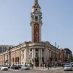
Lambeth’s transformation from a historic parish on the south bank of the River Thames into a densely developed London borough reflects centuries of religious influence, river trade, industrial growth, railway expansion, public housing, and urban regeneration. Today, the London Borough of Lambeth combines historic settlements, Victorian streets, major cultural landmarks, residential neighbourhoods, and modern transport connections.
- What Was Lambeth Like Before It Became an Urban Borough?
- How Did Lambeth Palace Influence the Area’s Early Development?
- How Did the River Thames Transform Lambeth’s Economy?
- How Did Bridges and Roads Encourage Lambeth’s Urban Expansion?
- How Did Railways Turn Lambeth’s Villages Into London Suburbs?
- Why Did Lambeth Develop Into a Centre of Industry and Working-Class Housing?
- How Did Local Government Change Lambeth From a Parish Into a Borough?
- How Did Twentieth-Century Housing Policies Reshape Lambeth?
- How Did Migration and Cultural Change Shape Modern Lambeth?
- How Have Transport Improvements Changed Lambeth’s Modern Urban Character?
- How Has Urban Regeneration Changed Waterloo, Vauxhall, and Brixton?
- Which Historic Places Explain Lambeth’s Transformation Most Clearly?
- Lambeth Palace and the historic riverside
- Kennington’s Georgian and Victorian streets
- Lambeth Walk and the history of working-class London
- Brixton Market and Electric Avenue
- Streatham and suburban expansion
- What Challenges Shape Lambeth’s Future Urban Development?
- How Can Visitors Understand Lambeth’s History Through Its Modern Streets?
- How Did Lambeth Become the Urban Borough It Is Today?
Understanding Lambeth’s development explains how a once-rural parish became an important part of inner London. Its history connects medieval religious estates with the growth of Westminster, the expansion of industrial South London, the development of Brixton and Streatham, and the creation of modern civic institutions.
What Was Lambeth Like Before It Became an Urban Borough?
Lambeth began as a historic riverside parish in Surrey, south of the River Thames, with land used for agriculture, religious estates, and scattered settlement. Its location opposite Westminster gradually increased its importance as London expanded across the river.
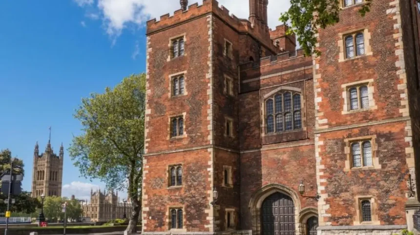
The name Lambeth is closely associated with its early medieval settlement and the historic Lambeth Palace estate. Lambeth Palace has served as the London residence of the Archbishops of Canterbury since the late medieval period. Its long institutional history makes it one of the most important surviving links between historic Lambeth and modern London.
During the medieval period, much of Lambeth consisted of open land, gardens, orchards, fields, and small settlements. The area did not possess the continuous urban development associated with central London today. Instead, its riverside position connected local communities with markets, religious institutions, and routes leading towards Westminster and the City of London.
The River Thames shaped everyday life. Before modern bridges and railways, boats offered an important means of moving people and goods between settlements on opposite banks. Lambeth’s waterfront therefore developed as a point of contact between rural Surrey and the growing political and commercial centre across the river.
Religious landownership also influenced development. Estates belonging to the Church of England and other landowners controlled substantial areas, affecting how land was managed and subsequently released for building. These historic landholdings helped determine the pattern of streets, institutions, and property development that emerged in later centuries.
The parish system provided a framework for local administration, poor relief, and community responsibilities. A parish was an ecclesiastical area centred on a church, but it also performed important civil functions before modern local government developed.
Lambeth’s early identity was therefore shaped by three connected features: its river crossing connections, its religious institutions, and its agricultural landscape. These features established the foundations for its later transformation into a major urban district.
How Did Lambeth Palace Influence the Area’s Early Development?
Lambeth Palace established a lasting religious and institutional presence beside the Thames. As the official London residence of the Archbishops of Canterbury, it influenced local landownership, settlement patterns, employment, and the historical identity of Lambeth.
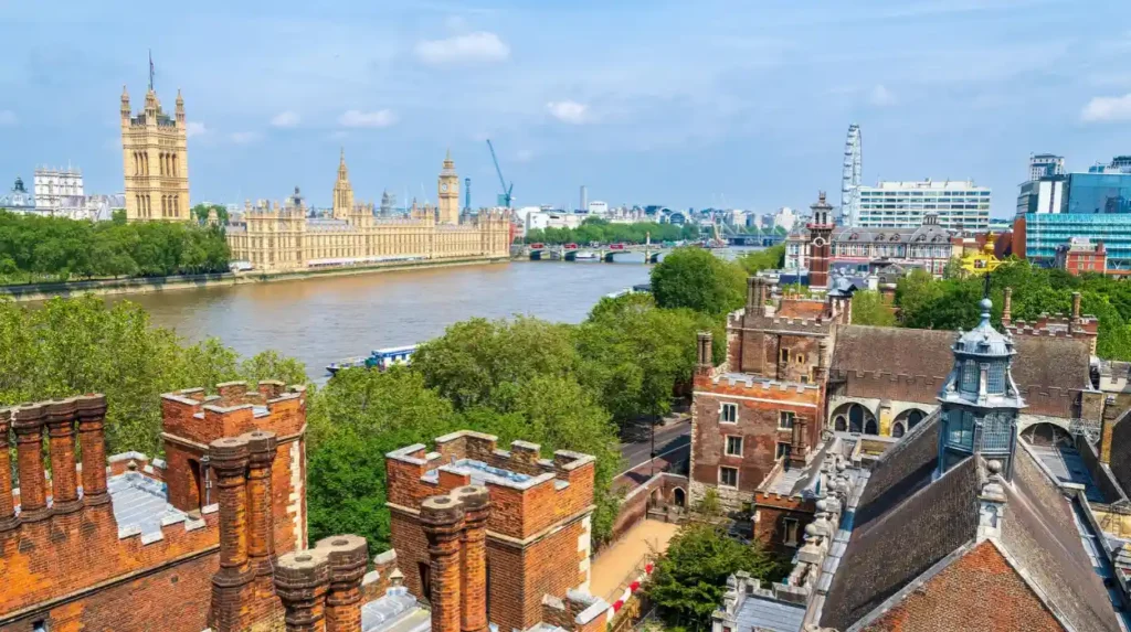
Lambeth Palace stands near the River Thames, opposite the Palace of Westminster. Its history extends back to the medieval period, and its surviving buildings preserve evidence of several phases of architectural change. The complex includes historic halls, a chapel, gardens, and the Lambeth Palace Library, an important collection of religious and historical manuscripts.
The Archbishops of Canterbury used the palace as a residence and administrative centre while conducting church business in London. This brought clerics, officials, visitors, craftsmen, and domestic workers into the surrounding area. The palace also helped maintain Lambeth’s connection with national religious affairs.
Its presence influenced the development of nearby land. Ecclesiastical estates often retained land for institutional use while allowing other areas to support agriculture, housing, and commercial activity. Over time, these different uses created a varied landscape rather than a single uniform settlement.
Lambeth Palace also provides evidence of how historic institutions survived the expansion of London. Roads, housing, commercial premises, and public buildings gradually appeared around the estate, yet the palace retained a distinct institutional identity beside the river.
Today, the palace remains an important historical landmark. Its library and architectural heritage help researchers understand the development of the Church of England, the history of London, and the relationship between religious institutions and urban growth.
Visitors exploring the riverside encounter a modern capital shaped by centuries of change. The historic context is explored further in the [history of Lambeth’s medieval parish and riverside heritage], which explains the origins of the settlement and its religious connections.
How Did the River Thames Transform Lambeth’s Economy?
The River Thames connected Lambeth with Westminster, the City of London, and wider trading networks. Riverside transport, wharves, workshops, and industries encouraged settlement growth and helped turn agricultural land into a commercially active urban district.
The Thames was one of the principal forces behind Lambeth’s economic development. Before railway networks and modern roads became dominant, river transport provided an efficient route for moving bulky materials, fuel, food, and manufactured goods.
Lambeth’s position opposite Westminster created opportunities for supplying the expanding capital. Riverside activity supported transport workers, traders, craftsmen, and businesses serving London’s growing population. As the city expanded, demand for building materials and everyday goods increased pressure on land near the river.
Industries gradually appeared along parts of the South Bank. Manufacturing and materials associated with construction became important features of the wider Lambeth area. Pottery, brickmaking, and related industrial activities formed part of the district’s historical economic landscape, although the location and scale of individual industries changed over time.
The river also influenced settlement density. Workers needed accommodation close to employment, encouraging the construction of houses, workshops, and commercial premises. Narrow streets and closely spaced buildings developed in some districts as urban activity intensified.
However, the Thames also created practical challenges. Flooding, changing river conditions, pollution, and the need for improved crossings affected development. The construction of bridges and improvements to roads progressively reduced the isolation of communities on the southern bank.
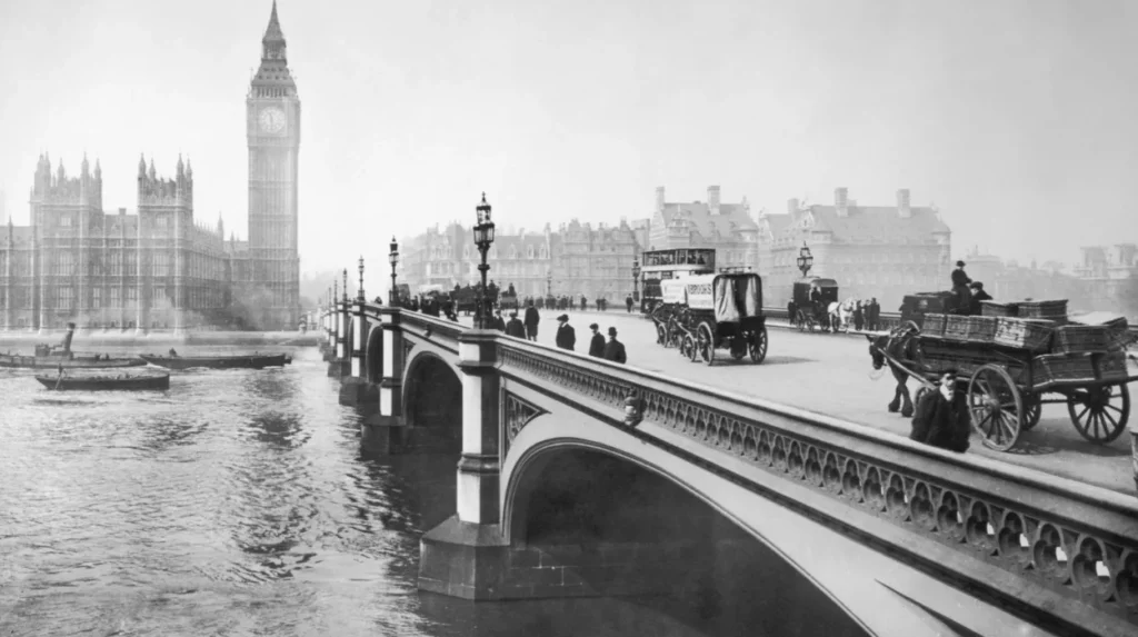
Westminster Bridge, opened in 1750, strengthened connections between Lambeth and Westminster. Other crossings subsequently improved movement across the river, supporting commuting, trade, and the integration of South London into the wider metropolitan economy.
The river’s role eventually changed. Large-scale industrial and freight activities declined or relocated as manufacturing patterns shifted and central London’s land use changed. Parts of the waterfront were redeveloped for housing, offices, public spaces, cultural institutions, and tourism.
The Thames remains central to Lambeth’s identity, but its function is now more varied. It serves as a transport corridor, public-realm asset, recreational destination, and setting for nationally significant landmarks.
How Did Bridges and Roads Encourage Lambeth’s Urban Expansion?
New bridges and improved roads made Lambeth easier to reach from central London. Westminster Bridge, Vauxhall Bridge, Waterloo Bridge, and Lambeth Bridge strengthened cross-river connections, encouraging residential construction, commercial growth, and the gradual replacement of farmland.
The eighteenth and nineteenth centuries marked a turning point in Lambeth’s development. Better transport reduced the physical separation between the southern bank of the Thames and London’s established commercial and political centres.
Westminster Bridge opened in 1750. Blackfriars Bridge followed in 1769, improving movement between the City of London and the southern bank. Waterloo Bridge opened in 1817, while Vauxhall Bridge opened in 1816 and Lambeth Bridge in 1818. These crossings strengthened access to different parts of central London and encouraged building beyond the immediate riverside.
Road construction was equally important. Routes such as Kennington Road and Westminster Bridge Road created connections between central London, developing residential districts, and communities farther south. New housing increasingly followed these transport corridors.
Developers constructed Georgian terraces, detached villas, and residential streets for households seeking homes outside the most congested parts of central London. Kennington, Waterloo, and parts of northern Lambeth became increasingly built-up during this period.
The growth did not happen uniformly. Landownership arrangements, the availability of building leases, and the cost of infrastructure affected the pace of construction. Some districts remained relatively open while other areas developed continuous streets of houses and shops.
The consequences extended beyond housing. Better roads supported markets, workshops, schools, churches, and public services. Increasing population created demand for drinking water, drainage, street lighting, waste collection, and improved local administration.
For modern visitors, historic road patterns remain visible in the relationship between major routes, railway corridors, terraces, and neighbourhood centres. These features demonstrate how transport infrastructure shaped Lambeth long before the development of the Underground and contemporary bus networks.
How Did Railways Turn Lambeth’s Villages Into London Suburbs?
Railway expansion during the nineteenth century connected Lambeth’s settlements with central London. Stations serving Waterloo, Brixton, Streatham, Herne Hill, and nearby districts encouraged commuting, residential construction, and the conversion of agricultural land into increasingly dense suburbs.
Railways accelerated the urban transformation that bridges and roads had begun. They allowed people to live farther from their workplaces while maintaining access to central London’s employment opportunities.
Waterloo became a major railway destination during the nineteenth century. Its station opened in 1848 as the London and South Western Railway developed its route into the capital. Railway access strengthened the connection between the riverside, the West End, and residential districts farther south.
Brixton, Streatham, and Herne Hill also experienced significant changes as railway services expanded. Stations increased the attractiveness of nearby land for residential development. Developers built houses around transport routes, while shops and services emerged to serve growing neighbourhood populations. Lambeth Council’s historical planning material identifies the mid-nineteenth-century railway expansion as a major driver of suburban growth.
The character of housing changed over time. Early suburban development included relatively spacious villas and terraces. Later construction increasingly accommodated working-class and lower-middle-class households through smaller terraced houses and denser residential streets.
Streatham illustrates this process particularly clearly. Its earlier village character gave way to a larger suburban settlement as rail services and housing development expanded. Brixton similarly developed from a landscape of fields, market gardens, and scattered buildings into a major commercial and residential centre.
Railways also changed shopping patterns. More residents supported permanent shops, markets, entertainment venues, and services. Local centres became important destinations rather than simply places along routes into London.
By the early twentieth century, most of Lambeth’s developable land had become urbanised, although parks, commons, and other open spaces remained. The borough’s present-day mixture of dense residential streets, commercial centres, and green spaces reflects this uneven process of expansion.
Why Did Lambeth Develop Into a Centre of Industry and Working-Class Housing?
Lambeth’s industrial economy and proximity to central London created demand for workers and affordable housing. Pottery, glassmaking, construction-related trades, transport, and other employment supported communities whose homes increasingly occupied dense streets near factories, workshops, markets, and railway routes.
Industrial growth helped distinguish northern Lambeth from the more suburban districts farther south. Riverside locations offered access to transport and materials, while central London provided a large market for manufactured goods and building supplies.
Pottery became particularly associated with Lambeth. The Doulton pottery works developed a significant presence in the area, reflecting the wider importance of manufacturing along the southern bank of the Thames. Glassmaking and boatbuilding also formed part of Lambeth’s historical industrial landscape.
Industrial employment attracted workers from different parts of London and beyond. As the population increased, landlords and developers provided accommodation in terraced houses, subdivided properties, and closely packed streets. The availability and condition of housing varied considerably between neighbourhoods.
Population growth placed pressure on local infrastructure. Overcrowding, inadequate sanitation, poor housing conditions, and limited public services became significant urban concerns during the nineteenth century. Local authorities gradually assumed greater responsibilities for improving streets, public health, drainage, lighting, and community facilities.
The establishment of workhouses and systems of poor relief also reflects the social challenges of industrial urbanisation. Lambeth opened a parish workhouse in 1726, before the major expansion of nineteenth-century industry. Later administrative changes transferred poor relief responsibilities into more formal local government structures.
Industrial employment did not remain dominant indefinitely. Changes in manufacturing, transport, technology, and the London economy reduced the role of some traditional industries. Former industrial premises subsequently became offices, housing, cultural spaces, or other commercial developments.
This industrial history remains important because it explains the relationship between Lambeth’s built environment and its social geography. Older working-class streets, former industrial sites, railway arches, and surviving factory buildings preserve evidence of the employment patterns that helped shape the borough.
How Did Local Government Change Lambeth From a Parish Into a Borough?
Lambeth moved from parish-based administration to elected local government as London’s population expanded. The nineteenth-century vestry system, metropolitan borough government in 1900, and the creation of the London Borough of Lambeth in 1965 established the modern administrative framework.
Lambeth’s historic parish originally combined religious responsibilities with local administrative duties. The parish vestry, associated with St Mary’s Church, dealt with matters including poor relief and aspects of local infrastructure.
The Poor Relief Act of 1601 formalised parish responsibilities for supporting people in poverty through a local rating system. Over subsequent centuries, parish authorities took on additional tasks, including highway maintenance and street lighting.
As urbanisation accelerated, the traditional parish system became increasingly inadequate for a growing metropolitan population. New demands included public sanitation, street improvements, burial provision, public facilities, and more organised administration.
The Metropolis Local Management Act 1855 created a framework for elected vestries and district boards across metropolitan London. Lambeth’s vestry became a more clearly defined secular local authority, although church representatives retained a formal role. Additional responsibilities followed, including the management of public baths and washhouses and library provision.
A further reorganisation took place in 1900, when the Metropolitan Borough of Lambeth was established. This brought local administration into the metropolitan borough structure used across inner London.
The modern London Borough of Lambeth was created on 1 April 1965 under the London Government Act 1963. The new borough combined the former Metropolitan Borough of Lambeth with Clapham and Streatham, previously administered within the Metropolitan Borough of Wandsworth.
The 1965 boundary change matters because the modern borough is larger than the historic parish alone. Its identity encompasses neighbourhoods with distinct histories, including Waterloo, Kennington, Stockwell, Brixton, Herne Hill, Norwood, and Streatham.
Today, Lambeth Council oversees local services, planning, housing, environmental responsibilities, and community programmes within the borough. Its work operates alongside the Greater London Authority, Transport for London, and national government bodies.
The transition from parish to borough therefore reflects more than a change in name. It represents the development of modern urban governance in response to population growth, public infrastructure needs, and the increasingly interconnected nature of London.
How Did Twentieth-Century Housing Policies Reshape Lambeth?
Twentieth-century housing policies transformed Lambeth through slum clearance, rebuilding, public housing estates, and later conservation-led rehabilitation. These changes replaced some older residential streets with modern developments while reshaping neighbourhood density, housing provision, and the borough’s architectural character.
By the early twentieth century, Lambeth had become predominantly urban. Its remaining open land was increasingly concentrated in parks, commons, and other protected or public spaces. The main development challenge shifted from suburban expansion towards housing conditions, reconstruction, and the management of a dense built environment.
Some nineteenth-century housing suffered from overcrowding, poor maintenance, and inadequate facilities. Housing reformers and public authorities increasingly pursued clearance and redevelopment programmes intended to improve living conditions.
During the interwar period and especially after the Second World War, public housing became a central part of urban policy. Bomb damage, housing shortages, and the condition of older properties created pressure for large-scale construction.
Lambeth experienced the development of council housing estates and the replacement of some older buildings with modern residential blocks. These projects provided homes for households requiring affordable accommodation, although demolition also removed historic buildings and disrupted established streets in some locations.
The post-war period introduced a different architectural scale. Larger housing developments, wider roads, shared open spaces, and purpose-built facilities altered the relationship between buildings and streets. The impact varied by neighbourhood, depending on the scale of redevelopment and the amount of older housing retained.
From the 1970s onwards, conservation-led rehabilitation gained greater importance. Instead of relying solely on demolition and replacement, planning increasingly recognised the value of historic buildings, established street patterns, and local architectural character. Lambeth Council’s design guidance identifies this shift towards conservation and rehabilitation as an important phase in the borough’s physical development.
The resulting built environment contains several generations of housing. Georgian terraces, Victorian streets, interwar homes, post-war estates, and newer apartment developments exist within the same borough.
These layers help explain Lambeth’s contemporary housing challenges. Maintaining older properties, providing affordable homes, improving energy efficiency, and accommodating population needs require decisions that balance heritage with modern living standards.
How Did Migration and Cultural Change Shape Modern Lambeth?
Migration transformed Lambeth’s social and cultural identity, particularly after the Second World War. Caribbean communities, including people arriving from Jamaica and other parts of the West Indies, helped shape Brixton’s music, businesses, public life, and continuing importance in Black British history.
Lambeth’s population has changed through successive waves of migration, reflecting its employment opportunities, transport connections, housing supply, and position within London. These changes helped transform the borough from a collection of Victorian suburbs into a diverse urban community.
The arrival of the Empire Windrush in 1948 became a defining moment in modern British migration history. Caribbean migration continued in the following decades, and Brixton developed into an important centre of Caribbean community life. Lambeth Council’s historical account identifies this migration as a major influence on the borough’s post-war social development.
Caribbean residents established businesses, community organisations, churches, cultural venues, and social networks. Brixton’s markets and high streets became important places for food, retail, music, and everyday community activity.
The neighbourhood’s cultural significance extends beyond Caribbean migration. Lambeth has also been shaped by African, European, Latin American, and other communities. These populations have contributed to changing languages, food businesses, religious institutions, creative industries, and patterns of local commerce.
Cultural change also influenced the public identity of the borough. Brixton became associated with Black British political activism, music, community organising, and debates about policing, inequality, and representation. Its history includes both major cultural contributions and periods of social tension.
The 1981 Brixton disorders became a significant event in national discussions about policing, racial discrimination, unemployment, and relations between communities and public authorities. The events formed part of a broader period of unrest in British cities and prompted official examination of the causes of the disorder.
Modern Lambeth continues to reflect these intersecting histories. Its neighbourhoods combine long-established residents, newer arrivals, independent businesses, cultural institutions, and changing housing markets.
The 2021 Census recorded nearly a third of a million residents in the borough, and Lambeth ranked fourth among local authority areas in England and Wales for population density. These figures demonstrate the scale and intensity of contemporary urban life.
For visitors, this history is visible in Brixton Market, Electric Avenue, community venues, local archives, and cultural events. These places provide a way to understand migration as an active force in Lambeth’s continuing development rather than simply a chapter in its past.
How Have Transport Improvements Changed Lambeth’s Modern Urban Character?
Modern transport has strengthened Lambeth’s links with central London and neighbouring boroughs. National Rail, London Underground services, buses, cycling routes, and pedestrian connections support commuting, tourism, education, shopping, and access to the borough’s cultural and employment centres.
Transport remains a defining feature of Lambeth’s urban geography. The borough stretches from the Thames at Waterloo and Vauxhall towards residential districts in the south, including Norwood and Streatham. Its long, narrow shape makes connections between neighbourhoods and central London particularly important.
Waterloo is one of the major railway hubs serving the borough. Its services connect London with destinations across south-west England and the wider South East, while Underground connections provide access to other parts of the capital. The surrounding district has developed into a major interchange for commuters, visitors, and workers.
Brixton provides another important transport centre. Its Underground station serves the Victoria line, while National Rail services and extensive bus connections support travel across South London and into central London. Vauxhall and Stockwell also provide important Underground connections.
The Victoria line stations at Vauxhall, Stockwell, and Brixton opened in 1972, improving access to central London and reinforcing the role of these neighbourhoods as connected urban centres.
Transport improvements have consequences for property development and local business. Areas with convenient connections attract workers, visitors, students, and customers. However, increased accessibility also contributes to development pressure, rising property demand, and competition for commercial and residential space.
Walking and cycling form another part of the modern transport network. Local streets, parks, riverside paths, and cycle routes provide alternatives to motorised travel. The availability and quality of these connections vary by location, so visitors should check current routes and accessibility before travelling.
For leisure travellers, transport allows a single visit to combine Waterloo’s riverside attractions, Kennington’s historic streets, Brixton’s markets, and Streatham’s suburban high streets. For business travellers, it provides access to central London employment areas and meeting venues.
The transport network therefore represents both a continuation of Lambeth’s history and a major influence on its future. Just as bridges and railways encouraged nineteenth-century expansion, modern connections shape where people live, work, shop, and spend their leisure time.
How Has Urban Regeneration Changed Waterloo, Vauxhall, and Brixton?
Urban regeneration has transformed parts of Lambeth through new housing, commercial development, public spaces, cultural venues, and improvements to existing buildings. Waterloo, Vauxhall, and Brixton demonstrate different approaches to adapting established urban districts to contemporary needs.
Urban regeneration refers to the planned improvement or redevelopment of existing urban areas. It includes changes to buildings, housing, public spaces, transport facilities, commercial premises, and local infrastructure.
In Lambeth, regeneration has not followed a single pattern. Different neighbourhoods have responded to their historical character, transport connections, land availability, and economic circumstances.
Waterloo and the South Bank
Waterloo has developed from a railway-centred district into a major destination for culture, business, and tourism. Its proximity to the Thames and Westminster supports a concentration of offices, hotels, restaurants, performance venues, and public spaces.
The South Bank’s cultural institutions attract visitors throughout the year. The Southbank Centre, the National Theatre, and nearby attractions contribute to an economy based on arts, hospitality, events, and tourism.
The area also retains historic features, including railway infrastructure and older streets around Lower Marsh. The coexistence of historic buildings and modern development demonstrates how changing economic functions reshape established urban districts.
Vauxhall
Vauxhall’s riverside location and transport connections have supported substantial redevelopment. Modern residential buildings, offices, public spaces, and commercial premises have altered parts of its former industrial and transport-related landscape.
Development pressure is linked to the wider regeneration of central London and the demand for homes close to employment centres. Planning decisions must address housing provision, infrastructure capacity, environmental considerations, and the relationship between new buildings and historic surroundings.
Brixton
Brixton’s regeneration has involved improvements to public spaces, markets, commercial buildings, and transport connections. Its established independent businesses and cultural institutions remain important to its local identity.
The area also illustrates the challenges of regeneration. Rising property values and commercial rents create pressure on smaller businesses and lower-income households. Protecting established community networks while improving buildings and public facilities remains an important planning consideration.
These examples show that regeneration is not simply the replacement of old buildings with new ones. It involves decisions about who benefits from investment, how public space is used, which historic features are retained, and how neighbourhoods accommodate changing economic needs.
Lambeth’s future development depends on balancing new investment with affordable housing, accessible transport, heritage protection, and the continued presence of independent businesses and community organisations.
Which Historic Places Explain Lambeth’s Transformation Most Clearly?
Lambeth’s historic landmarks reveal different stages of urban development. Lambeth Palace represents medieval religious influence, Georgian and Victorian terraces record suburban expansion, former industrial buildings preserve manufacturing history, and modern cultural venues demonstrate the borough’s changing economic role.
Visitors can explore Lambeth’s transformation by looking at places associated with its religious, residential, industrial, commercial, and cultural history.
Lambeth Palace and the historic riverside
Lambeth Palace provides a direct connection with the borough’s medieval and ecclesiastical past. Its historic buildings and library illustrate the continued presence of religious institutions beside a rapidly changing capital.
The surrounding riverside also demonstrates how a once-important transport corridor now combines heritage, tourism, public space, and modern infrastructure.
Kennington’s Georgian and Victorian streets
Kennington contains historic residential streets associated with the expansion of housing beyond central London. Terraces and squares reflect changing architectural tastes and the growth of suburban settlement during the eighteenth and nineteenth centuries.
These streets help explain how better roads and bridges encouraged people to establish homes outside the most congested parts of the city.
Lambeth Walk and the history of working-class London
Lambeth Walk became associated with working-class life, street trading, and popular culture. Its history connects the borough’s older commercial streets with the social and economic conditions that shaped urban communities.
The area also provides context for understanding the relationship between local markets, affordable goods, and neighbourhood employment.
Brixton Market and Electric Avenue
Brixton Market and Electric Avenue demonstrate the development of local commerce and the influence of migration on modern Lambeth. Their shops, food businesses, and trading spaces reflect the area’s changing population and cultural life.
Electric Avenue is especially associated with the introduction of electric street lighting in the late nineteenth century. Its name preserves an element of the area’s technological and commercial history.
Streatham and suburban expansion
Streatham illustrates the transformation of southern Lambeth from a more rural settlement into a substantial suburban district. Railway connections, residential construction, shopping streets, and entertainment venues helped create a distinct local centre.
Its development also shows that Lambeth’s history extends beyond the Thames. The borough’s southern neighbourhoods played an important role in the expansion of London during the nineteenth and twentieth centuries.
Together, these places reveal the layered nature of Lambeth’s development. Historic buildings survive within a modern borough, while markets, transport hubs, and cultural venues continue to serve changing communities.
What Challenges Shape Lambeth’s Future Urban Development?
Lambeth’s future development centres on housing affordability, heritage conservation, transport capacity, environmental resilience, and inclusive economic growth. The borough must accommodate a dense population while maintaining historic neighbourhoods, accessible public spaces, and the cultural character of its communities.
Lambeth’s transformation is ongoing. Its current urban form reflects centuries of building, demolition, infrastructure investment, migration, and changing land use. Future planning decisions will determine how these historic layers coexist with new housing and commercial development.
Housing affordability remains a major issue in a densely populated inner London borough. Demand for accommodation near employment and transport connections places pressure on rents and property prices. Affordable housing provision, suitable homes for different household sizes, and the maintenance of existing housing stock are important parts of long-term planning.
Heritage conservation creates another responsibility. Historic terraces, listed buildings, conservation areas, former industrial sites, and older commercial streets provide evidence of Lambeth’s development. Conservation policies help protect architectural character while allowing appropriate adaptation for modern uses.
Climate adaptation is also increasingly important. Lambeth’s riverside location requires attention to flood risk, while warmer summers increase the importance of shade, tree cover, ventilation, and accessible green spaces. Energy-efficient buildings and lower-emission transport can support wider environmental objectives.
Public transport and street accessibility affect how residents reach work, education, healthcare, shops, and leisure destinations. Improving walking routes, cycling facilities, bus services, and interchange areas supports a more connected borough. These measures also influence the quality of public spaces and the experience of visitors.
Economic inclusion matters as regeneration continues. New commercial developments can create jobs and improve infrastructure, but rising rents and property costs place pressure on independent traders and existing residents. Supporting local businesses and retaining community facilities helps ensure that investment benefits a wider range of people.
Lambeth’s historic pattern of development offers a useful framework for understanding these challenges. Earlier transport improvements stimulated growth, industrialisation changed employment and housing, and twentieth-century redevelopment reshaped entire neighbourhoods. Modern planning continues to manage the consequences of those changes.
The borough’s future therefore depends on combining development with conservation, infrastructure investment with affordability, and economic growth with community needs.
Explore More Area Guide
Lambeth Architecture Guide: Buildings for Students to Study
Discover Lambeth Maritime History Along the River Thames
How Can Visitors Understand Lambeth’s History Through Its Modern Streets?
Visitors can understand Lambeth’s history by exploring its riverside landmarks, historic residential streets, former industrial areas, markets, and transport hubs. These locations reveal how a rural parish evolved into a densely populated borough with distinct neighbourhoods and cultural identities.
A visit to Lambeth provides an opportunity to observe urban change at different scales. The riverside explains the importance of transport and religious institutions, while residential streets show how housing expanded as London grew.
Waterloo offers a starting point for exploring the relationship between railway development, cultural institutions, and modern commercial activity. The South Bank provides access to the Thames and a concentration of arts venues, public spaces, and historic infrastructure.
Kennington offers a different perspective through its residential architecture and historic street layout. Walking through the area reveals the role of planned housing and improved road connections in shaping nineteenth-century suburban growth.
Brixton provides insight into the borough’s commercial and cultural development. Markets, independent businesses, transport connections, and community landmarks demonstrate how migration and changing economic conditions have shaped a modern urban centre.
Further south, Streatham illustrates the expansion of residential London beyond the historic riverside. Its streets and commercial centre reveal how railways and suburban development brought previously separate settlements into the metropolitan area.
Visitors interested in deeper research can consult Lambeth Archives, the borough’s local record office and local studies library. Its collections include historical documents, maps, photographs, architectural records, and material relating to transport, social history, migration, and local government.
A useful approach is to compare historic maps and photographs with the present-day streetscape. This makes it easier to identify changes in road layouts, building types, commercial activity, and the relationship between residential districts and transport infrastructure.
Lambeth’s history is not confined to preserved monuments. It remains visible in ordinary streets, markets, railway viaducts, public housing, cultural institutions, and the pattern of neighbourhoods extending south from the Thames.
How Did Lambeth Become the Urban Borough It Is Today?
Lambeth evolved through a sequence of interconnected changes rather than a single act of urban expansion. Its early identity developed around a historic parish, religious estates, agricultural land, and the River Thames. Improved bridges and roads then encouraged residential growth, while railways connected southern settlements with central London and accelerated suburban development.
Industrial employment, population growth, changing local government, and twentieth-century housing policies reshaped the borough’s streets and communities. Post-war migration, especially Caribbean migration, added further cultural and social dimensions, most visibly in Brixton.
The modern London Borough of Lambeth was formally established on 1 April 1965. Today, its neighbourhoods combine historic buildings, dense housing, major transport connections, cultural destinations, and modern redevelopment.
Understanding Lambeth’s past explains the character of its present-day streets and the challenges facing its future. Its transformation remains visible in the contrast between medieval institutions, Victorian terraces, post-war estates, independent markets, and contemporary riverside development.
What was Lambeth like before it became an urban borough?
Lambeth was a historic parish in Surrey, south of the River Thames. It contained agricultural land, gardens, scattered settlements, and religious estates, including Lambeth Palace. Its riverside location connected the area with Westminster and the growing City of London.